MyTopo
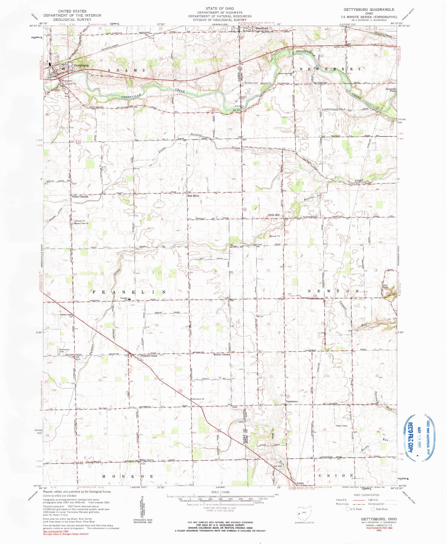
Classic USGS Gettysburg Ohio 7.5'x7.5' Topo Map
Couldn't load pickup availability
Historical USGS topographic quad map of Gettysburg in the state of Ohio. Map scale may vary for some years, but is generally around 1:24,000. Print size is approximately 24" x 27"
This quadrangle is in the following counties: Darke, Miami.
The map contains contour lines, roads, rivers, towns, and lakes. Printed on high-quality waterproof paper with UV fade-resistant inks, and shipped rolled.
Contains the following named places: Adams Strip, Allfox School, Bradford Cemetery, Bradford Quarry, Buckeye School, Canyon School, Circle Hill, Cool Farms, Cromer Cemetery, Deeter Cemetery, Famous School, First Baptist Church, Franklin-Monroe Elementary School, German Church, Gettysburg, Gettysburg Elementary School, Gettysburg Post Office, Gettysburg Rural Fire Department, Greenville Creek Cemetery, Greenville Creek United Church of Christ, Greenville Falls State Nature Preserve, Heller School, Kemps Field of Dreams Airport, Little Painter Creek, Miami Valley Organic Farms, Milken Farms, Miller Grove, Minnich School, Mole Hill School, Muddy Corners, Neff School, Newcomers Cemetery, Painter Creek, Painter Creek Church of the Brethren, Painter Creek Post Office, Pattytown, Pleasant View Missionary Church, Red River, Red River Post Office, Township of Franklin, Union Corners, Village of Gettysburg, Weaver Swine Farm, West Grove Church, ZIP Code: 45328