MyTopo
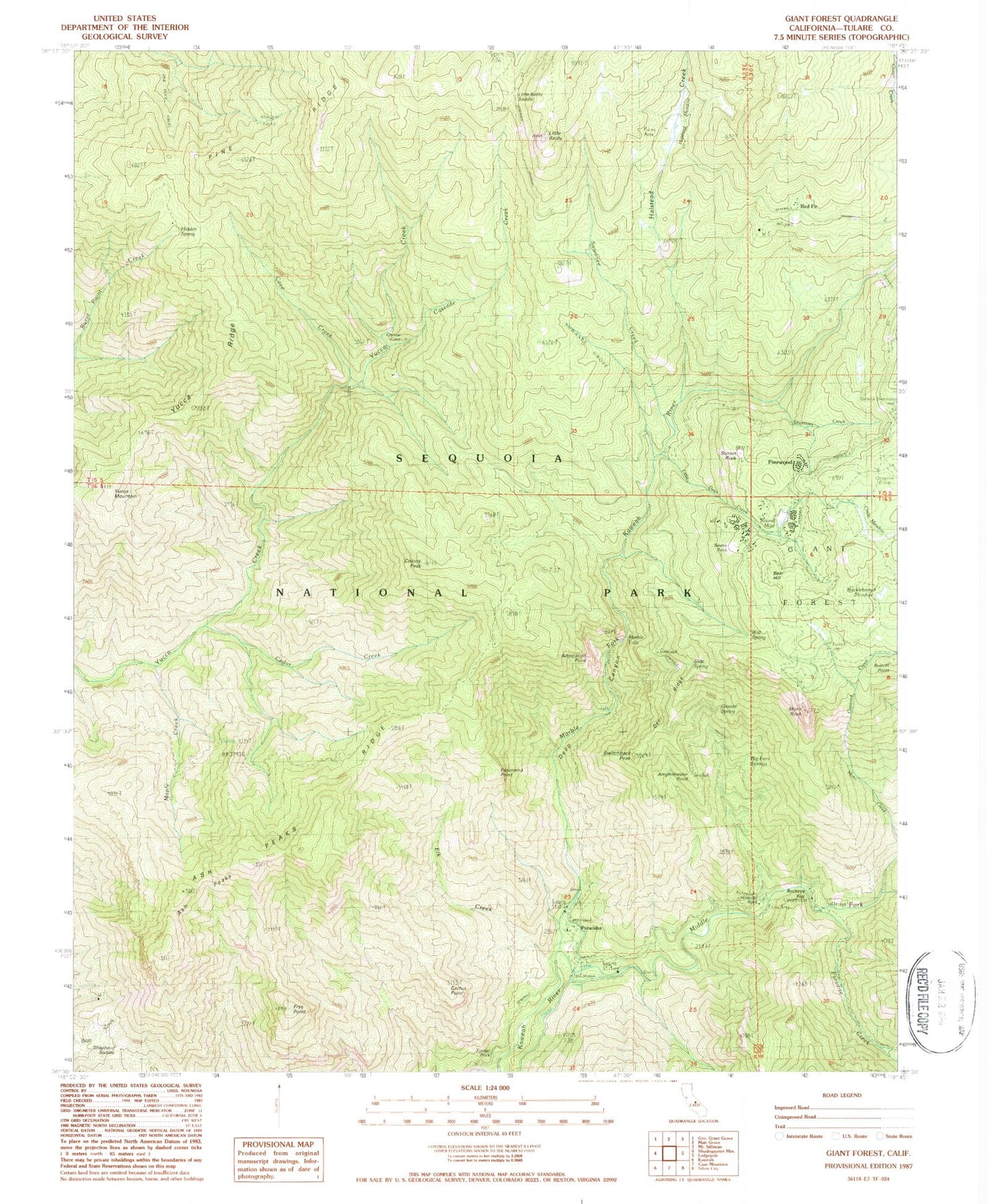
Classic USGS Giant Forest California 7.5'x7.5' Topo Map
Couldn't load pickup availability
Historical USGS topographic quad map of Giant Forest in the state of California. Typical map scale is 1:24,000, but may vary for certain years, if available. Print size: 24" x 27"
This quadrangle is in the following counties: Tulare.
The map contains contour lines, roads, rivers, towns, and lakes. Printed on high-quality waterproof paper with UV fade-resistant inks, and shipped rolled.
Contains the following named places: Buckeye Flat, Ash Peaks Ridge, Admiration Point, Amphitheater Point, Ash Peaks, Bobcat Point, Cactus Point, Cascade Creek, Cave Creek, Cedar Creek, Circle Meadow, Colony Mill Ranger Station, Colony Peak, Crescent Creek, Deep Canyon, Deer Ridge, Elk Creek, Frys Point, General Sherman Tree, Halstead Creek, Halstead Meadow, Hidden Spring, Hospital Rock Ranger Station, Huckleberry Meadow, Kaweah Camp, Little Baldy, Little Baldy Saddle, Little Deer Creek, Maple Creek, Marble Falls, Marble Fork Kaweah River, Middle Fork Kaweah River, Moro Rock, Panorama Point, Pine Ridge, Round Meadow, Sherman Creek, Skagway Grove, Giant Forest, Sunset Rock, Suwanee Creek, Suwanee Grove, Switchback Peak, Wolverton Creek, Yucca Mountain, Yucca Ridge, Paradise Creek, Hospital Rock Picnic Area, Buckeye Flat Recreation Site, Potwisha Recreation Site, Generals, Bear Hill, Pinewood, Potwisha, Beetle Rock, Big Fern Springs, Granite Spring, Hospital Rock, Red Fir, Shepherd Saddle, Slide Spring, Tunnel Log, Tunnel Rock, Wall Spring, Potwisha Campground, Woodlake-Three Rivers Division


