MyTopo
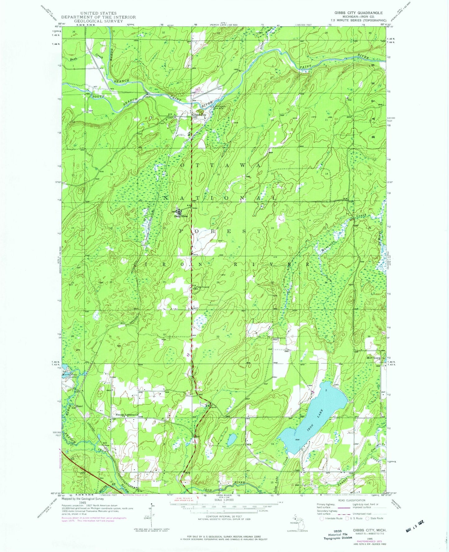
Classic USGS Gibbs City Michigan 7.5'x7.5' Topo Map
Couldn't load pickup availability
Historical USGS topographic quad map of Gibbs City in the state of Michigan. Map scale may vary for some years, but is generally around 1:24,000. Print size is approximately 24" x 27"
This quadrangle is in the following counties: Iron.
The map contains contour lines, roads, rivers, towns, and lakes. Printed on high-quality waterproof paper with UV fade-resistant inks, and shipped rolled.
Contains the following named places: Autio Creek, Black House Campground, Bush Creek, Camp Gibbs, Camp Gibbs Recreation Area, Costigan Creek, De Mongo Creek, Defiance Creek, Edna Creek, Finnish Lutheran Church, Gibbs City, Gibbs City Post Office, Gibbs Lookout, Hazel, Hazel Station, Iron Lake, McColman Creek, Merriman Lake, North Branch Iron River, North Branch Paint River, Old Atkinson Dam Site, Paint River Forks Campground, Silver Creek, South Branch Iron River, South Branch Paint River, Webb Lake, Wild River Motel and RV Park