
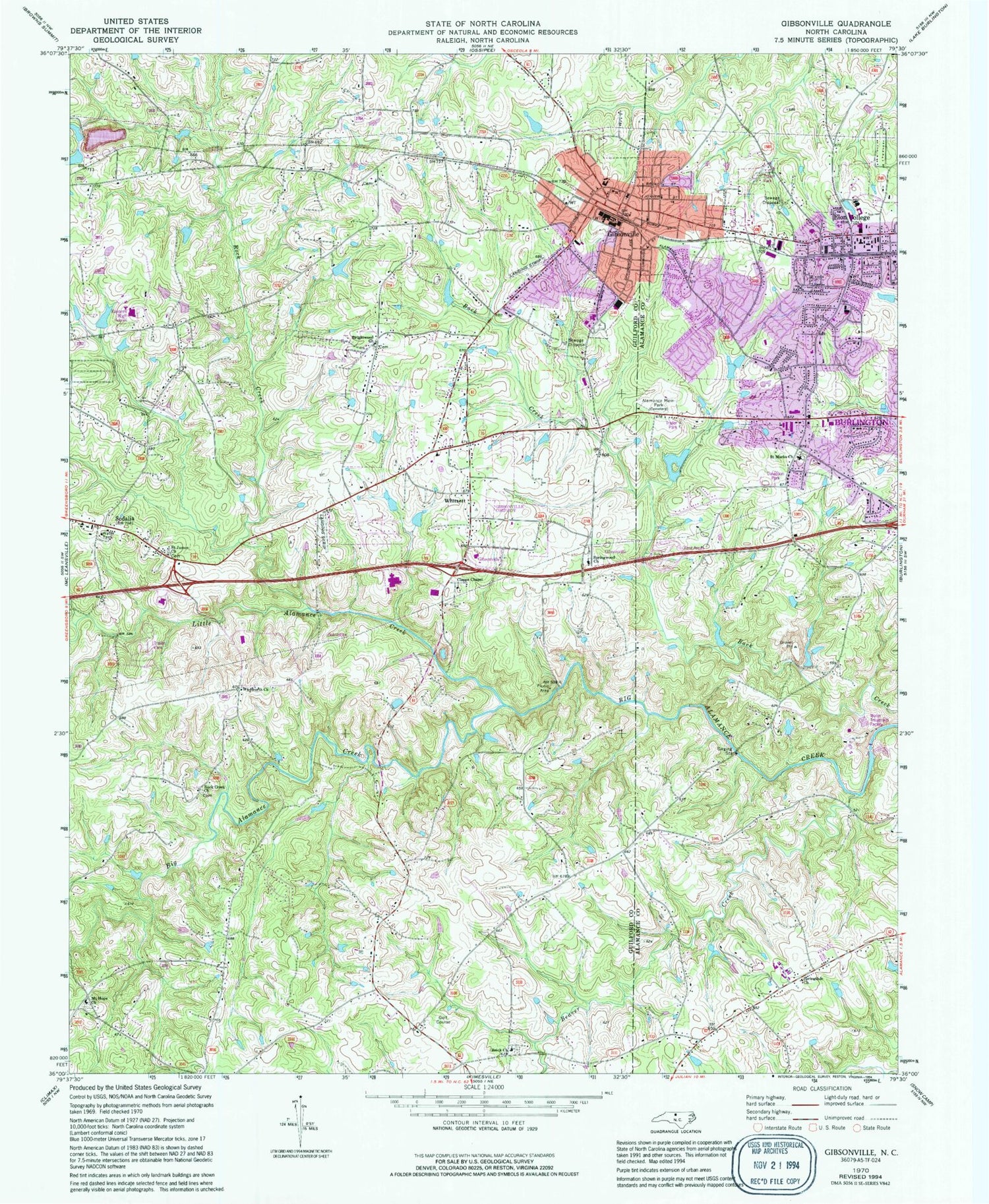
MyTopo
Classic USGS Gibsonville North Carolina 7.5'x7.5' Topo Map
Couldn't load pickup availability
Historical USGS topographic quad map of Gibsonville in the state of North Carolina. Map scale may vary for some years, but is generally around 1:24,000. Print size is approximately 24" x 27"
This quadrangle is in the following counties: Alamance, Guilford.
The map contains contour lines, roads, rivers, towns, and lakes. Printed on high-quality waterproof paper with UV fade-resistant inks, and shipped rolled.
Contains the following named places: Alamance Battleground Historic Site, Alamance Memorial Park, Alamance Regional Medical Center, Allen House, Beaver Creek, Beth Schmidt Park, Brick Church, Brightwood Church, Burlington Quarry, Clapps Chapel, Clayton Airpark, Country Club Acres, Deerfield, Eastern High School, Elon, Elon Elementary School, Elon Fire Department Station 1, Elon Post Office, Elon University Campus Police Department, Gerrards Lake, Gerrards Lake Dam, Gibsonville, Gibsonville Elementary School, Gibsonville Fire Department Station 6, Gibsonville Police Department, Gibsonville Post Office, Glenwood Acres, Guilford County Sheriff's Office - District 2, Little Alamance Creek, Mark View, McEwen Estate Dam, McLean Brothers Airport, Morgan Place Park, Mount Hope Church, Random Hills, Rock Creek, Rock Creek Church, Saint James Church, Sedalia, Sedalia Post Office, Springdale Church, Springwood Church, Superior Stone Company Lake, Superior Stone Company Lake Dam, The Country, Town of Elon, Town of Gibsonville, Town of Sedalia, Town of Whitsett, Township 3-Boone Station, Township of Rock Creek, Wadworth Church, Westbrook, Westbrook Forest, Westview, Westview Terrace, Whitsett, Whitsett Fire and Rescue Department, Whitsett Post Office, WSoe-FM (Elon College), ZIP Code: 27377


