MyTopo
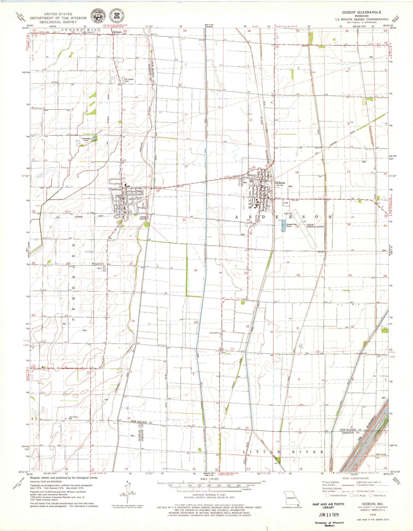
Classic USGS Gideon Missouri 7.5'x7.5' Topo Map
Couldn't load pickup availability
Historical USGS topographic quad map of Gideon in the state of Missouri. Map scale may vary for some years, but is generally around 1:24,000. Print size is approximately 24" x 27"
This quadrangle is in the following counties: Dunklin, New Madrid, Pemiscot.
The map contains contour lines, roads, rivers, towns, and lakes. Printed on high-quality waterproof paper with UV fade-resistant inks, and shipped rolled.
Contains the following named places: City of Clarkton, City of Gideon, Clarkton, Clarkton Post Office, Clarkton Volunteer Fire Department, Crossroads Church, Ditch Number 1, Ditch Number 258, Ditch Number 293, Ditch Number 4, Douglas Grove Church, Dunn, Gideon, Gideon Memorial Airport, Gideon Post Office, Gideon Volunteer Fire Department, Glendale, Hedgerow School, Little Walnut School, Main Ditch, Main Ditch District Number 17, Marlow, Marlow Chapel, Marlow School, McBride School, McGuire, Miller School, Moark, Mount Gilead Cemetery, Mount Gilead Church, New Hope Church, Oak Grove Cemetery, Oak Grove Church, Oak Grove School, Page, Peanut School, Sarff, Stanfield Cemetery, Stanfield Church, Stanfield General Church, Sweetwater Camp, Township of Anderson, Township of Freeborn, Union Grove Church, Wrightsville, Wrightsville Post Office, Zion School, ZIP Codes: 63837, 63848