MyTopo
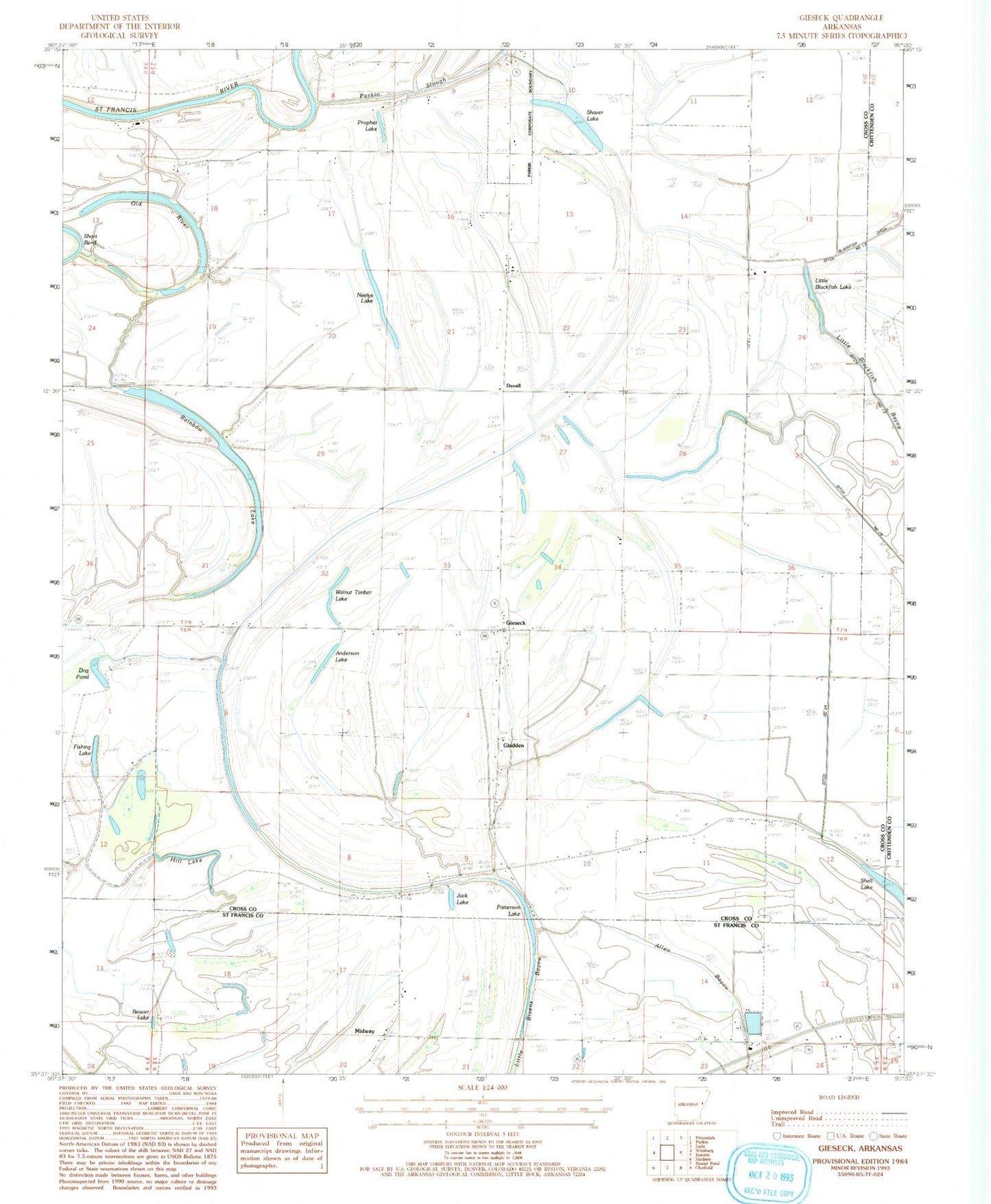
Classic USGS Gieseck Arkansas 7.5'x7.5' Topo Map
Couldn't load pickup availability
Historical USGS topographic quad map of Gieseck in the state of Arkansas. Map scale may vary for some years, but is generally around 1:24,000. Print size is approximately 24" x 27"
This quadrangle is in the following counties: Crittenden, Cross, St. Francis.
The map contains contour lines, roads, rivers, towns, and lakes. Printed on high-quality waterproof paper with UV fade-resistant inks, and shipped rolled.
Contains the following named places: Anderson Lake, Bailes, Beaver Lake, Butler Chapel, Campbell School, Ditch Number 24, Dog Pond, Duvall, Fishing Lake, Friendship Church, Gieseck, Gladden, Gladden Church, Hill Lake, Holly Grove Church, Jack Lake, Lansing Grove School, Little Blackfish Lake, Locust Grove Church, Locust Lake, Midway, Mount Harmon School, Neelys Lake, New Bethel Church, New Light Church, Old River, Parkin Slough, Patterson, Patterson Lake, Patterson School, Pilgrims Rest Church, Prophet Lake, Rainbow Lake, Riverside, Rose Place, Shaver Lake, Smith Lake, Snowden Lake, Thompson Lake, Township of Tyronza, Walkers Store, Walnut Timber Lake