
MyTopo
Classic USGS Gilbert Peak NE Utah 7.5'x7.5' Topo Map
Regular price
$16.95
Regular price
Sale price
$16.95
Unit price
per
Couldn't load pickup availability
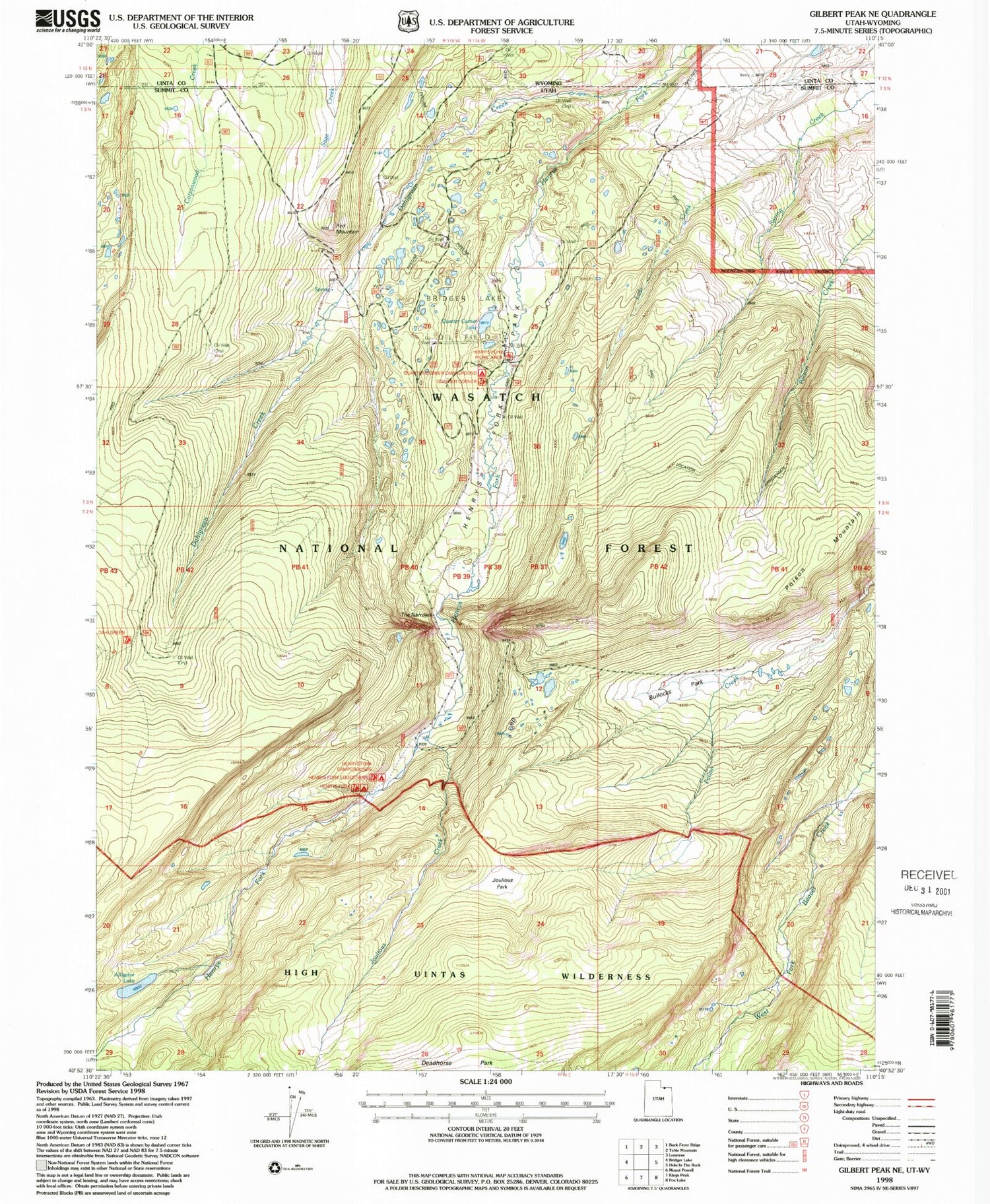
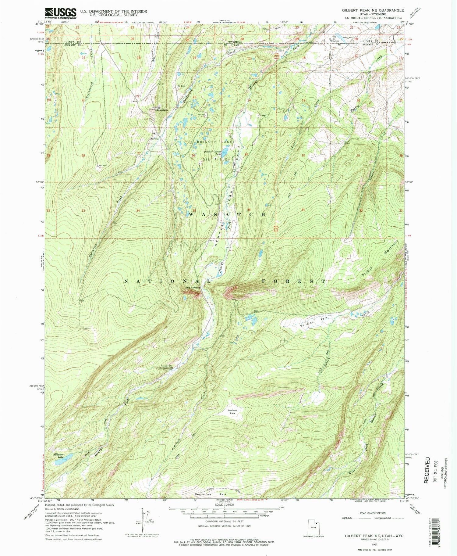
Historical USGS topographic quad map of Gilbert Peak NE in the state of Utah. Typical map scale is 1:24,000, but may vary for certain years, if available. Print size: 24" x 27"
This quadrangle is in the following counties: Summit, Uinta.
The map contains contour lines, roads, rivers, towns, and lakes. Printed on high-quality waterproof paper with UV fade-resistant inks, and shipped rolled.
Contains the following named places: Alligator Lake, Bridger Lake Oil Field, Bullocks Park, Dahlgreen Creek, Deadhorse Park, Henrys Fork Campground, Henrys Fork Park, Joulious Creek, Joulious Park, Lost Creek, Poison Mountain, Quarter Corner Lake, Red Mountain, The Narrows, Henrys Fork Trailhead


