MyTopo
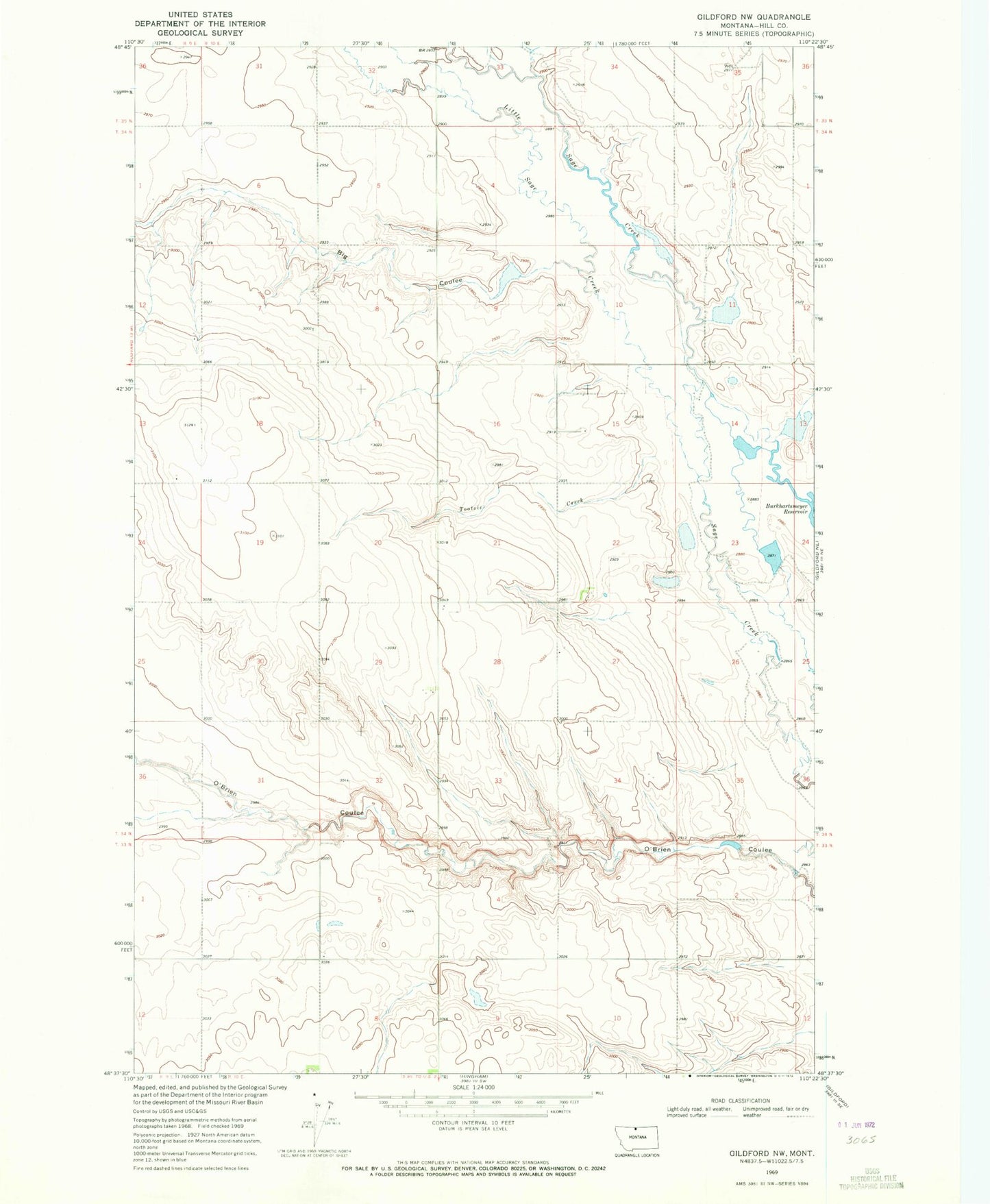
Classic USGS Gildford NW Montana 7.5'x7.5' Topo Map
Regular price
$16.95
Regular price
Sale price
$16.95
Unit price
per
Couldn't load pickup availability
Historical USGS topographic quad map of Gildford NW in the state of Montana. Map scale may vary for some years, but is generally around 1:24,000. Print size is approximately 24" x 27"
This quadrangle is in the following counties: Hill.
The map contains contour lines, roads, rivers, towns, and lakes. Printed on high-quality waterproof paper with UV fade-resistant inks, and shipped rolled.
Contains the following named places: 33N10E07DACC01 Well, 34N10E14BCAA01 Well, 34N10E14BCAB01 Well, Big Coulee, Big Sage Hen Dam, Burkhartsmeyer Too Dam, Little Sage Creek, Mustapha Dam, O'Brien Coulee Dam, Pester Airport, Schultz Coulee, Tootsie Creek