MyTopo
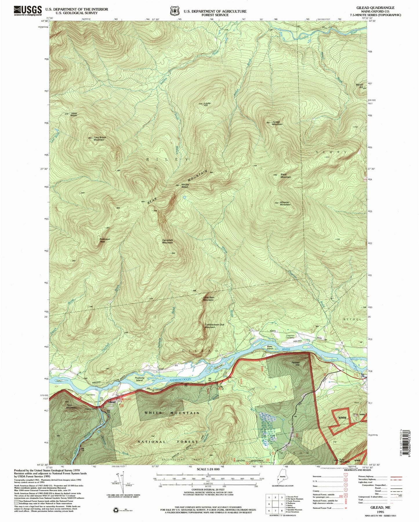
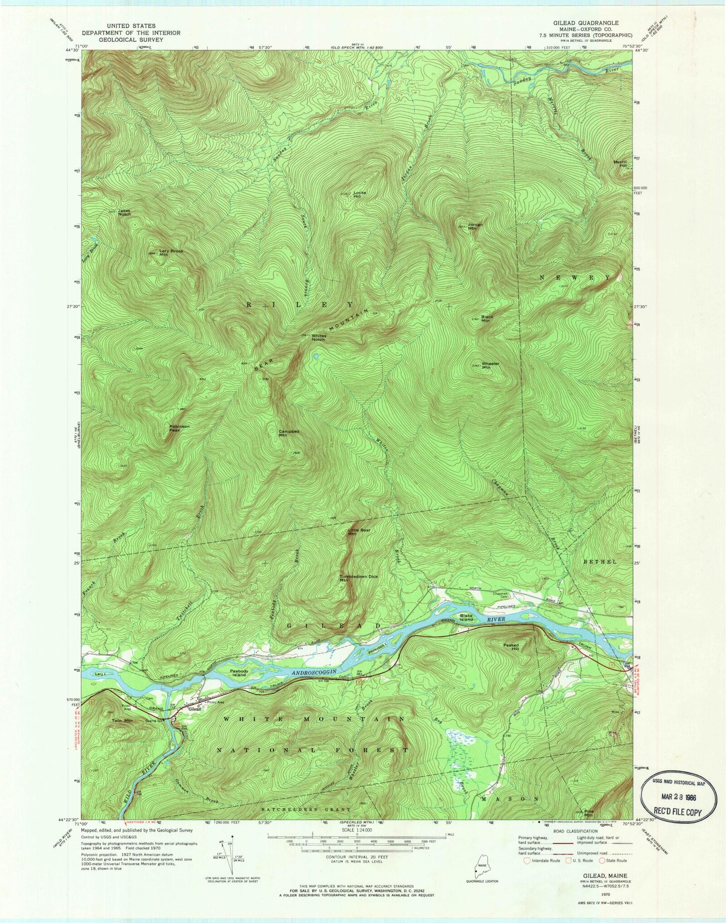
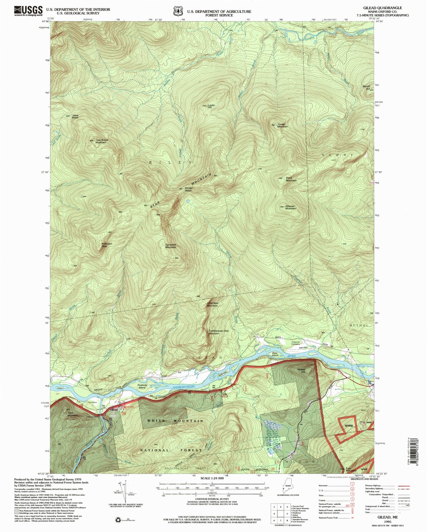
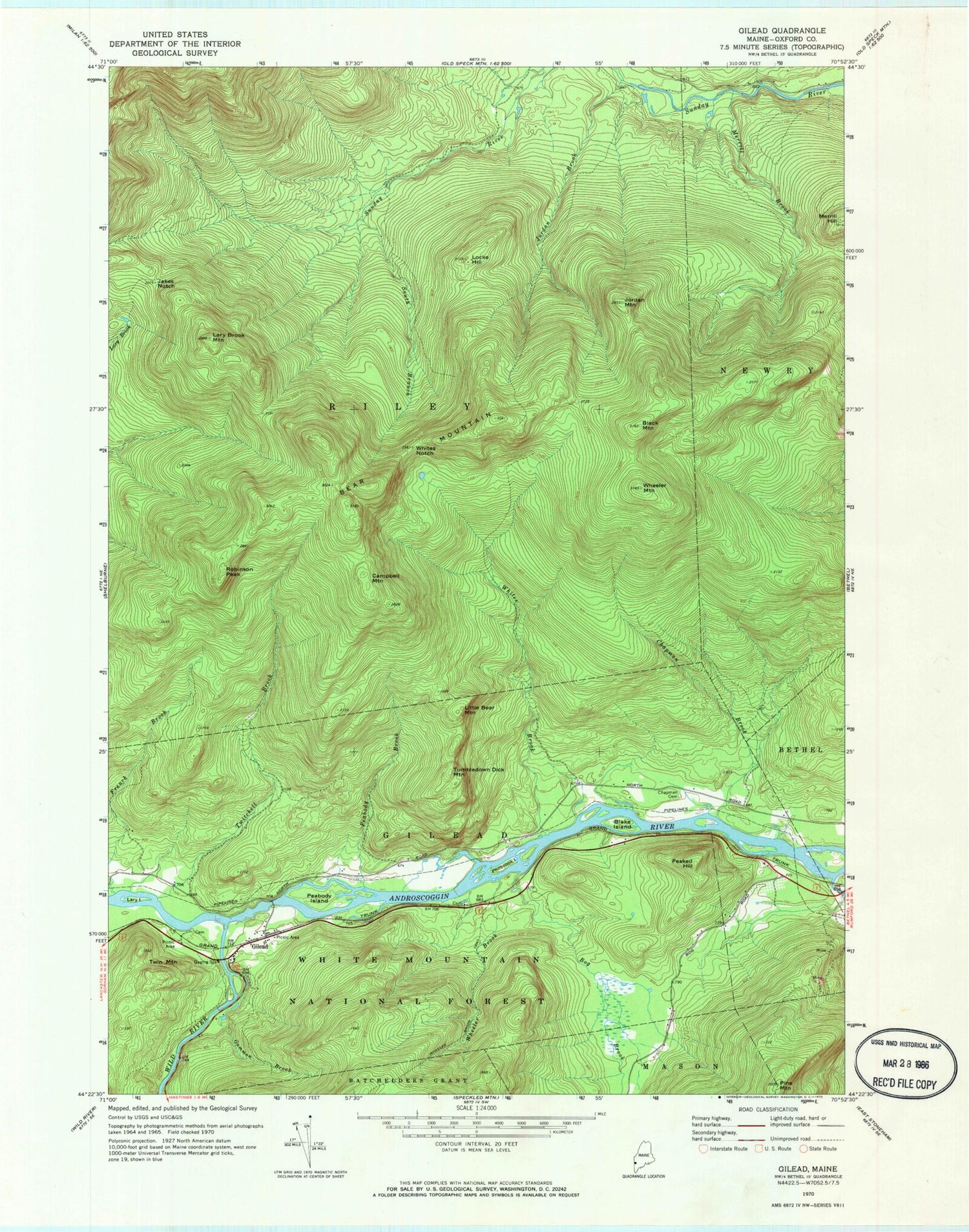
Classic USGS Gilead Maine 7.5'x7.5' Topo Map
Couldn't load pickup availability
Historical USGS topographic quad map of Gilead in the state of Maine. Typical map scale is 1:24,000, but may vary for certain years, if available. Print size: 24" x 27"
This quadrangle is in the following counties: Oxford.
The map contains contour lines, roads, rivers, towns, and lakes. Printed on high-quality waterproof paper with UV fade-resistant inks, and shipped rolled.
Contains the following named places: Bear Mountain, Black Mountain, Blake Island, Bog Brook, Bull Branch, Campbell Mountain, Chapman Brook, Chapman Cemetery, Eames Brook, French Brook, Gammon Brook, Gilead, Jakes Notch, Jordan Brook, Jordan Mountain, Lary Brook Mountain, Lary Island, Little Bear Mountain, Locke Hill, Merrill Brook, Merrill Hill, Peabody Brook, Peabody Island, Peaked Hill, Philbrook Island, Pine Mountain, Pleasant River, Robinson Peak, South Branch Sunday River, Tumbledown Dick Mountain, Twin Mountain, Twitchell Brook, Wheeler Brook, Wheeler Mountain, Whites Brook, Whites Notch, Wild River, Town of Gilead, Chapman School (historical), Peabody School (historical), Gilead Fire Station, Peabody Cemetery