MyTopo
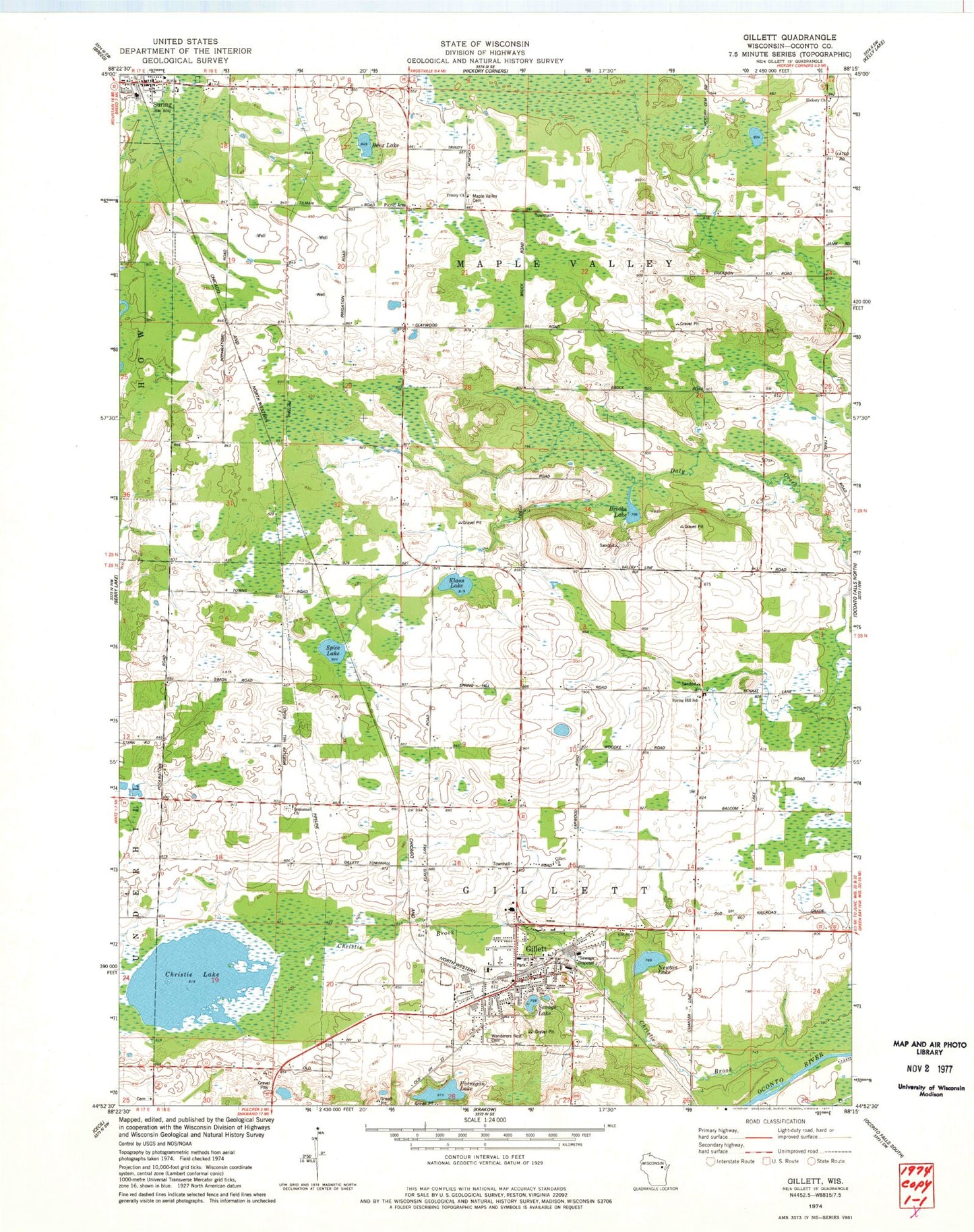
Classic USGS Gillett Wisconsin 7.5'x7.5' Topo Map
Couldn't load pickup availability
Historical USGS topographic quad map of Gillett in the state of Wisconsin. Map scale may vary for some years, but is generally around 1:24,000. Print size is approximately 24" x 27"
This quadrangle is in the following counties: Oconto.
The map contains contour lines, roads, rivers, towns, and lakes. Printed on high-quality waterproof paper with UV fade-resistant inks, and shipped rolled.
Contains the following named places: Apple Orchard School, Benz Lake, Brooks Lake, Christie Brook, Christie Lake, City of Gillett, Claywood School, Clover Nook School, Finnegan Lake, Four Town School, Gillett, Gillett Area Ambulance Service, Gillett Church, Gillett Elementary School, Gillett High School, Gillett Middle School, Gillett Police Department, Gillett Post Office, Gillett Township Volunteer Fire Department, Gillett Volunteer Fire Department, Gillett Wastewater Plant, Hickory Church, Immanuel Evangelical Lutheran Cemetery, Immanuel Lutheran Church, Immanuel School, Klaus Lake, Maple Valley Cemetery, Maple Valley Orchard and Nursery, Mosling Lutheran Cemetery, Newton Lake, Savage Lake, Spice Lake, Spring Hill School, Suring, Suring Area Public Library, Suring Police Department, Suring Post Office, Town of Gillett, Town of Maple Valley, Trinity Church, Valley Line School, Wanderer's Rest Cemetery, ZIP Code: 54124