MyTopo
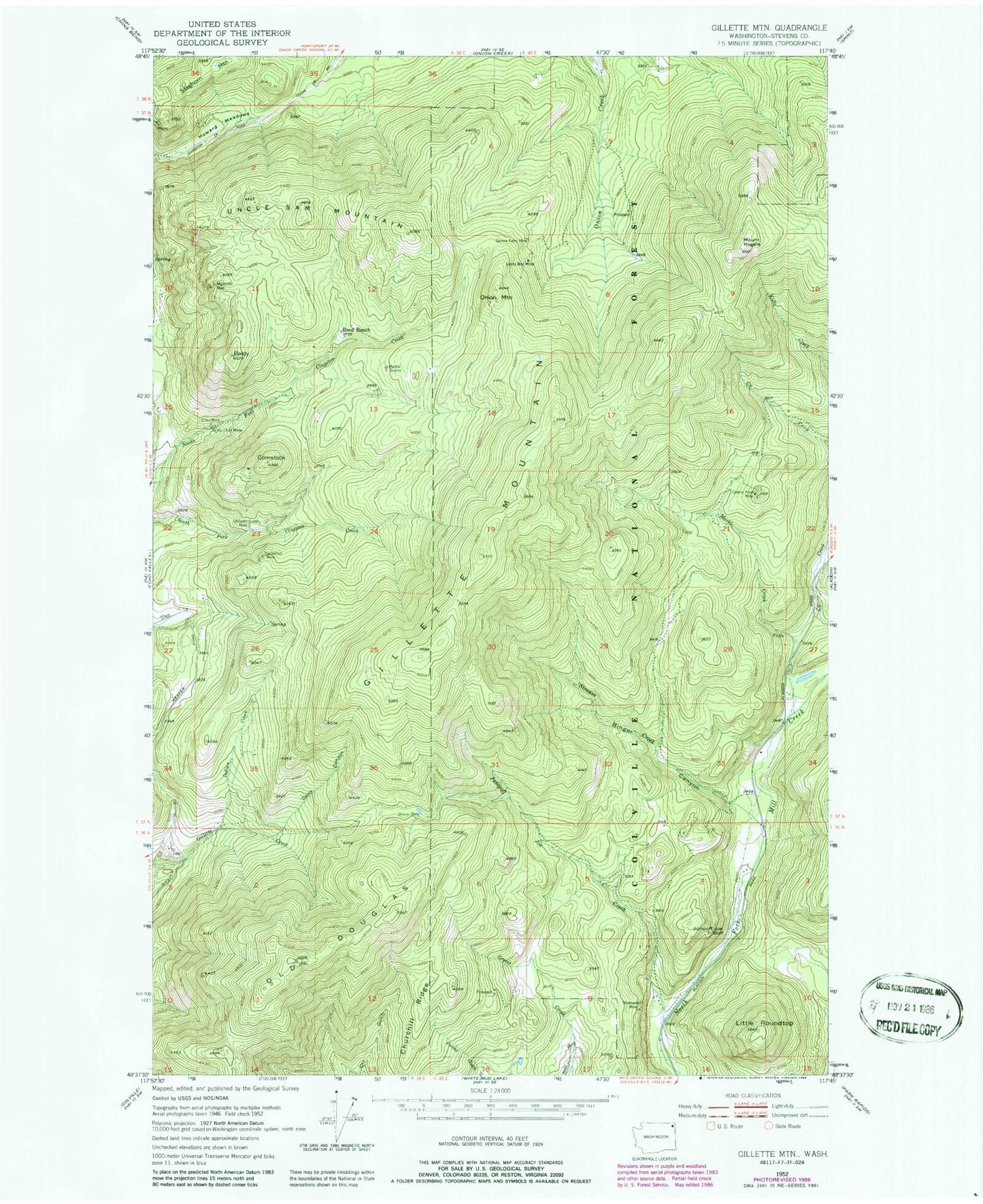
Classic USGS Gillette Mountain Washington 7.5'x7.5' Topo Map
Couldn't load pickup availability
Historical USGS topographic quad map of Gillette Mountain in the state of Washington. Map scale may vary for some years, but is generally around 1:24,000. Print size is approximately 24" x 27"
This quadrangle is in the following counties: Stevens.
The map contains contour lines, roads, rivers, towns, and lakes. Printed on high-quality waterproof paper with UV fade-resistant inks, and shipped rolled.
Contains the following named places: Baldy, Big Chief Mine, Binger Canyon, Chloride Queen Mine, Churchill Ridge, Comstock, Davis Canyon, Echo Mine, Galena Farm Mine, Galena Knob Mine, Gillette Mountain, Green Mountain, Howard Meadows, Indian Creek, Jumpoff Joe Bluff, Jumpoff Joe Creek, Little Roundtop, Lucky Boy Mine, Marble Creek, Marble Quarry, Mount Rogers, Neglected Mine, Old Douglas, Onion Mountain, Reed Ranch, Shoemaker Mine, Staghorn Mountain, Strauss Creek, Tenderfoot Mine, Uncle Sam Mountain