MyTopo
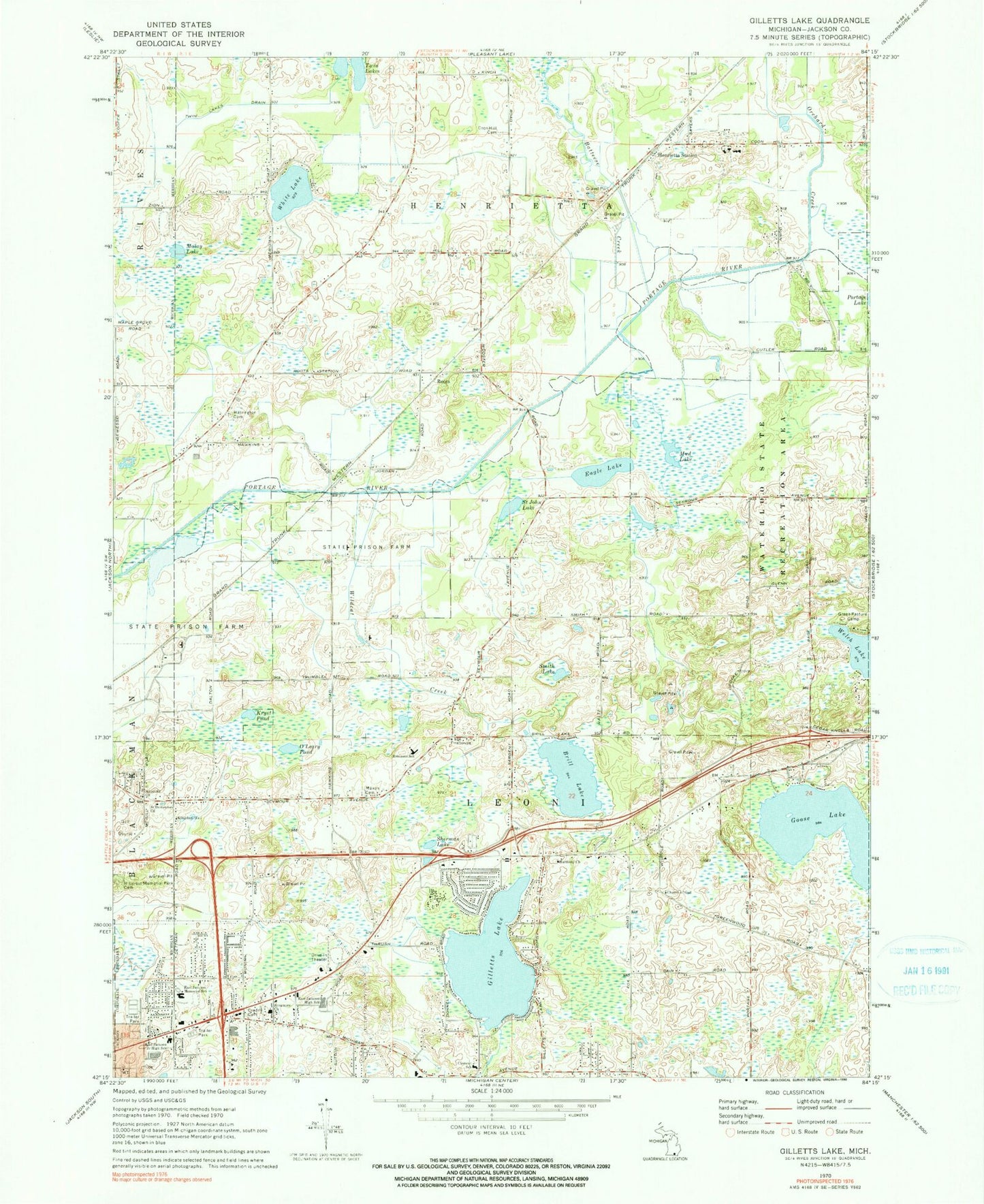
Classic USGS Gilletts Lake Michigan 7.5'x7.5' Topo Map
Couldn't load pickup availability
Historical USGS topographic quad map of Gilletts Lake in the state of Michigan. Map scale may vary for some years, but is generally around 1:24,000. Print size is approximately 24" x 27"
This quadrangle is in the following counties: Jackson.
The map contains contour lines, roads, rivers, towns, and lakes. Printed on high-quality waterproof paper with UV fade-resistant inks, and shipped rolled.
Contains the following named places: Apostolic Church, Batteese Creek, Blackman Township Department of Public Safety Station 2, Brill Lake, Clement School, Cradit Cemetery, Eagle Lake, East Jackson High School, East Jackson Junior High School, East Jackson Memorial School, Eastgate Shopping Center, Gilletts Lake, Goose Lake, Green Pasture Camp, Greenwood Acres Campground, Harmony Church, Harrington Cemetery, Henrietta Station, Hideaway Campgrounds, Holiday Manor Park, Jackson District Library-East Branch, Kinch Cemetery, Kingdom Hall, Kryst Pond, Leoni Township Fire Department Station 2, Malay Lake, Maxon Cemetery, McArthur Cemetery, Mud Lake, O'Leary Pond, Orchard Creek, Pine Hollow Golf Club, Robinson School, Roots, Roots Post Office, Roots Station, Saint Demetrius Church, Saint John Lake, Sherman Lake, Smith Lake, Sparrow Hawk Golf Course, Sun Valley Mobile Home Estates, Sycamore Church, Township of Leoni, Twin Lakes, Twin Lakes Drain, White Lake, Wildcat Creek, ZIP Code: 49259