MyTopo
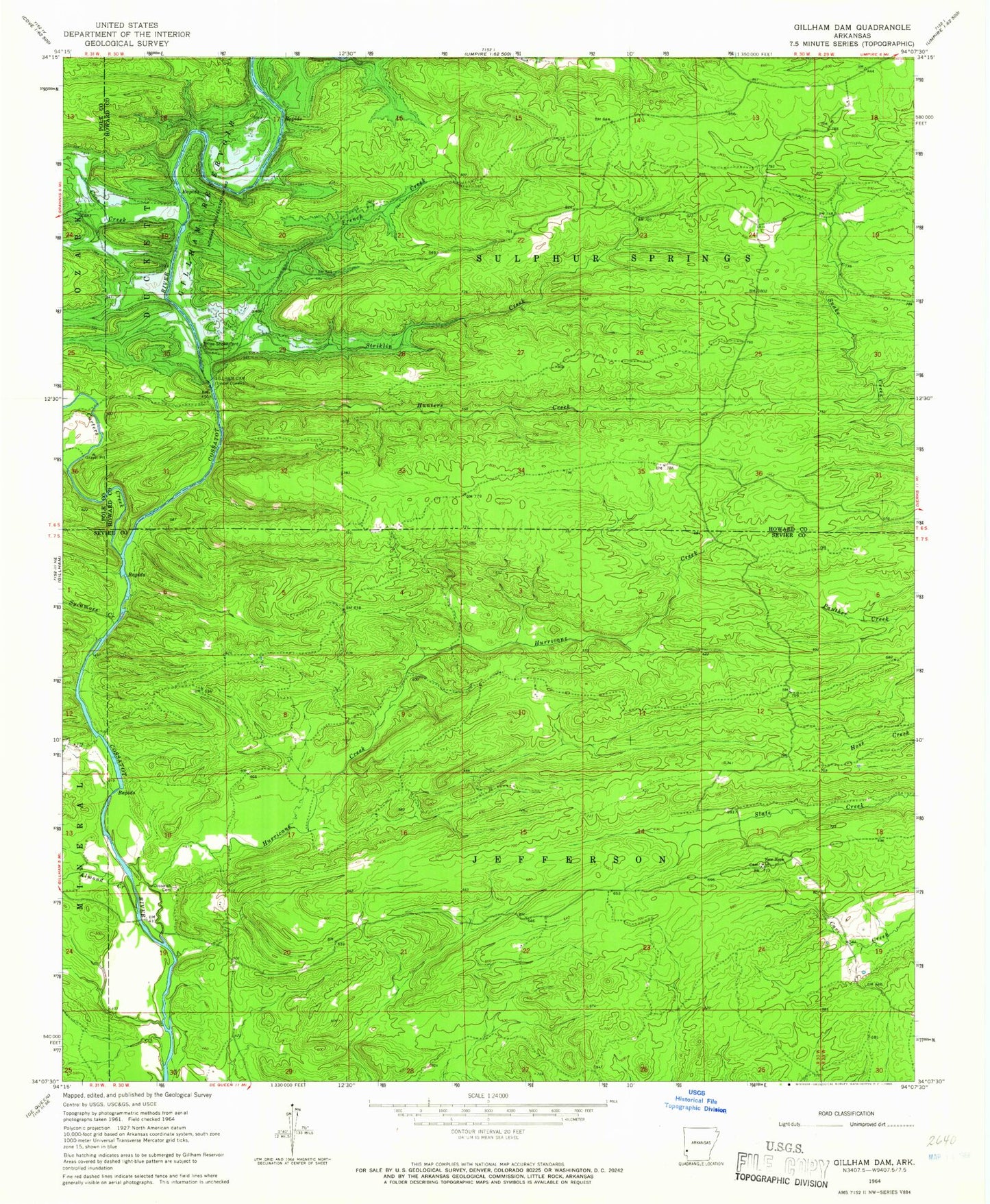
Classic USGS Gillham Dam Arkansas 7.5'x7.5' Topo Map
Couldn't load pickup availability
Historical USGS topographic quad map of Gillham Dam in the state of Arkansas. Map scale may vary for some years, but is generally around 1:24,000. Print size is approximately 24" x 27"
This quadrangle is in the following counties: Howard, Polk, Sevier.
The map contains contour lines, roads, rivers, towns, and lakes. Printed on high-quality waterproof paper with UV fade-resistant inks, and shipped rolled.
Contains the following named places: Almond Creek, Antimony, Antimony School, Carters Creek, Cedar Glade, Cedar Glade School, Clinton Ford, Coon Creek, Cooper School, Cossatot Cemetery, Cossatot Church, Dalrymple Ford, Flanagan Ford, French Creek, Gillham Dam, Gillham Lake, Graves School, Howard County State Wildlife Management Area, Hunters Creek, Hurricane Creek, Ladd Ford, Ladds Bridge, Mallon Ford, New Hope Church, Newhope School, Old New Hope Cemetery, Pleasant Ridge School, Roundtop School, Smyrna, Striklin Creek, Sycamore Creek, Three Shoot Ford, Township of Jefferson, Township of Sulphur Springs, Valley Ridge, Valley Ridge School, Wiser Ford