MyTopo
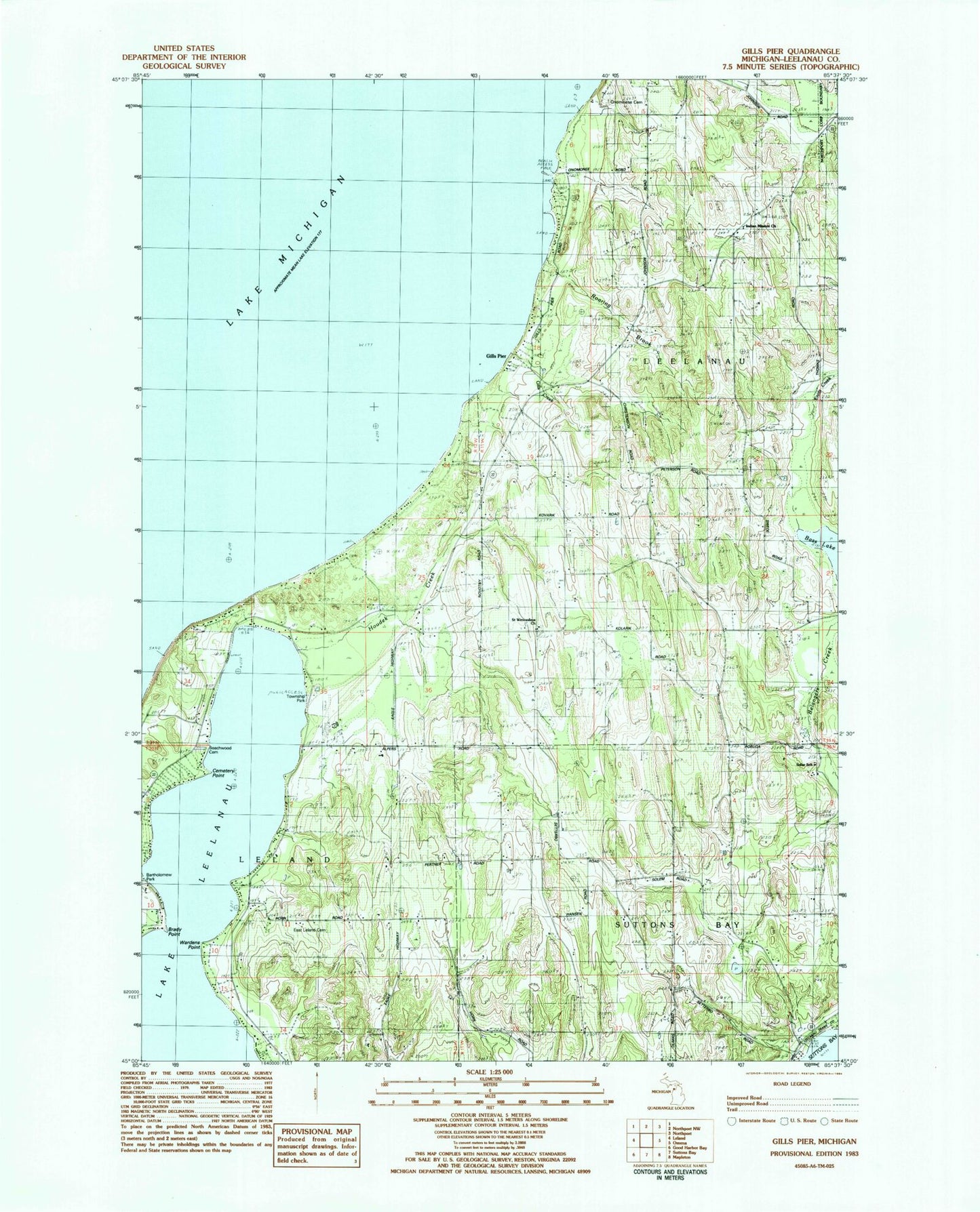
Classic USGS Gills Pier Michigan 7.5'x7.5' Topo Map
Couldn't load pickup availability
Historical USGS topographic quad map of Gills Pier in the state of Michigan. Map scale may vary for some years, but is generally around 1:24,000. Print size is approximately 24" x 27"
This quadrangle is in the following counties: Leelanau.
The map contains contour lines, roads, rivers, towns, and lakes. Printed on high-quality waterproof paper with UV fade-resistant inks, and shipped rolled.
Contains the following named places: Bartholomew Park, Bass Lake, Beechwood Cemetery, Brady Point, Cemetery Point, Cherry Bay Orchards, East Leland Cemetery, Gills Creek, Gills Pier, Gills Pier Post Office, Houdek Creek, Indian Church, Leland Township Park, Onominese Indian Cemetery, Onomonese Indian Cemetery, Roaring Brook, Saint Wenceslaus Cemetery, Saint Wenceslaus Church, Saint Wenceslaus Church and Cemetery Historical Marker, Sollar School, Wardens Point, Wild Cherry Campground