MyTopo
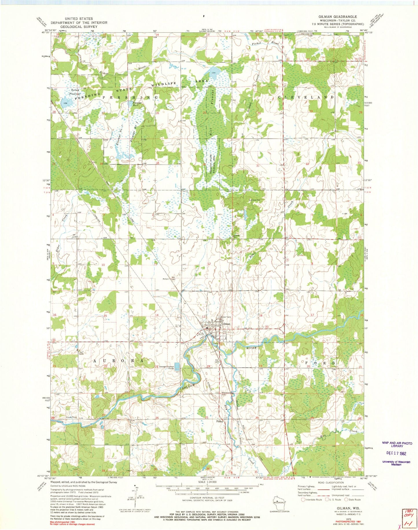
Classic USGS Gilman Wisconsin 7.5'x7.5' Topo Map
Couldn't load pickup availability
Historical USGS topographic quad map of Gilman in the state of Wisconsin. Map scale may vary for some years, but is generally around 1:24,000. Print size is approximately 24" x 27"
This quadrangle is in the following counties: Taylor.
The map contains contour lines, roads, rivers, towns, and lakes. Printed on high-quality waterproof paper with UV fade-resistant inks, and shipped rolled.
Contains the following named places: Babit Creek, Flowage Number One, Flowage Number Three, Flowage Number Two, Gilman, Gilman Elementary School, Gilman High School, Gilman Police Department, Gilman Post Office, Gilman Rural Volunteer Fire Department, Hannibal Cemetery, Hay Creek, Meadowbrook Catholic Cemetery, Meadowbrook Cemetery, Meadowbrook Lutheran Cemetery, Pershing State Wildlife Area, Polley, Sotak Flowage, Sotak Flowage G12.575 Dam, Town of Aurora, Town of Pershing, Village of Gilman, Witt Flowage, Witt Flowage G12.575 Dam, ZIP Code: 54433