MyTopo
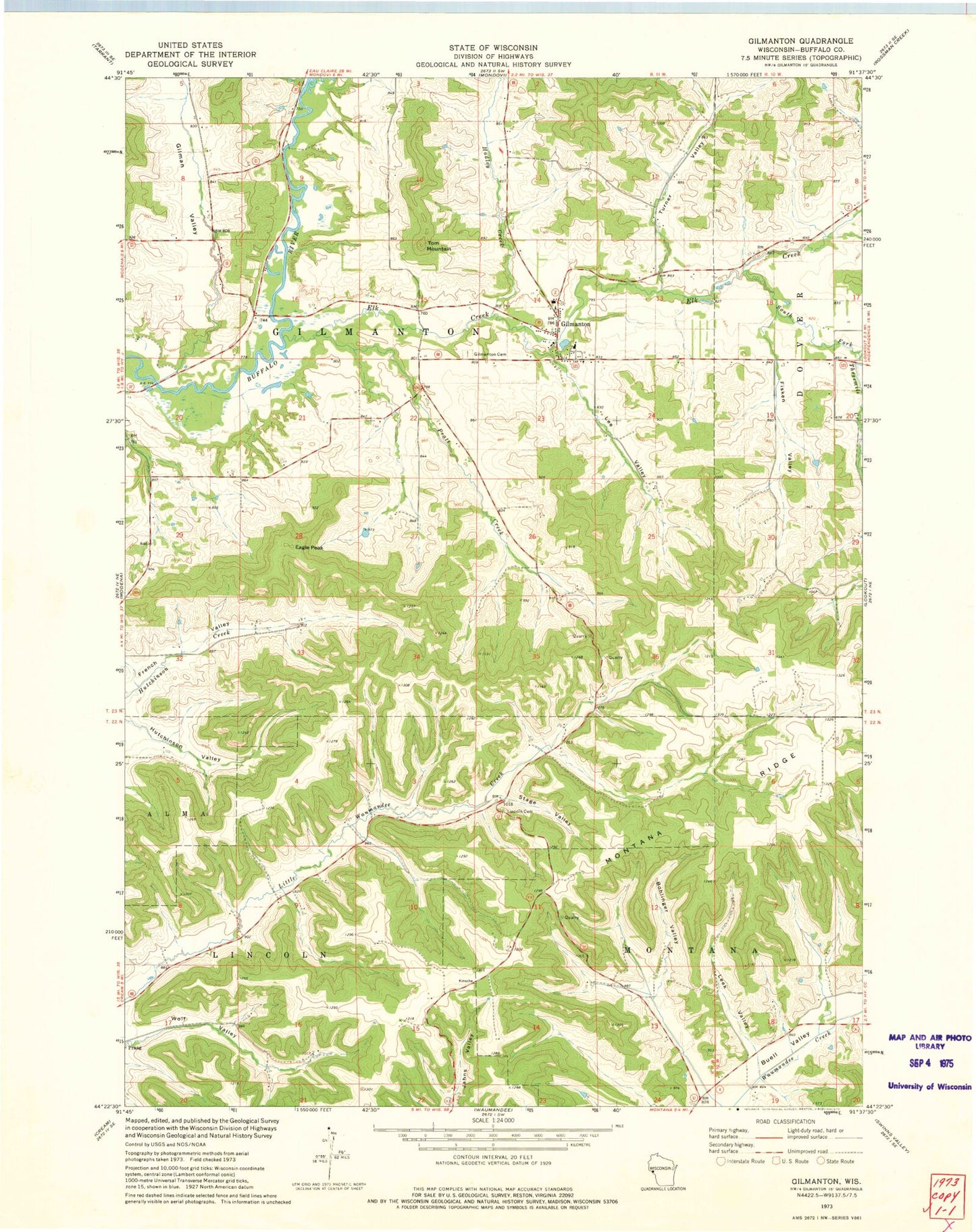
Classic USGS Gilmanton Wisconsin 7.5'x7.5' Topo Map
Couldn't load pickup availability
Historical USGS topographic quad map of Gilmanton in the state of Wisconsin. Map scale may vary for some years, but is generally around 1:24,000. Print size is approximately 24" x 27"
This quadrangle is in the following counties: Buffalo.
The map contains contour lines, roads, rivers, towns, and lakes. Printed on high-quality waterproof paper with UV fade-resistant inks, and shipped rolled.
Contains the following named places: 02 Reservoir, Bennett Valley, Bohlinger Valley, Churches Creek, Eagle Peak, Elk Creek, Fisken Valley, Four Corners School, Gilman Creek, Gilman Valley, Gilman Valley School, Gilmanton, Gilmanton Cemetery, Gilmanton Census Designated Place, Gilmanton Elementary School, Gilmanton High School, Gilmanton Post Office, Griffin School, Hadley Creek, Helwig H1605 Dam, Hutchinson Valley, Lee Valley, Leek Valley, Lincoln Church, Oak Grove School, Pratt Creek, Rutchow Cemetery, Sharp Corner School, South Fork Elk Creek, Stage Valley, Three Mile Creek, Threemile Creek, Threemile Creek School, Tom Mountain, Town of Gilmanton, Turner Valley, Whelan School, Wolf Valley