MyTopo
Classic USGS Gilmer Texas 7.5'x7.5' Topo Map
Couldn't load pickup availability
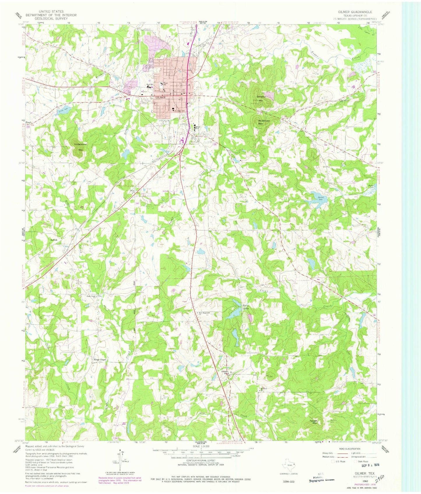
Historical USGS topographic quad map of Gilmer in the state of Texas. Map scale may vary for some years, but is generally around 1:24,000. Print size is approximately 24" x 27"
This quadrangle is in the following counties: Upshur.
The map contains contour lines, roads, rivers, towns, and lakes. Printed on high-quality waterproof paper with UV fade-resistant inks, and shipped rolled.
Contains the following named places: Bee Branch, Bruce School, Cherokee Baptist Church, Church of Christ, Church of the Nazarene, City of Gilmer, Cypress Church of Christ, East Texas Medical Center, Enoch, Faith Church, First Baptist Church, Fox Stephens Field - Gilmer Municipal Airport, Gilmer, Gilmer City Hall, Gilmer Country Club, Gilmer Division, Gilmer Fire Department, Gilmer High School, Gilmer Police Department, Gilmer Post Office, Glade Creek Church, Historic Upshur Museum, Hollis Chapel Church of God in Christ, KLSQ-FM (Gilmer), Lindsey Lake, Lindsey Lake Dam, McDonald Mountain, Messner Lake, Messner Lake Dam, Mings Chapel, Moses Chapel Church, Mount Gilead Baptist Church, Mount Olive Church, New Hopewell Church, Nunn Lake, Nunn Lake Dam, Pattonfield, Piedmont, Piedmont School, Pilgrims Rest Baptist Church, Pine Grove Church, Pond Creek, Reynolds Cemetery, Safady Lake Dam, Saint Davids Episcopal Church, Shelton Lake, Sheltons Lake Dam, Simpson Mountain, Sonny Oats Lake Number 1, Sonny Oats Lake Number 1 Dam, Sonny Oats Lake Number 2, Sonny Oats Lake Number 2 Dam, South Twin Lakes, South Twin Lakes Dam, Stillhouse Creek, Sunset Memorial Park, Tanyard Creek, Texas Forest Service Gilmer Fire Station, Tidwell Mountain, Tullos Lake, Twin Lakes, Underwood Mountain, Upshur County, Upshur County Constable's Office Precinct 1, Upshur County Constable's Office Precinct 2, Upshur County Constable's Office Precinct 4, Upshur County Jail, Upshur County Sheriff's Office, Ward School


