MyTopo
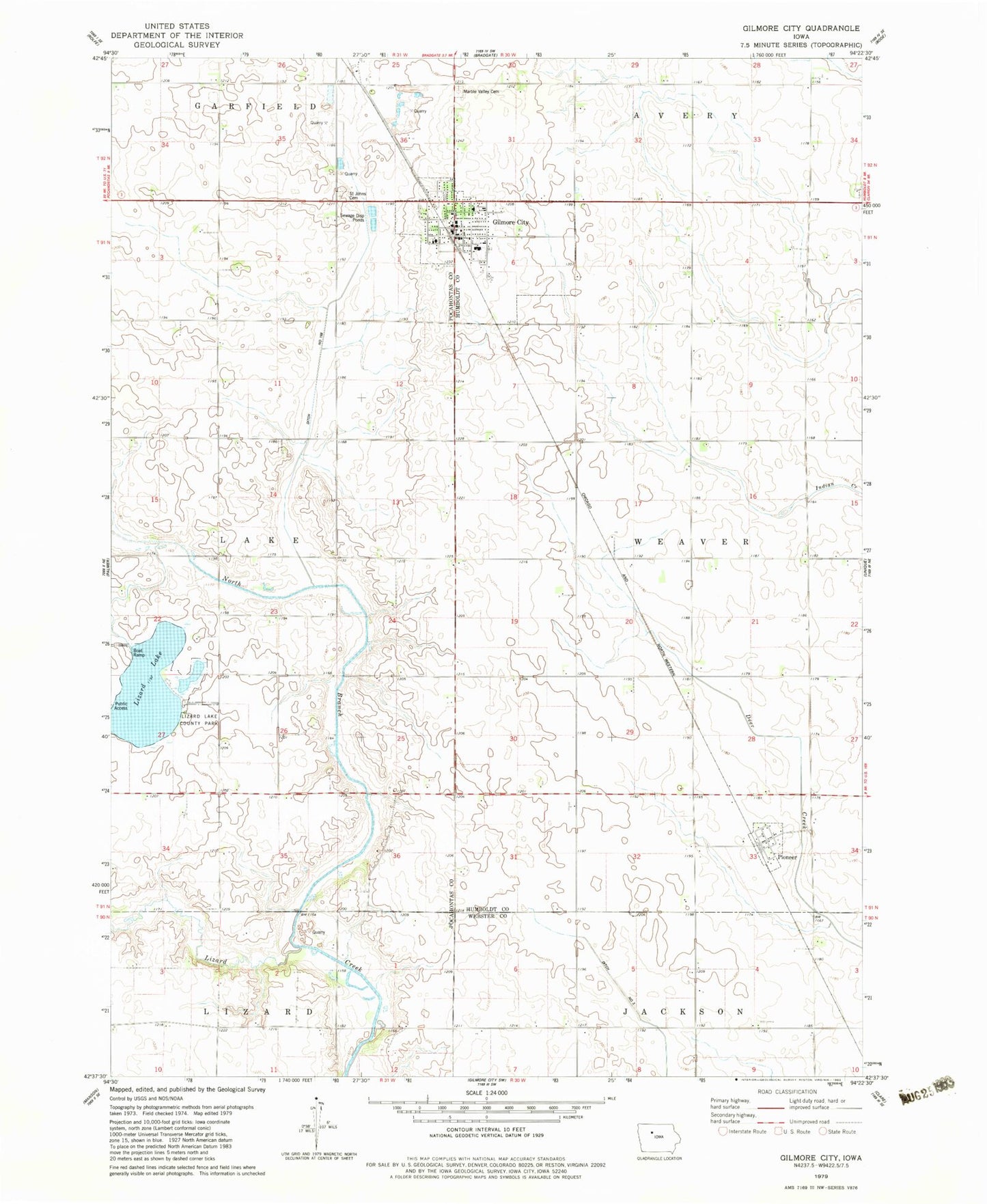
Classic USGS Gilmore City Iowa 7.5'x7.5' Topo Map
Couldn't load pickup availability
Historical USGS topographic quad map of Gilmore City in the state of Iowa. Map scale may vary for some years, but is generally around 1:24,000. Print size is approximately 24" x 27"
This quadrangle is in the following counties: Humboldt, Pocahontas, Webster.
The map contains contour lines, roads, rivers, towns, and lakes. Printed on high-quality waterproof paper with UV fade-resistant inks, and shipped rolled.
Contains the following named places: City of Gilmore City, City of Pioneer, Drainage Ditch Number 168, Faith United Methodist Church, First Baptist Church, First Lutheran Church, Gilmore City, Gilmore City - Bradgate Elementary School, Gilmore City Ambulance, Gilmore City City Hall, Gilmore City Fire Department, Gilmore City Library, Gilmore City Police Department, Gilmore City Post Office, Lizard Lake, Lizard Lake Access, Lizard Lake County Park, Lizard Lake Wildlife Management Area, Lizzard Creek Wildlife Area, Marble Valley Cemetery, North Branch Lizard Creek, Pioneer, Pioneer City, Pioneer City Census Designated Place, Pioneer Post Office, Pro Cooperative Elevator, Saint Johns Catholic Cemetery, Saint John's Church, Stein's Rockin R Mobile Home Park, Township of Weaver, Twin River Valley Middle School, ZIP Code: 50541