MyTopo
Classic USGS Gilson Mountain Vermont 7.5'x7.5' Topo Map
Couldn't load pickup availability
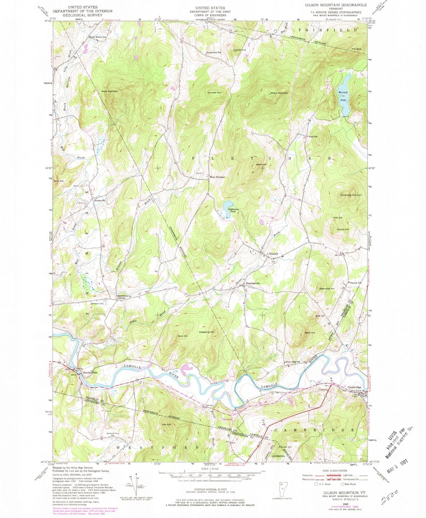
Historical USGS topographic quad map of Gilson Mountain in the state of Vermont. Typical map scale is 1:24,000, but may vary for certain years, if available. Print size: 24" x 27"
This quadrangle is in the following counties: Chittenden, Franklin, Lamoille.
The map contains contour lines, roads, rivers, towns, and lakes. Printed on high-quality waterproof paper with UV fade-resistant inks, and shipped rolled.
Contains the following named places: Armstrong Hill, Bald Knob, Beaver Brook, Binghamville, Black Hill, Buck Hill, Buck Hollow School, Buck Mountain, Cobbler Hill, Cambridge, Church Hill, Coombs Hill, Ellenwood Hill, Fairfax Falls, Fletcher, Gilson Mountain, Halfmoon Pond, Hedgehog Hill, Huntsville, Leach Hill, Metcalf Pond, Oak Hill, Oak Hill, Parsons School, Polly Brook, Buck Hollow, Pond School, Putnam Hill, River View School, Sand Hill, Sanderson Cemetery, Sanderson Corner, Shepardson School, Stones Brook, The Gore, West Fletcher, Westford Plains Cemetery, Wilkins Brook, Town of Fletcher, Fairfax Falls Dam, Fairfax Falls Pond, Cambridge Congregational Church, Cambridge Post Office, Cambridge State Forest, Fletcher Elementary School, Gates Cemetery, Giddings Cemetery, Mountainview Cemetery, Saint Marys Catholic Church, Binghamville Cemetery, Carroll Hill Cemetery, Cobler Hill Cemetery, Fletcher Union Church, Mudgett Cemetery, Pioneer Cemetery, River Road Cemetery, Spafford Cemetery, Village of Cambridge, Fletcher Elementary School