MyTopo
Classic USGS Gimlet Creek Michigan 7.5'x7.5' Topo Map
Regular price
$16.95
Regular price
Sale price
$16.95
Unit price
per
Couldn't load pickup availability
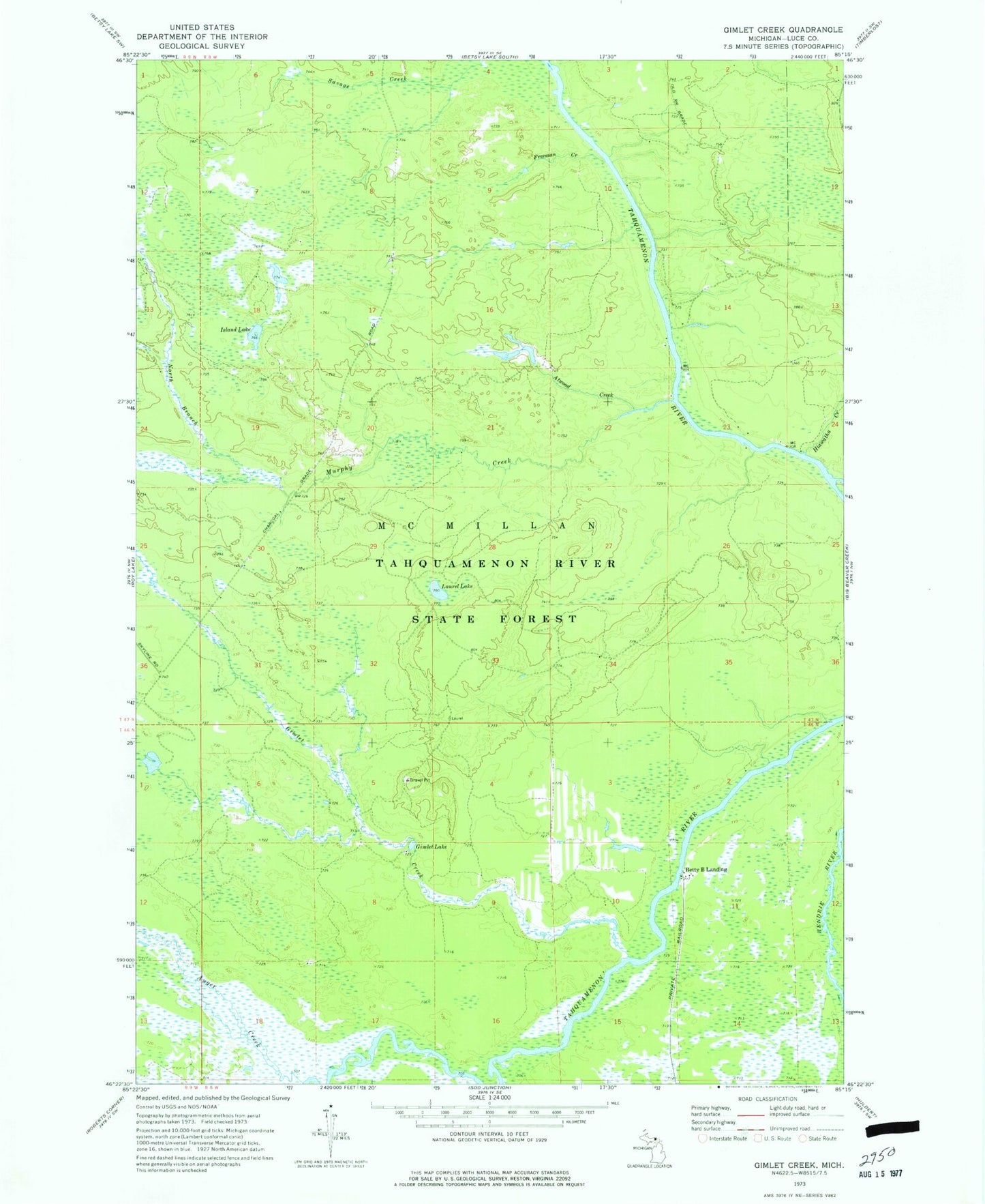
Historical USGS topographic quad map of Gimlet Creek in the state of Michigan. Map scale may vary for some years, but is generally around 1:24,000. Print size is approximately 24" x 27"
This quadrangle is in the following counties: Luce.
The map contains contour lines, roads, rivers, towns, and lakes. Printed on high-quality waterproof paper with UV fade-resistant inks, and shipped rolled.
Contains the following named places: Atwood Creek, Auger Creek, Betty B Landing, East Branch Tahquamenon River, Freeman Creek, Gimlet Creek, Gimlet Lake, Hiawatha Creek, Island Lake, Laurel Lake, Murphy Creek, North Branch Murphy Creek