MyTopo
Classic USGS Ginhouse Island Alabama 7.5'x7.5' Topo Map
Couldn't load pickup availability
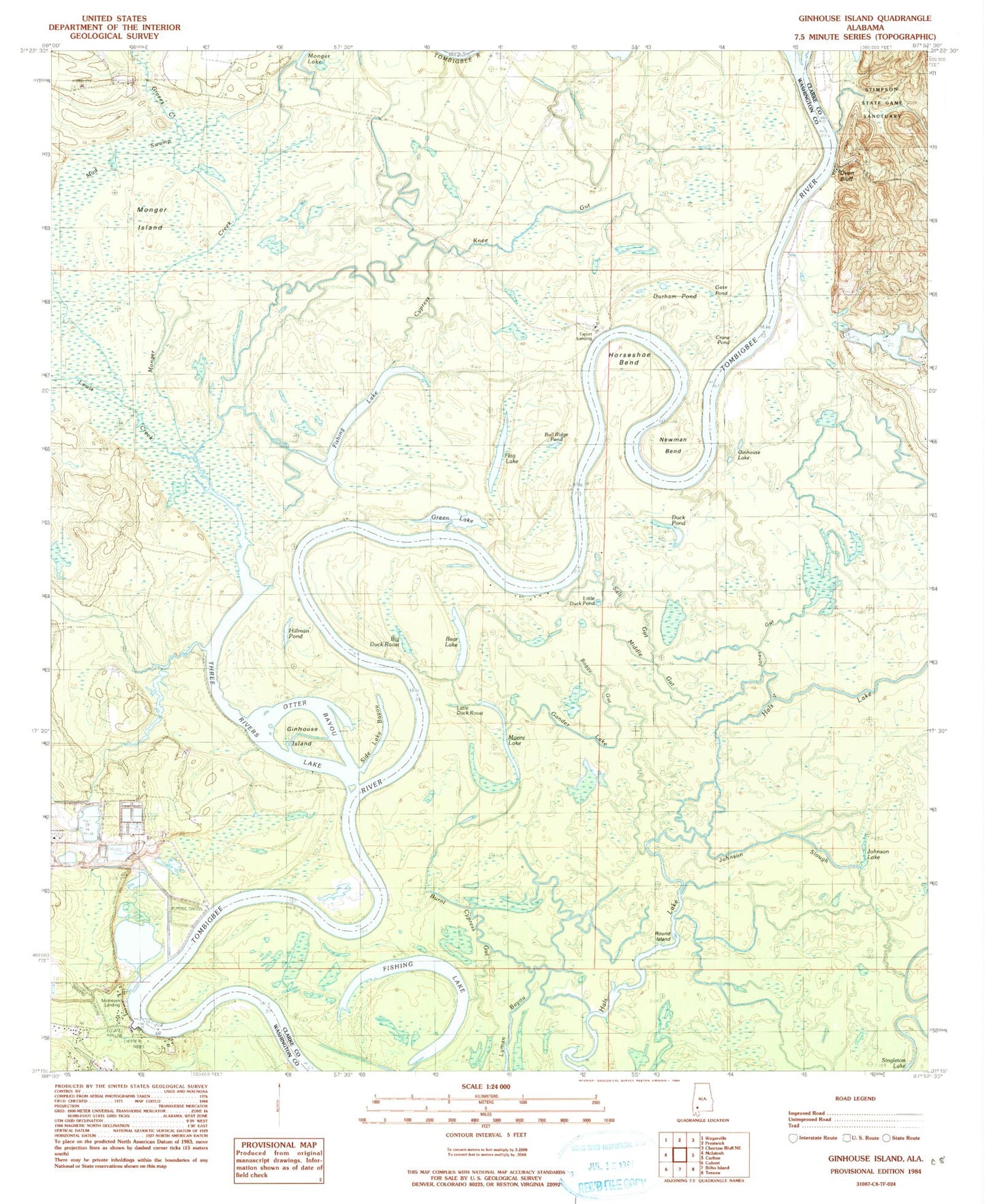
Historical USGS topographic quad map of Ginhouse Island in the state of Alabama. Map scale may vary for some years, but is generally around 1:24,000. Print size is approximately 24" x 27"
This quadrangle is in the following counties: Clarke, Washington.
The map contains contour lines, roads, rivers, towns, and lakes. Printed on high-quality waterproof paper with UV fade-resistant inks, and shipped rolled.
Contains the following named places: Alexander Landing, Batchelors Landing, Bear Lake, Berris Landing, Big Duck Roost, Boggy Gut, Bull Ridge Pond, Burnt Cypress Gut, Ciba Geigy McIntosh Plant Pond 1, Ciba Geigy McIntosh Plant Pond 2, Crane Pond, Cypress Knee Gut, D R Dunlap Estate Dam, Days Bar, Duck Pond, Dunham Pond, Dunlap Lake, Export Landing, Fishing Lake, Flag Lake, Gander Lake, Gate Pond, Ginhouse Island, Ginhouse Lake, Graves Creek, Green Lake, Hals Lake, Hillman Pond, Holders Ferry, Horseshoe Bend, Hunters Slough, Johnson Lake, Johnson Slough, Johnsons Creek, Johnsons Landing, Jones Gut, Lewis Creek, Little Duck Roost, Lower Duck Pond, Lyman Bayou, McIntosh Bluff, McIntosh Landing, Middle Gut, Monger Creek, Monger Island, Moore Lake, Mud Swamp, Newman Bend, Otter Bayou, Oven Bluff, Oven Bluff Fishing Camp, Oven Landing, Round Island, Salt Gut, Side Lake Bayou, South Lake, Sunflower Junior High School, The Cove, Three Rivers, Three Rivers Lake, Vaughns Landing, Whistlers Landing