MyTopo
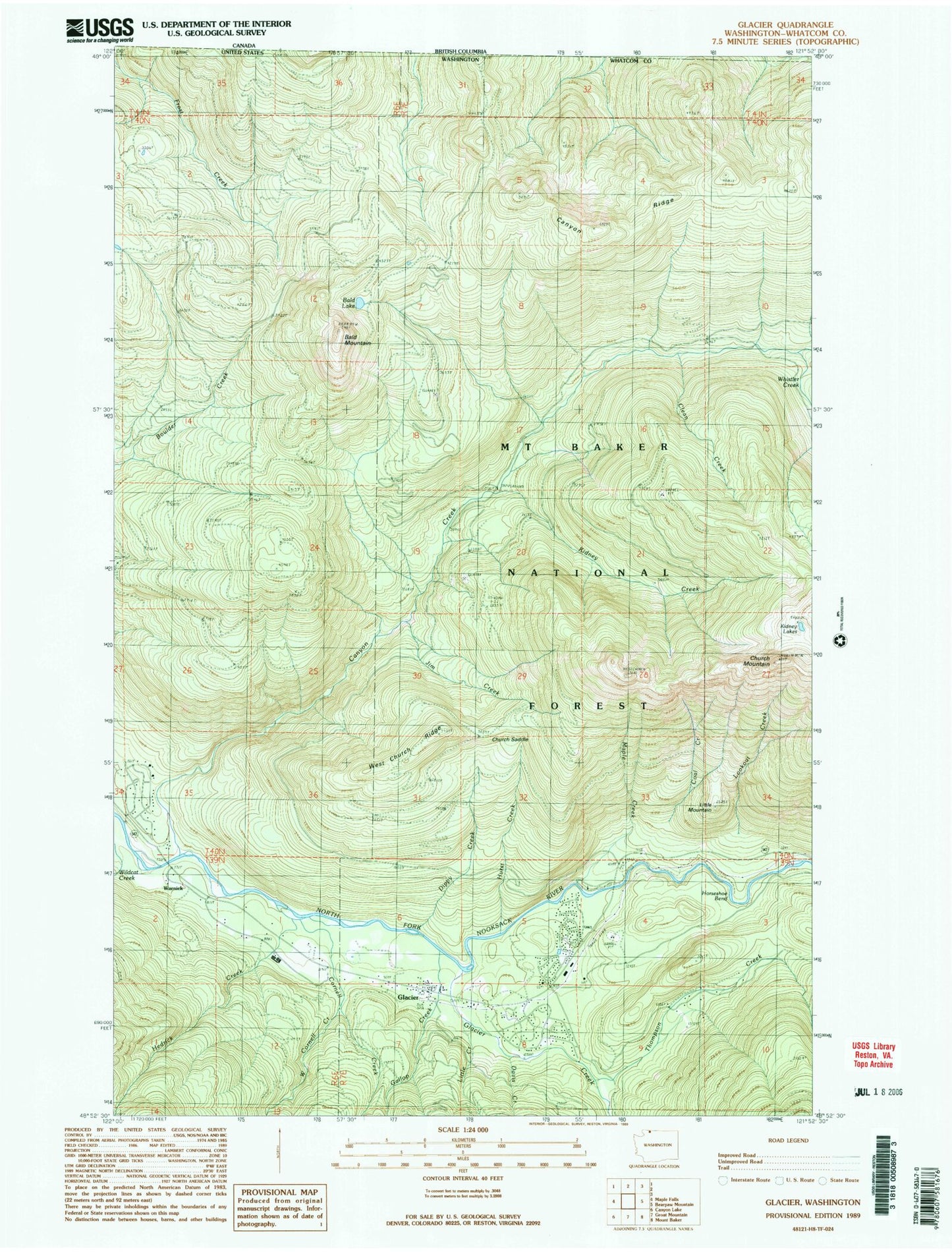
Classic USGS Glacier Washington 7.5'x7.5' Topo Map
Couldn't load pickup availability
Historical USGS topographic quad map of Glacier in the state of Washington. Map scale may vary for some years, but is generally around 1:24,000. Print size is approximately 24" x 27"
This quadrangle is in the following counties: Whatcom.
The map contains contour lines, roads, rivers, towns, and lakes. Printed on high-quality waterproof paper with UV fade-resistant inks, and shipped rolled.
Contains the following named places: Bald Lake, Canyon Creek, Canyon Creek Campground, Church Mountain, Church Saddle, Clean Creek, Coal Creek, Cornell Creek, Davis Creek, Dippy Creek, Douglas Fir Campground, Gallop Creek, Glacier, Glacier Census Designated Place, Glacier Chamber of Commerce, Glacier Creek, Glacier Public Service Center, Hedrick Creek, Horseshoe Bend, Hurst Creek, Jim Creek, Kaisoots Mountain, Kidney Creek, Kidney Lakes, Little Creek, Little Mountain, Lookout Creek, Maple Creek, Mount Baker-Snoqualmie National Forest, Thompson Creek, Warnick, Warnick Bridge, West Church Ridge, West Cornell Creek, Whatcom County Fire District 19 Glacier Fire and Rescue, Whistler Creek