MyTopo
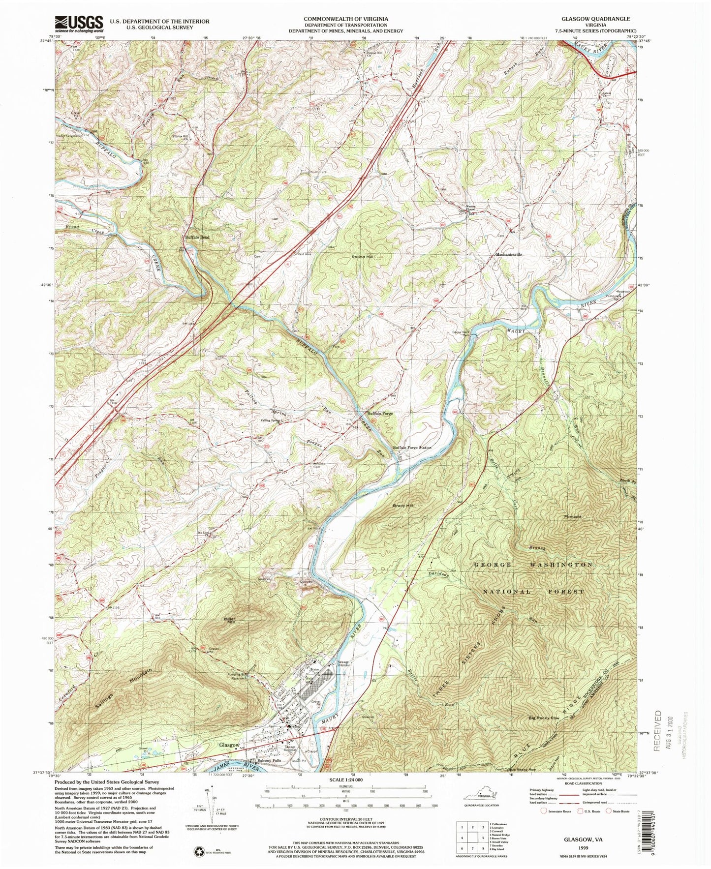
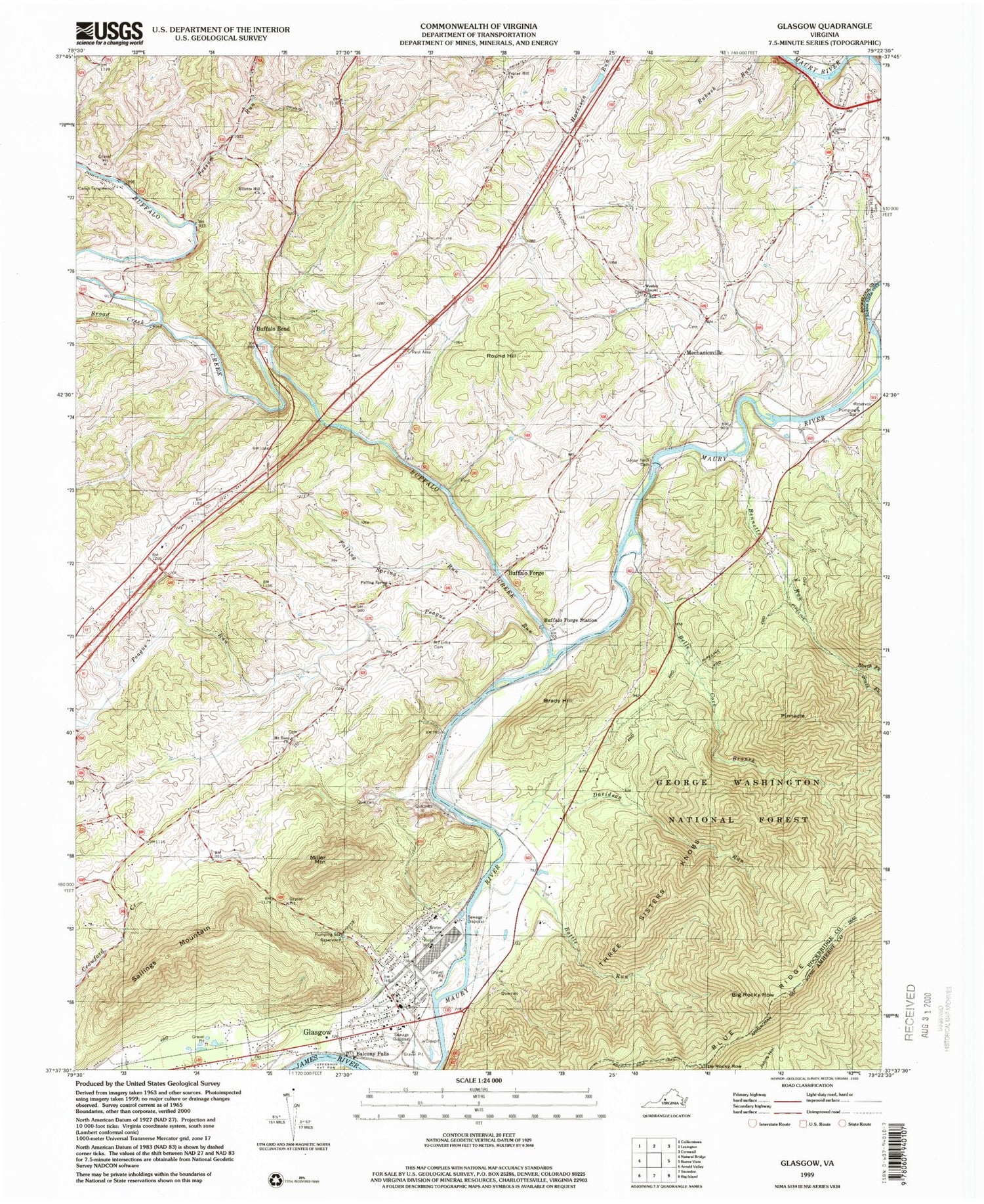
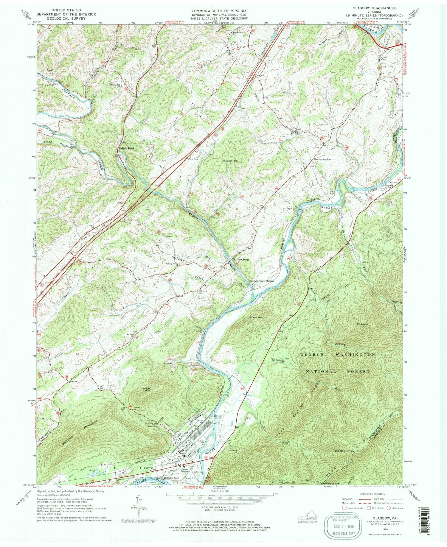
Classic USGS Glasgow Virginia 7.5'x7.5' Topo Map
Couldn't load pickup availability
Historical USGS topographic quad map of Glasgow in the state of Virginia. Typical map scale is 1:24,000, but may vary for certain years, if available. Print size: 24" x 27"
This quadrangle is in the following counties: Amherst, Buena Vista (city), Rockbridge.
The map contains contour lines, roads, rivers, towns, and lakes. Printed on high-quality waterproof paper with UV fade-resistant inks, and shipped rolled.
Contains the following named places: Battle Run, Belle Cove Branch, Bennetts Run, Big Rocky Row, Brady Hill, Broad Creek, Buffalo Creek, Buffalo Forge Station, Camp Tanglewood, Davidson Run, Elliots Hill Church, Falling Spring Church, Falling Spring Run, Goose Neck Dam, Green Hill Cemetery, Little Rocky Row, Lowry Run, Miller Mountain, Mount Lidia Cemetery, Mount Zion Church, North Fork Bennetts Run, Pinnacle, Poague Run, Poplar Hill Church, Possum Run, Rocky Row Trail, Round Hill, Salem Church, Sallings Mountain, South Fork Bennetts Run, Three Sisters Knobs, Wesley Chapel, Balcony Falls, Buffalo Bend, Buffalo Forge, Glasgow, Mechanicsville, Balcony Downs Airstrip (historical), Twin River Airport (historical), B G Locher Bridge, Ben Salem School (historical), Lone Jack Quarry, Falling Spring Cemetery, Glasgow Baptist Church, Glasgow Cemetery, Glasgow Elementary School (historical), Glasgow Presbyterian Church, Moores School (historical), Paxton Cemetery, Possum Hollow, Salling Family Cemetery, Wesley Chapel Cemetery, Zollman (historical), Buffalo District, Entoto Knob, Glasgow Volunteer Fire Department, Glasgow Rescue Squad Rescue 3, Town of Glasgow, Glasgow Post Office, Glasgow Police Department, Virginia State Police Division 6 Area 39 Office