
MyTopo
Classic USGS Gleason Basin Nevada 7.5'x7.5' Topo Map
Regular price
$16.95
Regular price
Sale price
$16.95
Unit price
per
Couldn't load pickup availability
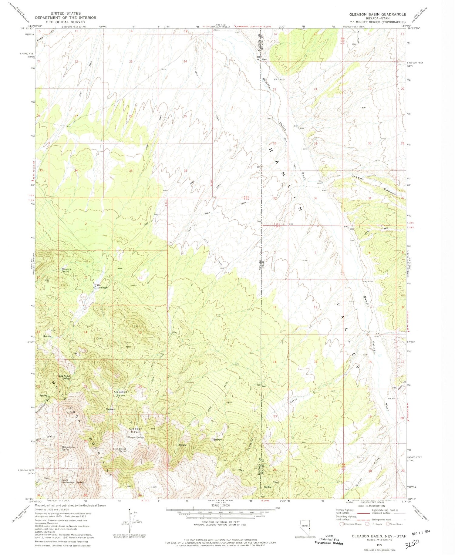
Historical USGS topographic quad map of Gleason Basin in the states of Nevada, Utah. Map scale may vary for some years, but is generally around 1:24,000. Print size is approximately 24" x 27"
This quadrangle is in the following counties: Beaver, Lincoln.
The map contains contour lines, roads, rivers, towns, and lakes. Printed on high-quality waterproof paper with UV fade-resistant inks, and shipped rolled.
Contains the following named places: Alexander Basin, Gleason Basin, Gleason Springs, Greens Canyon, Lone Trough Spring, Milk Ranch Springs, Monumental Reservoir, Monumental Spring, Picketts Wash, Ripgut Creek, Sawmill Creek, South Monumental Springs, The Hermitage, Whiskey Spring


