MyTopo
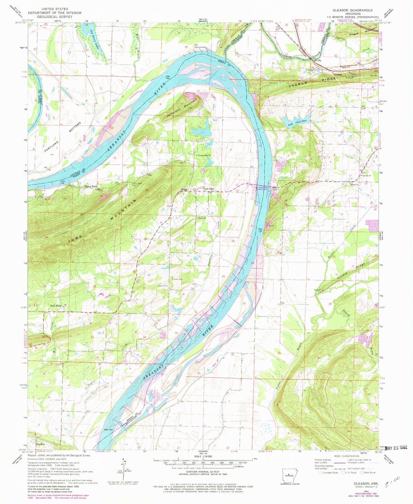
Classic USGS Gleason Arkansas 7.5'x7.5' Topo Map
Couldn't load pickup availability
Historical USGS topographic quad map of Gleason in the state of Arkansas. Map scale may vary for some years, but is generally around 1:24,000. Print size is approximately 24" x 27"
This quadrangle is in the following counties: Conway, Faulkner, Perry.
The map contains contour lines, roads, rivers, towns, and lakes. Printed on high-quality waterproof paper with UV fade-resistant inks, and shipped rolled.
Contains the following named places: Arkansas Noname 194 Dam, Bessie, Bethel Church, Cadron, Cadron Creek, Cadron Settlement Park, Calvary Baptist Church, Cantrell Field, Casey Cemetery, Conway City Landfill, Conway Fire Department Station 5, Cypress Creek, Dew Drop School, Dixie, Dixie School, Gay Branch, Gleason, Jefferson Mountain, Jones Lake Dam Number Two, Jones Lake Number Two, Lake Carol-Dan, Lake Carol-Dan Dam, Lipsmeyers Store, Miller Bayou, New Dixie, Nogal, Old River Lake, Ouachita Creek, Ouachita Creek Watershed Site One Dam, Ouachita Creek Watershed Site One Reservoir, Ouachita Creek Watershed Site Three Reservoir, Ouachita Creek Watershed Site Two Dam, Ouachita Creek Watershed Site Two Reservoir, Pleasant Hill Church, Pool Eight, Portland Bottoms, Red Hill, Red Hill School, Ruth Doyle Intermediate School, Salem, Salem Baptist Church, Salem Cemetery, Stony Point, Stony Point Baptist Church, Stony Point Cemetery, Stony Point School, Stony Point Volunteer Fire Station, Toad Suck, Toad Suck Ferry, Toad Suck Ferry Damsite Park, Toad Suck Ferry Lock and Dam, Township of Perry, Township of Union, Tucker Creek, Tupelo Bayou Site One Dam, Tupelo Bayou Site One Reservoir, Tupelo Bayou Site Two Dam, Tupelo Bayou Site Two Reservoir, Wescon Volunteer Fire Department, Whittens Store