
MyTopo
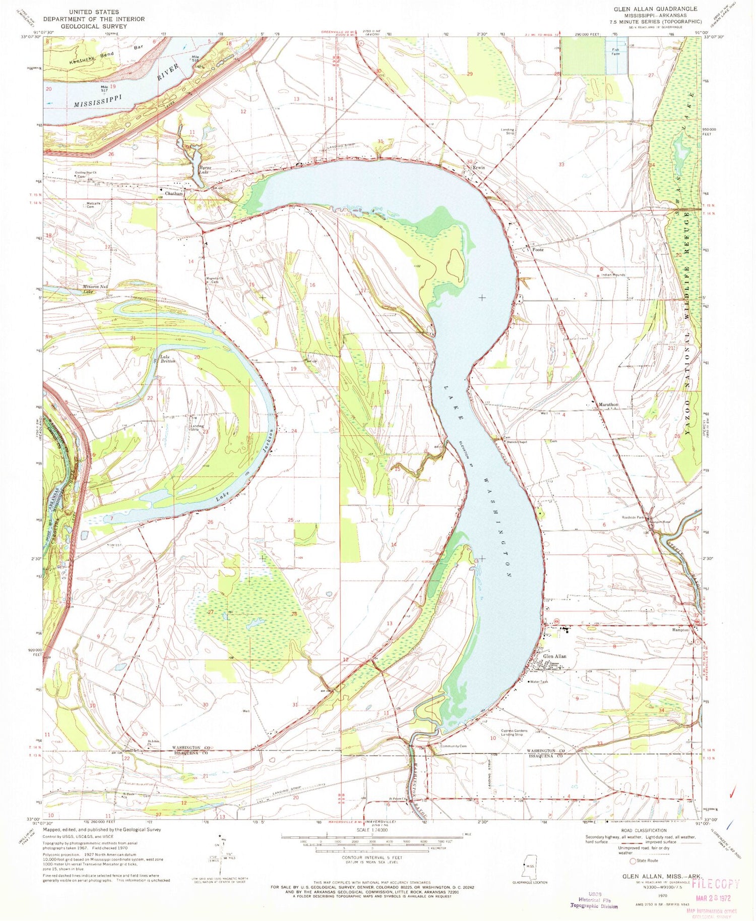
Classic USGS Glen Allan Mississippi 7.5'x7.5' Topo Map
Couldn't load pickup availability
Historical USGS topographic quad map of Glen Allan in the states of Mississippi, Arkansas. Map scale may vary for some years, but is generally around 1:24,000. Print size is approximately 24" x 27"
This quadrangle is in the following counties: Chicot, Issaquena, Washington.
The map contains contour lines, roads, rivers, towns, and lakes. Printed on high-quality waterproof paper with UV fade-resistant inks, and shipped rolled.
Contains the following named places: Alhambra, Allan Chapel, Byrne City, Byrne Lake, Carolina Chute, Chatham, Chatham Community Post Office, Damascus Church, Daniels Chapel, Eastern Star Church, Erwin, Evening Star Church, Foote, Glen Allan, Glen Allan Attendance Center, Glen Allan Census Designated Place, Glen Allan Post Office, Guiding Star Church, Hampton, Kentucky Bend Revetment, Lake Britton, Lake Jackson, Lake Washington, Lake Washington Airport, Leota, Lewis Airport, Linsey, Magnolia Church, Marathon, Metcalfe Cemetery, Minorca Nut Lake, Moore Elementary School, Mount Holly Church, Pleasant Star Church, Princeton, Princeton Landing, Rising Sun Church, Saint Johns Church, Saint Pauls Church, Saint Peters Church, Shiloh Church, Strangers Home Church, Swan Lake Slough, Valewood, ZIP Codes: 38704, 38731, 38744


