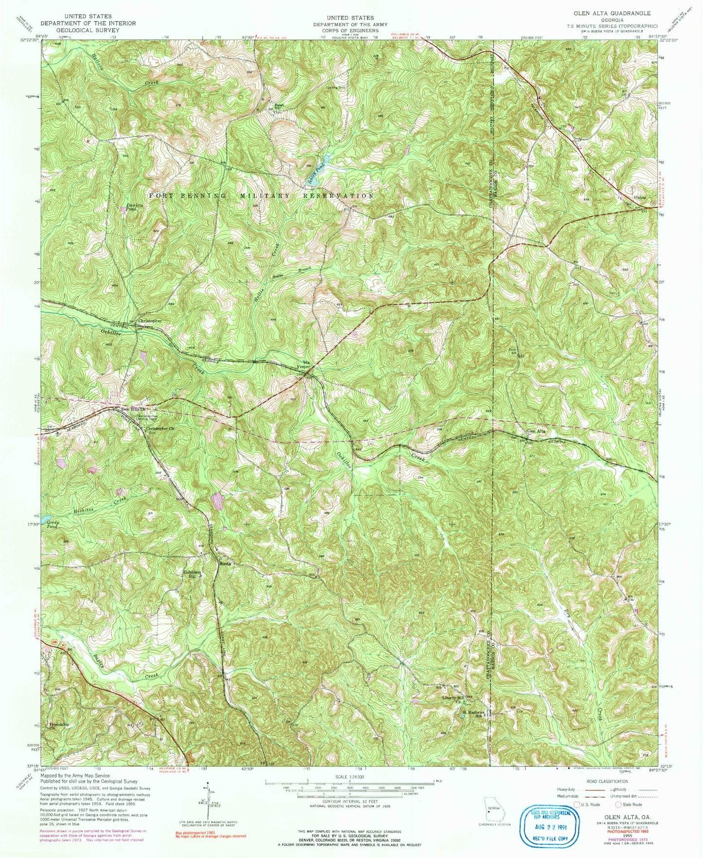
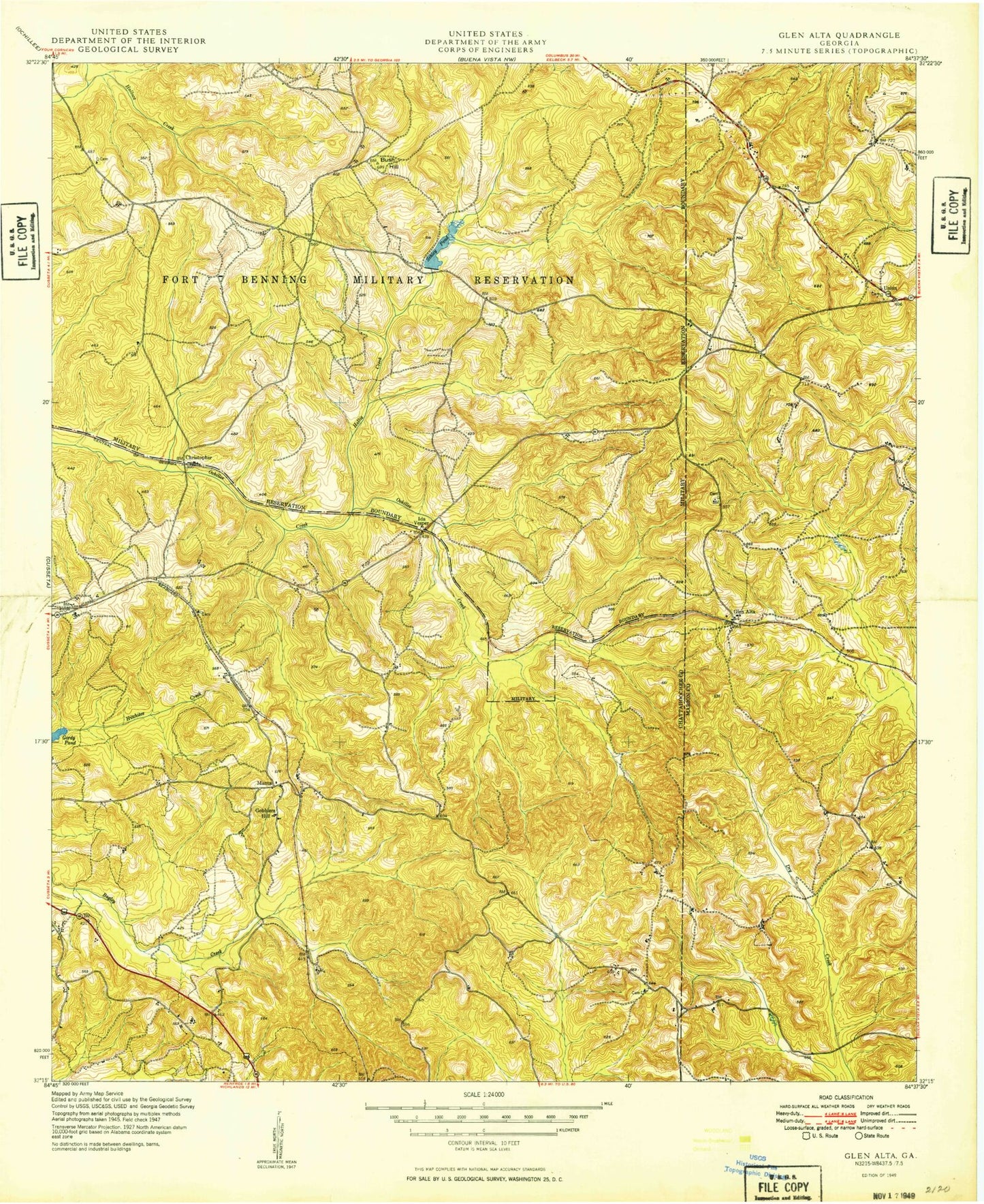
MyTopo
Classic USGS Glen Alta Georgia 7.5'x7.5' Topo Map
Couldn't load pickup availability
Historical USGS topographic quad map of Glen Alta in the state of Georgia. Typical map scale is 1:24,000, but may vary for certain years, if available. Print size: 24" x 27"
This quadrangle is in the following counties: Chattahoochee, Marion.
The map contains contour lines, roads, rivers, towns, and lakes. Printed on high-quality waterproof paper with UV fade-resistant inks, and shipped rolled.
Contains the following named places: Bush Hill, Daniels Pond, Friendship Church, Friendship School, Gordy Pond, Hollis Branch, Hollis Creek, Liberty Hill Church, Saint Mathews School, Schley Pond, Zion Hills Church, Christopher, Gobblers Hill, Ida Vesper, Manta, Union, Bagley Lake Dam, Bagley Lake, Anderson Lake Dam, Anderson Lake, Gordy Pond Dam, Saint Paul Church, Chattahoochee Lookout Tower, Hollis Mill (historical), Kingsville School (historical), Mission Church (historical), Prosperity Church (historical), Shelton Church (historical), Christopher Church, Glen Alta, Chattahoochee County Volunteer Fire Department, Zion Hill Baptist Church Cemetery