MyTopo
Classic USGS Glen Arbor Michigan 7.5'x7.5' Topo Map
Couldn't load pickup availability
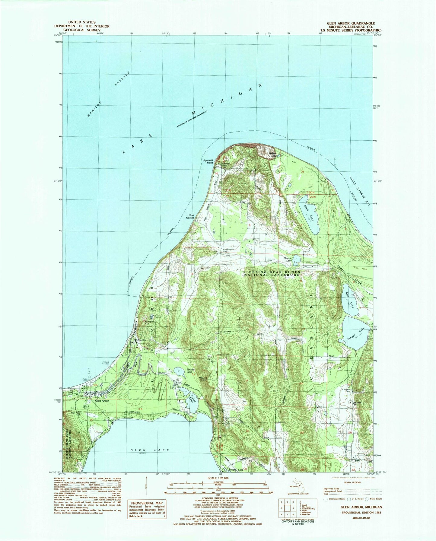
Historical USGS topographic quad map of Glen Arbor in the state of Michigan. Map scale may vary for some years, but is generally around 1:24,000. Print size is approximately 24" x 27"
This quadrangle is in the following counties: Leelanau.
The map contains contour lines, roads, rivers, towns, and lakes. Printed on high-quality waterproof paper with UV fade-resistant inks, and shipped rolled.
Contains the following named places: Bass Lake, Bethlehem Lutheran Church, Camp Kohahna, Crystal River, First Church of Christ Scientist, Fisher Lake, Forrest River Airport, Glen Arbor, Glen Arbor Cemetery, Glen Arbor Census Designated Place, Glen Arbor Post Office, Glen Lake Fire Department Station 1, Hatt Pond, Hidden Lake, Innestree Camp, Kelderhouse Port Oneida Cemetery, Leelanau School Road Cemetery, Leelanau Schools, Miller Cemetery, Miller Hill Lookout, Miller Hill Post Office, Mountain Flowers Golf Course, Narada Lake, North Unity Post Office, North University School, Port Oneida, Port Oneida Post Office, Prospect Hill, Pyramid Point, Pyramid Point Shoal, Saint Joseph Cemetery, Saint Joseph Church, School Lake, Shalda Creek, Shell Lake, Township of Cleveland, Tucker Lake, Tucker Lake Cemetery, Vacation Valley Camp, Werner - Erickson Cemetery, WTHM-FM (Glen Arbor), ZIP Code: 49664