MyTopo
Classic USGS Glen Richey Pennsylvania 7.5'x7.5' Topo Map
Couldn't load pickup availability
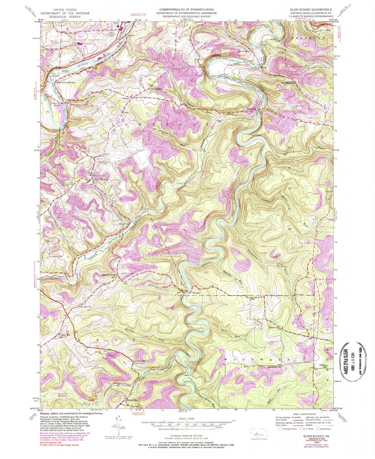
Historical USGS topographic quad map of Glen Richey in the state of Pennsylvania. Map scale may vary for some years, but is generally around 1:24,000. Print size is approximately 24" x 27"
This quadrangle is in the following counties: Clearfield.
The map contains contour lines, roads, rivers, towns, and lakes. Printed on high-quality waterproof paper with UV fade-resistant inks, and shipped rolled.
Contains the following named places: Baughman Cemetery, Believers Tabernacle Apostolic Church, Bethlehem School, Boardman, Camp Hope Run, Centre Grove Church, Centre School, Cherry Run, Clearfield and Curwensville Country Club, Clearfield Area High School, Clover Hill, Crown Crest Memorial Park, Develing, Dimeling, Dunlap Run, Evergreen School, Faunce, Glen Richey, Hartshorn Run, Hogback Run, Jeffries, Jeffries Church, Jeffries School, Kellytown, Krebs, Laurel Run, Lawrence Township Police Department, Lawrence Township Volunteer Fire Company Station 7, Little Clearfield Creek, Little Potts Run, Litz Bridge, Long Run, Lytle Run, Mitchells, Morgan Run, Mount Hope, Mount Zion Memorial Cemetery, Mount Zion Methodist Church, New Birth Church, Oshaniter Post Office, Oshanter, Pine Grove, Pine Grove Bethel Cemetery, Pleasant Ridge School, Porters Bridge, Potts Run, Raccoon Run, Sanborn, Sanborn Cemetery, Sanborn Church of God, Sanborn Run, Sanborn United Methodist Church, Stoneville Cemetery, Stonville, Susquehanna Bridge, The Narrows, Thompson Cemetery, Township of Knox, Turkey Hill School, Upper Morgan Run, Wallace Run, ZIP Codes: 16837, 16855, 16863