MyTopo
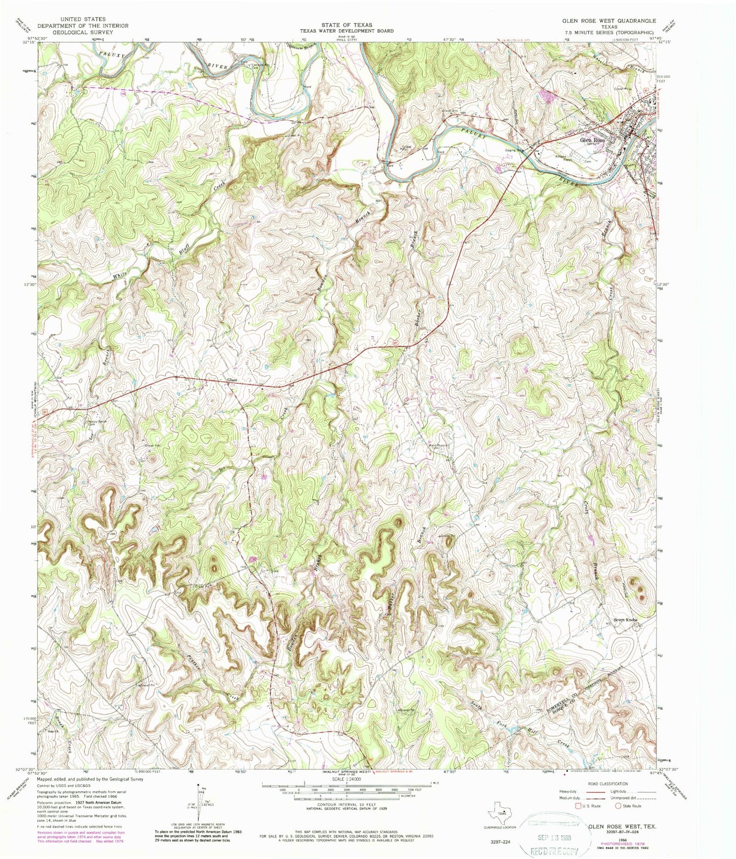
Classic USGS Glen Rose West Texas 7.5'x7.5' Topo Map
Couldn't load pickup availability
Historical USGS topographic quad map of Glen Rose West in the state of Texas. Map scale may vary for some years, but is generally around 1:24,000. Print size is approximately 24" x 27"
This quadrangle is in the following counties: Bosque, Somervell.
The map contains contour lines, roads, rivers, towns, and lakes. Printed on high-quality waterproof paper with UV fade-resistant inks, and shipped rolled.
Contains the following named places: Barker Branch, Barnards Mill, Bowden Branch, Circle P Ranch Airport, Cross Branch, Dinosaur Valley State Park, Fossil Rim Wildlife Center, Glass, Glen Rose, Glen Rose City Hall, Glen Rose Division, Glen Rose Elementary School, Glen Rose High School, Glen Rose Intermediate School, Glen Rose Post Office, Ice Branch, Ice Creek, Lake Reed, Lanham Mill Cemetery, Montgomery Branch, Nancy Smith Cemetery, Oden Church, Panther Creek, Prairie Creek, Rancho Hielo Brazos Airport, Russell Lake, Russell Lake Dam, Saint Rose of Lima Catholic Church, Somervell County, Somervell County Constable's Office Precincts 1 and 2, Somervell County Fire Department, Somervell County Museum, Tiger Stadium, Ward Branch Cemetery, White Bluff Creek, Wright Ranch Airport, ZIP Code: 76043