MyTopo
Classic USGS Glencoe Alabama 7.5'x7.5' Topo Map
Couldn't load pickup availability
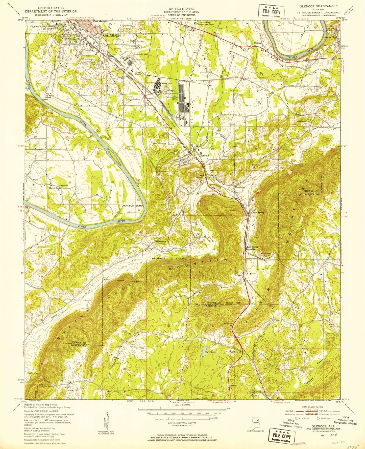
Historical USGS topographic quad map of Glencoe in the state of Alabama. Map scale may vary for some years, but is generally around 1:24,000. Print size is approximately 24" x 27"
This quadrangle is in the following counties: Calhoun, Etowah.
The map contains contour lines, roads, rivers, towns, and lakes. Printed on high-quality waterproof paper with UV fade-resistant inks, and shipped rolled.
Contains the following named places: Alabama Technical College, Alexander Gap, Allen Hall, Antioch Baptist Church, Austin R Meadows Library, Beck Field House, Bethlehem Baptist Church, Bevill Hall, Big Cove Creek, Brierwood Hills Baptist Church, Browder Hall, Burns Park, Burns Valley, Calvin Grove Post Office, Camp Gadsden Alabama State Prison, Chapmans Chapel, Christ Evangelistic Church, Chums Lake, Church Lake, City of Glencoe, Cobb City, Cobb Quarry, Colvin, Colwell, Coosa Valley Convalesent Center, Crestwood Memorial Cemetery, Davis Gap, Donehoo Elementary School, Douthrittville, East Gadsden Post Office, East Gadsden School, Emanuel Baptist Church, Ewing, First Century Church, Fowler Ferry, Fowler Hall, Gadsden Fire Department Station 9, Gadsden Fire Department Training Facility, Gadsden Ordnance Plant, Gadsden Raceway, Gadsden State Community College George Wallace Drive Campus, Glencoe, Glencoe Bible Methodist Church, Glencoe City Police Department, Glencoe Cumberland Presbyterian Church, Glencoe Elementary School, Glencoe Fire Department, Glencoe First Baptist Church, Glencoe First Methodist Church, Glencoe High School, Glencoe Middle School, Glencoe Post Office, Glencoe Quarry, Glencoe Spring, Goodyear Heights Baptist Church, Green Valley Christian Holiness Church, Green Valley Raceway, Greens Creek Mountain, Heath Missionary Baptist Church, Helderman Hall, Hokes Bluff Ferry, Hokes Bluff First Baptist Church, Holy Ghost Revival Center, Keeling Bend, Keeling Island, Keysburg, Laney, Lay Dam, Lee Dam, Lees Lake, Little Cove Creek, Masingale, Masingale Post Office, Naylor Hall, New Hope Baptist Church, Nisbit, Nisbit Post Office, North Glencoe Baptist Church, Oak Grove, Oak Grove Baptist Church, Oak Level, Paden Church, Pennys Crossroads, Phillips Gap, Pine Grove, Pine Grove Baptist Church, Pine Grove Cemetery, Presbyterian Church Dam, Rock Spring, Rock Spring Junction, Saint Paul Holiness Church, Smiths Crossroads, Smiths Temple Holiness Church, Tidmore Bend, Victory Temple Church of God, Walker Gap, Wallace Hall, Webster Chapel Methodist Church, WEXP-FM (Gadsden), Whorton Bend, Whorton Bend Baptist Church, Whorton Bend Methodist Church, Whorton Bend Volunteer Fire Department, ZIP Code: 35905