MyTopo
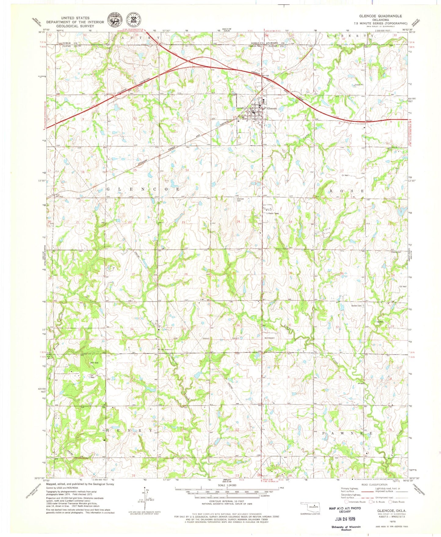
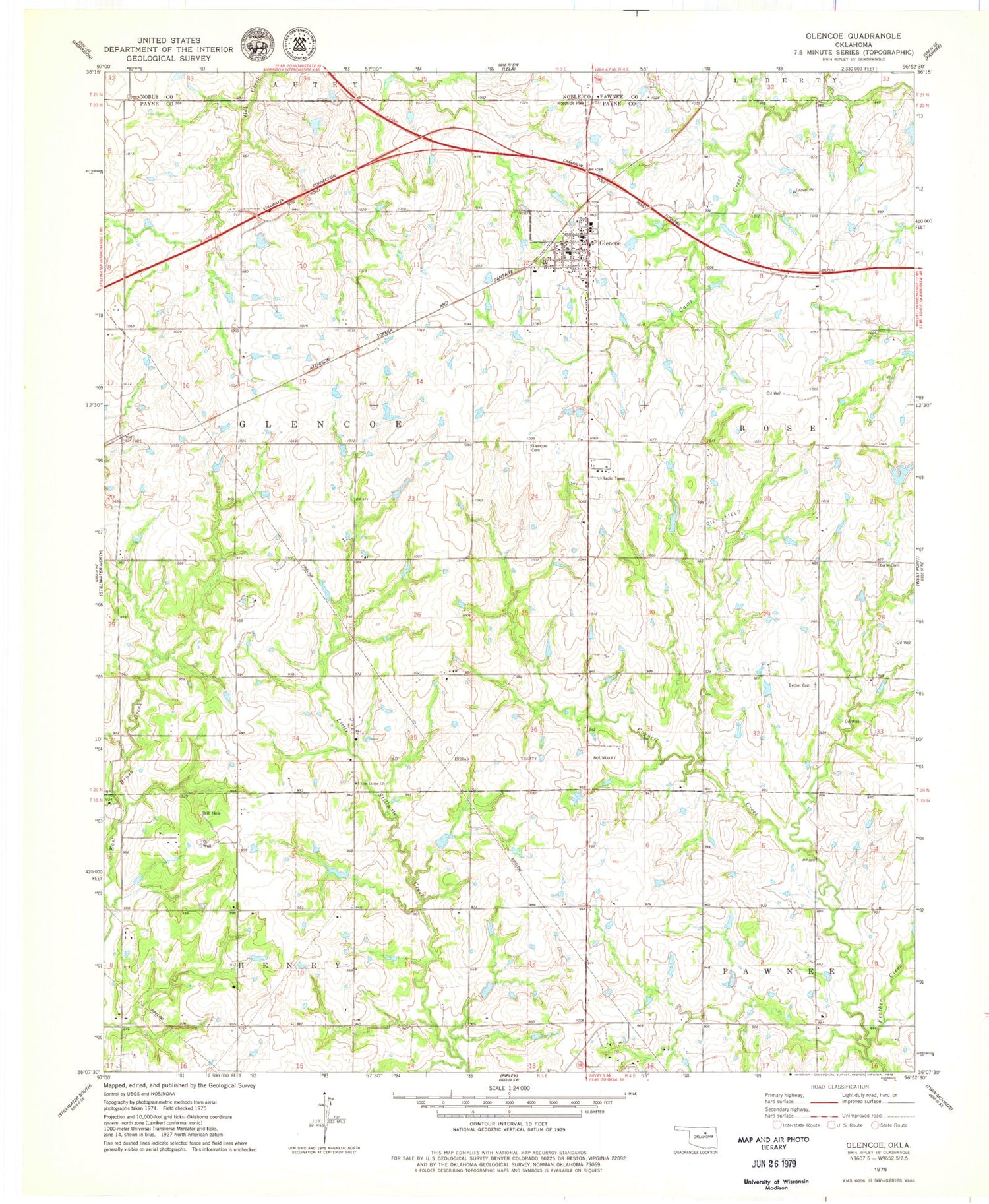
Classic USGS Glencoe Oklahoma 7.5'x7.5' Topo Map
Couldn't load pickup availability
Historical USGS topographic quad map of Glencoe in the state of Oklahoma. Map scale may vary for some years, but is generally around 1:24,000. Print size is approximately 24" x 27"
This quadrangle is in the following counties: Noble, Pawnee, Payne.
The map contains contour lines, roads, rivers, towns, and lakes. Printed on high-quality waterproof paper with UV fade-resistant inks, and shipped rolled.
Contains the following named places: Bethel Cemetery, Eberle Cemetery, Feather Creek, Glencoe, Glencoe Cemetery, Glencoe Elementary School, Glencoe High School, Glencoe Police Department, Glencoe Post Office, Glencoe Volunteer Fire Department, Longbranch Site 1 Dam, Longbranch Site 1 Reservoir, Mulberry Hill Airport, Oknoname 11903 Dam, Oknoname 11903 Reservoir, Stillwater Creek Site 10 Dam, Stillwater Creek Site 10 Reservoir, Stillwater Creek Site 7 Dam, Stillwater Creek Site 7 Reservoir, Stillwater Creek Site 8 Dam, Stillwater Creek Site 8 Reservoir, Town of Glencoe, Township of Glencoe, Union Home Church, ZIP Code: 74032