MyTopo
Classic USGS Glendale Springs North Carolina 7.5'x7.5' Topo Map
Couldn't load pickup availability
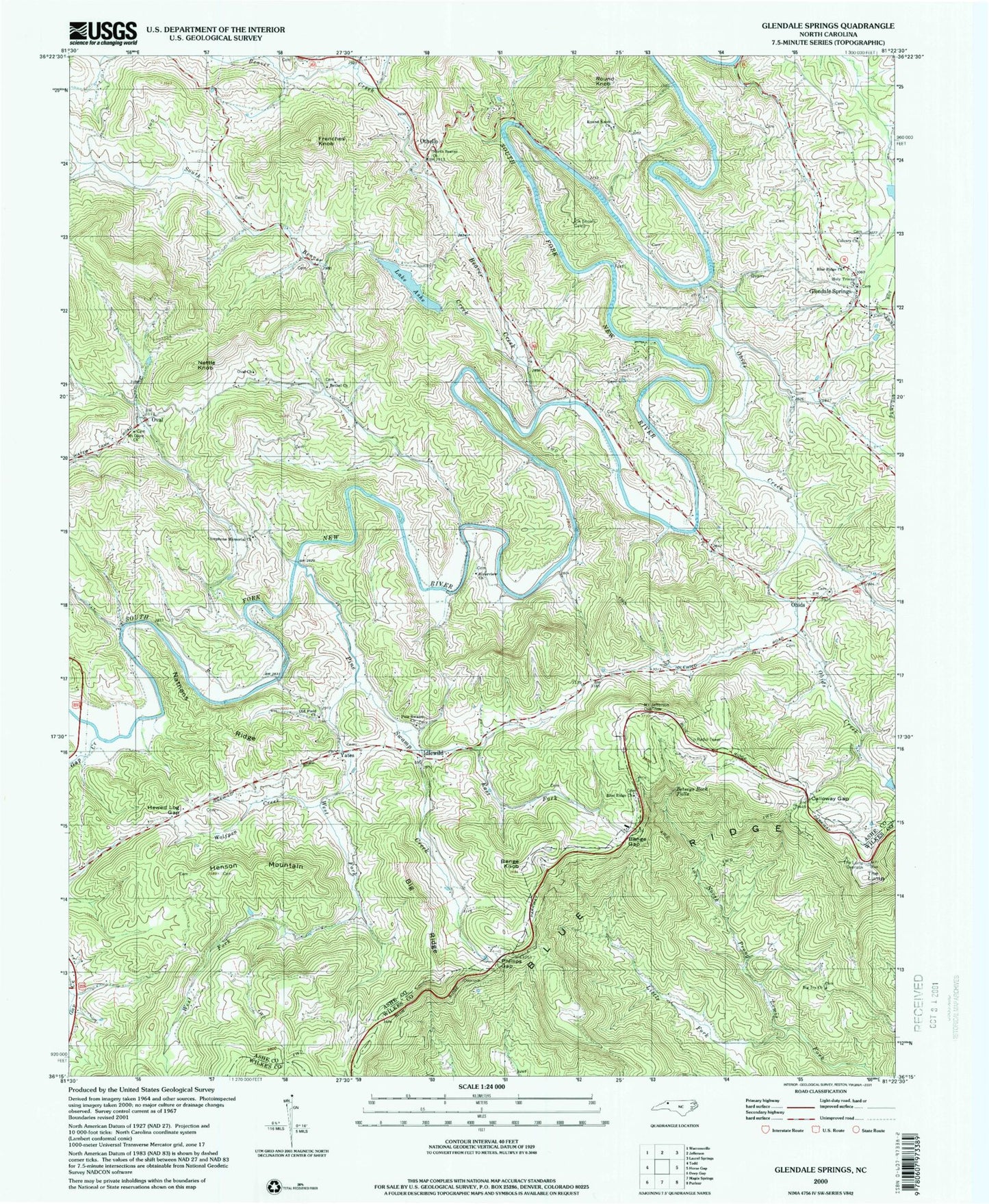
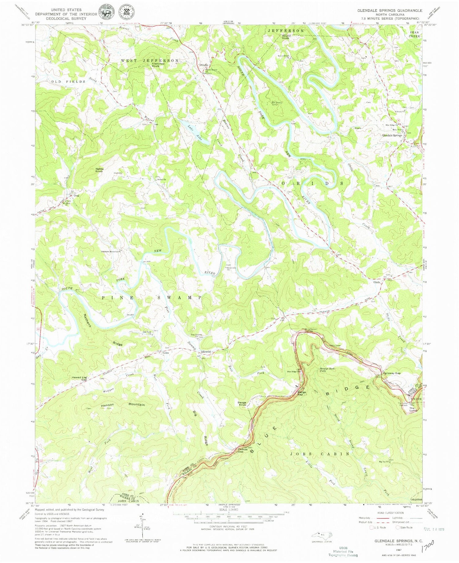
Historical USGS topographic quad map of Glendale Springs in the state of North Carolina. Typical map scale is 1:24,000, but may vary for certain years, if available. Print size: 24" x 27"
This quadrangle is in the following counties: Ashe, Wilkes.
The map contains contour lines, roads, rivers, towns, and lakes. Printed on high-quality waterproof paper with UV fade-resistant inks, and shipped rolled.
Contains the following named places: Lake Ashe, Beaver Creek, Benge Gap, Benge Knob, Bethel Church, Betseys Rock Falls, Big Ivy Church, Big Ridge, Blue Ridge Church, Blue Ridge Church, Calloway Gap, Calvary Church, Cole Branch, East Fork Pine Swamp Creek, Elk Shoals Camp, Frenches Knob, Hewed Log Gap, Holy Trinity Church, Idlewild, Little Fork, Mount Jefferson Overlook, Mount Olive Church, Nathens Ridge, Nettle Knob, North Beaver Church, Obids Creek, Old Field Church, Oval Church, Phillips Gap, Pine Swamp Church, Pine Swamp Creek, Riverview Church, Round Knob, Round Knob Church, South Beaver Creek, Stephens Memorial Church, The Lump Overlook, West Fork Pine Swamp Creek, Wolfpen Creek, Yates, Ashe Lake Dam, Obids, Oval, Gap Creek, Glendale Springs, Henson Mountain, Othello, The Lump, Township of Obids, Township of Pine Swamp, Walsh (historical), Glendale Springs Volunteer Fire Department, Glendale Springs Post Office