
MyTopo
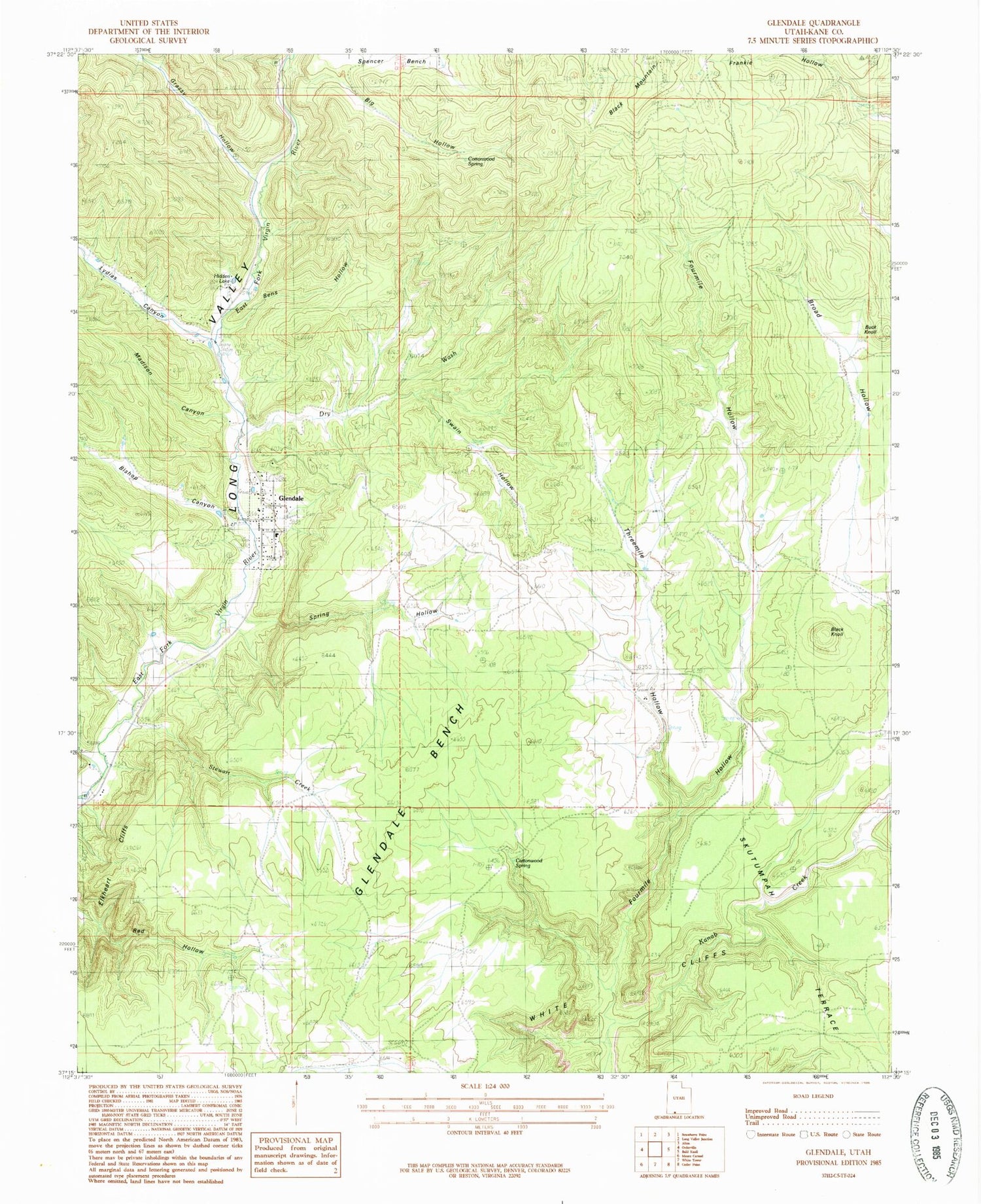
Classic USGS Glendale Utah 7.5'x7.5' Topo Map
Couldn't load pickup availability
Historical USGS topographic quad map of Glendale in the state of Utah. Map scale may vary for some years, but is generally around 1:24,000. Print size is approximately 24" x 27"
This quadrangle is in the following counties: Kane.
The map contains contour lines, roads, rivers, towns, and lakes. Printed on high-quality waterproof paper with UV fade-resistant inks, and shipped rolled.
Contains the following named places: Big Hollow, Bishop Canyon, Black Knoll, Broad Hollow, Buck Knoll, Calf Pasture Hollow, Cottonwood Spring, Dry Wash, East Bens Hollow, Fourmile Hollow, Glendale, Glendale Bench, Glendale City Cemetery, Glendale Post Office, Glendale Town Fire Department, Grassy Canyon, Harris Cemetery, Hidden Lake, Lydias Canyon, Madison Canyon, Spring Hollow, Stewart Creek, Swain Hollow, The Church of Jesus Christ of Latter Day Saints, Threemile Hollow, Tortoise and Hare Trailer Court, Town of Glendale


