MyTopo
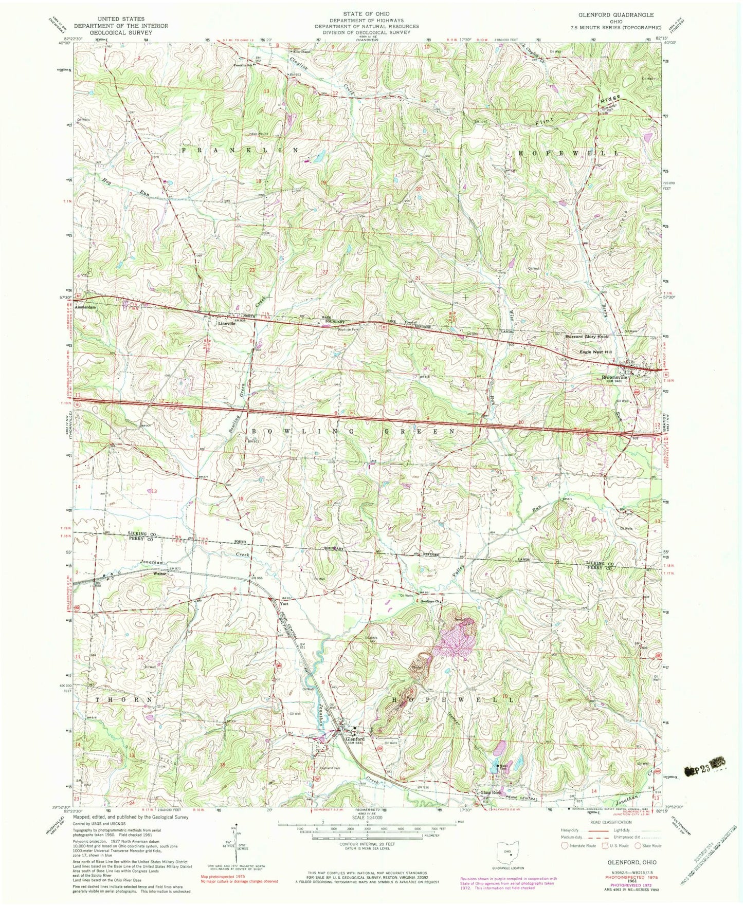
Classic USGS Glenford Ohio 7.5'x7.5' Topo Map
Couldn't load pickup availability
Historical USGS topographic quad map of Glenford in the state of Ohio. Map scale may vary for some years, but is generally around 1:24,000. Print size is approximately 24" x 27"
This quadrangle is in the following counties: Licking, Perry.
The map contains contour lines, roads, rivers, towns, and lakes. Printed on high-quality waterproof paper with UV fade-resistant inks, and shipped rolled.
Contains the following named places: Baraca Church, Bowling Green Creek, Brook Hall Farm, Brownsville, Brownsville Census Designated Place, Brownsville Post Office, Buzzard Glory Knob, Cedar Hill Cemetery, Central Silica Company Pond 9722-009, Central Silica Company Pond 9722-012, Central Silica Company Pond 9722-012 Dam, Chestnut Ridge Farm, Cold Spring Farm, Eagle Nest Hill, Ellis Chapel, Ellis Chapel Cemetery, Elmwood Farm, Fairview School, Flint Ridge, Flint Ridge Park, Franklin Elementary School, Glass Rock, Glenford, Glenford Elementary School, Glenford Post Office, Good Hope Lutheran Cemetery, Goodhope Lutheran Church, Greenwood Church, Hearst School, Heartland Orchard, Highland Cemetery, Hopewell Township Fire Department, Licking Township Fire Company Station 2, Linnville, Linnville Cemetery, Linnville Post Office, Little Bowling Green Prairie, Locust Grove Farm, Maple Grove Farm, Paddy Run, Pike Farm, Pleasant Ridge Farm, Pleasant Valley Farm, Porter School, Prairie Valley Farm, Roberts School, Stockberger School, Sugar Spring Farm, Township of Bowling Green, Township of Franklin, Valley Run, Village of Glenford, Walser, Wise Run, Yost, Yost Post Office, ZIP Codes: 43721, 43739