MyTopo
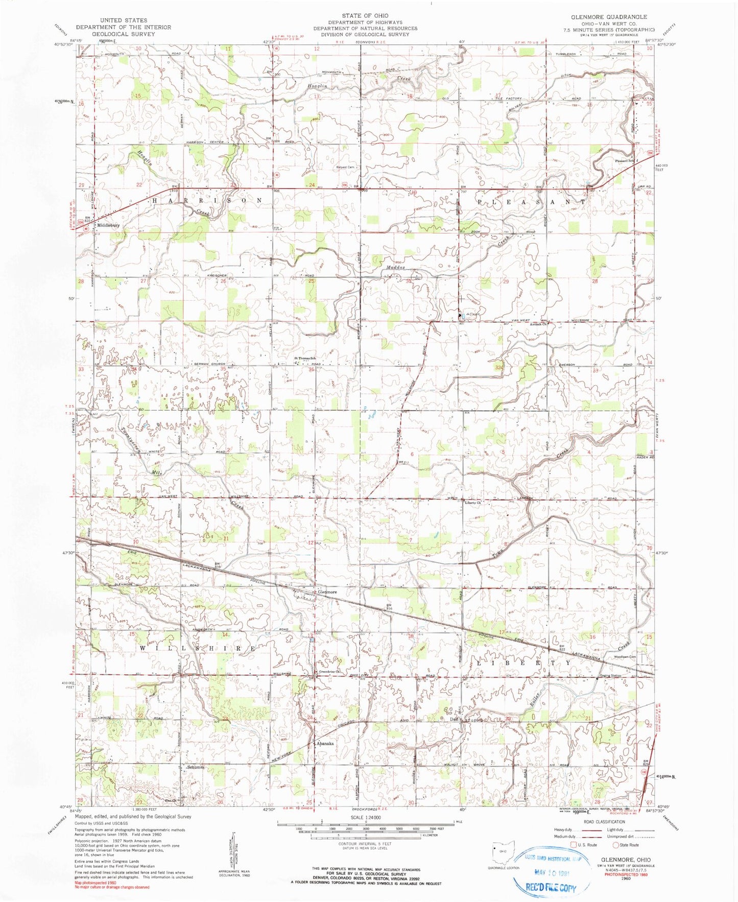
Classic USGS Glenmore Ohio 7.5'x7.5' Topo Map
Couldn't load pickup availability
Historical USGS topographic quad map of Glenmore in the state of Ohio. Map scale may vary for some years, but is generally around 1:24,000. Print size is approximately 24" x 27"
This quadrangle is in the following counties: Van Wert.
The map contains contour lines, roads, rivers, towns, and lakes. Printed on high-quality waterproof paper with UV fade-resistant inks, and shipped rolled.
Contains the following named places: Abanaka, Abanaka Post Office, Antioch Church, Aurora Borealis Farms, Balyeat Cemetery, Balyeat Ditch, Bebout Farms, Buckeye Acres Family Farms, Darn - Dom Farms, Dull, Dull Post Office, Edwards Farm, Eickholt Farms, Etzler Farm, Evangelical Protestant Cemetery, Gamble Family Farms, Gar Bar Farms, Gardner Green Farm, German School, Germann Farms, Gina Dairy, Glenmore, Glenmore Post Office, Glenn Cemetery, Greenbriar Cemetery, Greenbrier Church, Heller School, Hileman Farm, Hoverman Ditch, Johns School, Jones Farm, Kerns Farms, Kiehl Farms, Kreider School, L and S Farm, Liberty Church, Liberty School, Lillick Ditch, Middlebury, Mount Zion Church, Norman Farm, Pleasant Elementary School, Pleasant Grove Church, Riley Farms, Roller Creek, Royston School, Saint Thomas School, School Number 1, School Number 2, School Number 5, Schumm, Schumm Cemetery, Schumm Farms, Schumm Post Office, Sheets Ditch, Township of Harrison, Township of Liberty, Township of Pleasant, Township of Willshire, Walters School, Wiseman School, Wolfe School, Woodlawn Cemetery, Zion Lutheran Church, ZIP Code: 45874