MyTopo
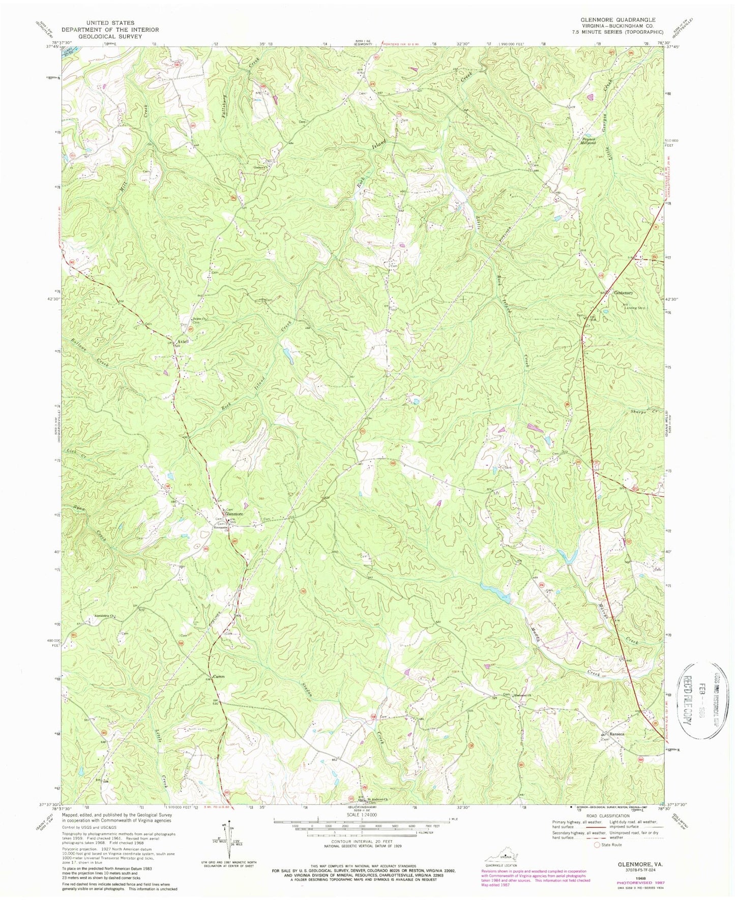
Classic USGS Glenmore Virginia 7.5'x7.5' Topo Map
Couldn't load pickup availability
Historical USGS topographic quad map of Glenmore in the state of Virginia. Map scale may vary for some years, but is generally around 1:24,000. Print size is approximately 24" x 27"
This quadrangle is in the following counties: Albemarle, Buckingham.
The map contains contour lines, roads, rivers, towns, and lakes. Printed on high-quality waterproof paper with UV fade-resistant inks, and shipped rolled.
Contains the following named places: Alexandria Church, Axtell, Brill Dam, Buckingham County Volunteer Rescue Squad Station 18, Camm, Centenary, Ebenezer Church, Emmanuel Church, Fitzgerald Dam, Glenmore, Glenmore Post Office, Glenmore Volunteer Fire Department, Goshen Church, Little Rock Island Creek, Maxeys Creek, Muddy Creek Number One Dam, Muddy Creek Number Two Dam, Paynes Millpond, Ransons, Ridgeway School, Saint Andrews Church, Salem Church, Smith Store