MyTopo
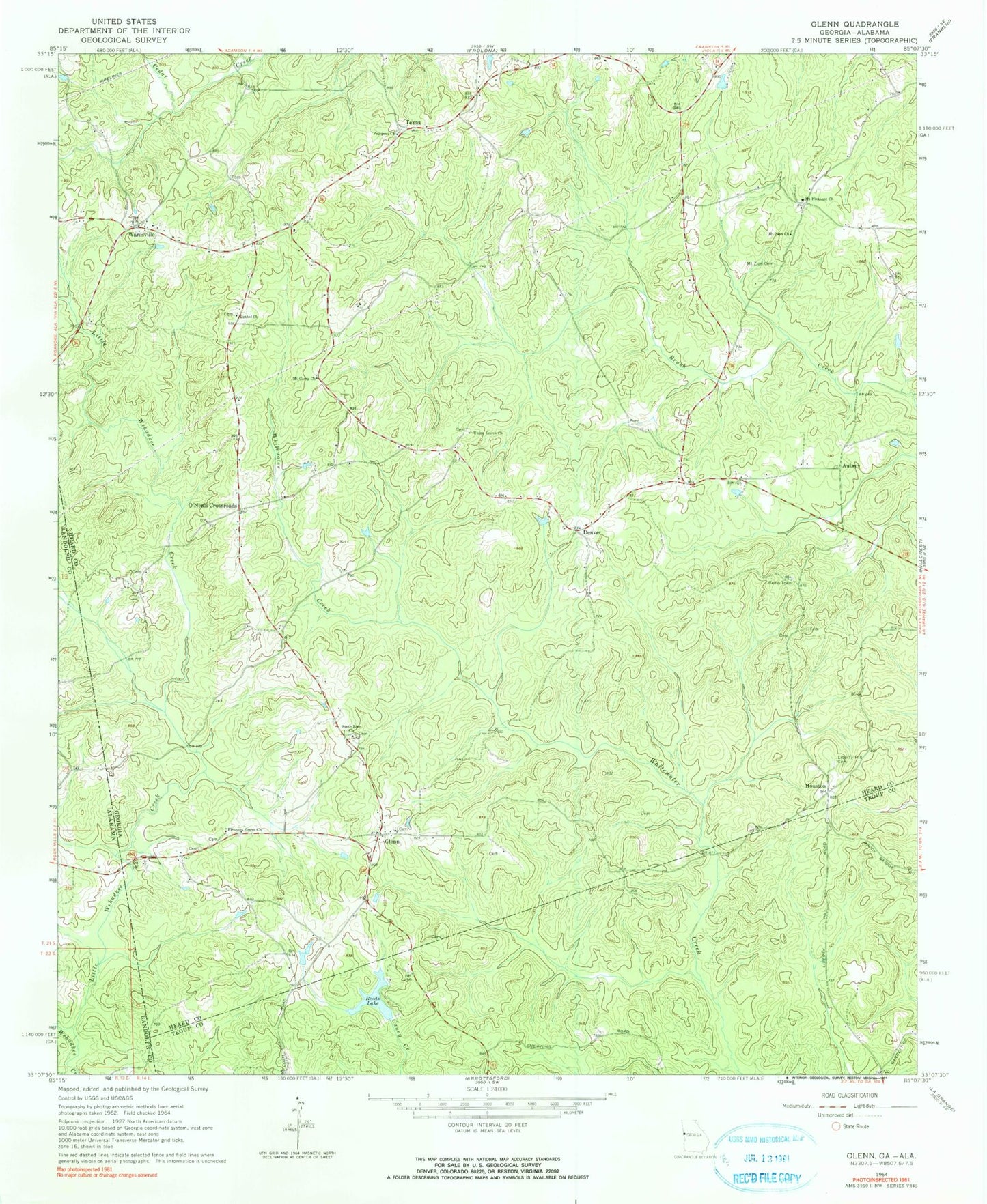
Classic USGS Glenn Georgia 7.5'x7.5' Topo Map
Couldn't load pickup availability
Historical USGS topographic quad map of Glenn in the states of Georgia, Alabama. Map scale may vary for some years, but is generally around 1:24,000. Print size is approximately 24" x 27"
This quadrangle is in the following counties: Heard, Randolph, Troup.
The map contains contour lines, roads, rivers, towns, and lakes. Printed on high-quality waterproof paper with UV fade-resistant inks, and shipped rolled.
Contains the following named places: Adamson Cemetery, Allen Cemetery, Aubrey, Believers Church, Bethel Cemetery, Bethel Church, Brett Cemetery, Brown Cemetery, Canaan Primitive Baptist Church, Cooper Cemetery, Denver, Garrett Cemetery, Glenn, Glenn - Burpee - Cole Cemetery, Glenn Census Designated Place, Glenn Missionary Baptist Church, Glenn Post Office, Heard County Fire Department Station 6, Houston, James Cemetery, Kirk, Lewis Cemetery, Liberty Hill Cemetery, Little Wehadkee Creek, Mount Carrie Baptist Church, Mount Pleasant Baptist Church, Mount Pleasant Cemetery, Mount Zion Academy, Mount Zion Cemetery, Mount Zion Church, Mount Zion Church Cemetery, Mount Zion United Methodist Church, O'Neals Crossroad, Panacea Airport, Persons Cemetery, Pittman Cemetery, Pleasant Grove Cemetery, Pleasant Grove Primitive Baptist Church, Prospect Cemetery, Prospect United Methodist Church, Reeds Dam, Reeds Lake, State Line Baptist Church, State Line Cemetery, Stateline Academy, Texas, Texas Division, Troup County Fire Department Station 3, Turman Cemetery, Union Grove Cemetery, Union Grove Missionary Baptist Church, Union Grove School, Waresville, Western Cemetery, Zachary Cemetery