MyTopo
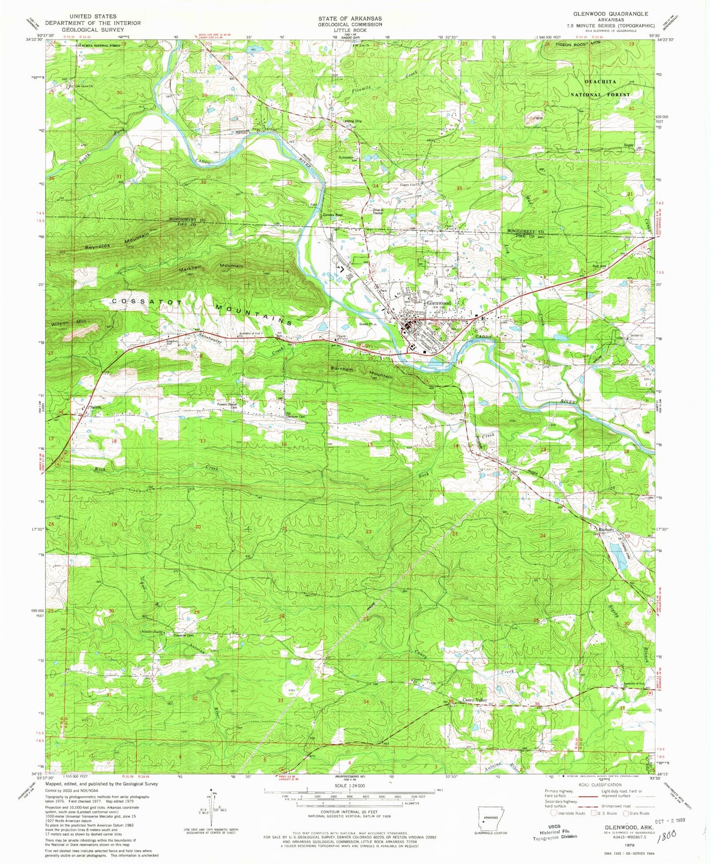
Classic USGS Glenwood Arkansas 7.5'x7.5' Topo Map
Couldn't load pickup availability
Historical USGS topographic quad map of Glenwood in the state of Arkansas. Map scale may vary for some years, but is generally around 1:24,000. Print size is approximately 24" x 27"
This quadrangle is in the following counties: Clark, Montgomery, Pike.
The map contains contour lines, roads, rivers, towns, and lakes. Printed on high-quality waterproof paper with UV fade-resistant inks, and shipped rolled.
Contains the following named places: Assembly of God Church, Bethel Missionary Baptist Church, Bethel School, Bigsby Branch, Burnham Mountain, Caddo Ranger Station and Work Center, Caney Valley, Caney Valley Missionary Baptist Church, Centerpoint Elementary School, Centerpoint High School, Centerpoint Middle School, Church of Christ, Church of God, City of Glenwood, Community Bible Baptist Church, County Line Cemetery, County Line Methodist Church, County Line School, Ebenezer Cemetery, Emergency Medical Transport, Fields School, Five Mile School, Fivemile Creek, Forest Hill Church, Fox Branch, Glenwood, Glenwood Elementary School, Glenwood Fire Department, Glenwood High School, Glenwood Police Department, Glenwood Post Office, Hickory Station, Juneau Spur, Kingdom Hall, KWXE-FM (Glenwood), KWXI-AM (Glenwood), Little Antoine Creek, Logan School, Markham Mountain, Mill Pond, Mill Pond Dam, Mountain View School, Mud Lick Creek, Oak Grove Baptist Church, Oak Grove Cemetery, Old Ebenezer Cemetery, Pigeon Roost Mine, Powers Chapel, Powers Chapel Cemetery, Primitive Baptist Church, Reynolds Mountain, Rock Creek, Rosboro, Rosboro Missionary Baptist Church, Salem, Salem Baptist Church, Segur, South Fork Caddo River, Steller Cemetery, Sweetwater Creek, Tigue Lake, Tigue Lake Dam, Township of Clark, ZIP Code: 71943