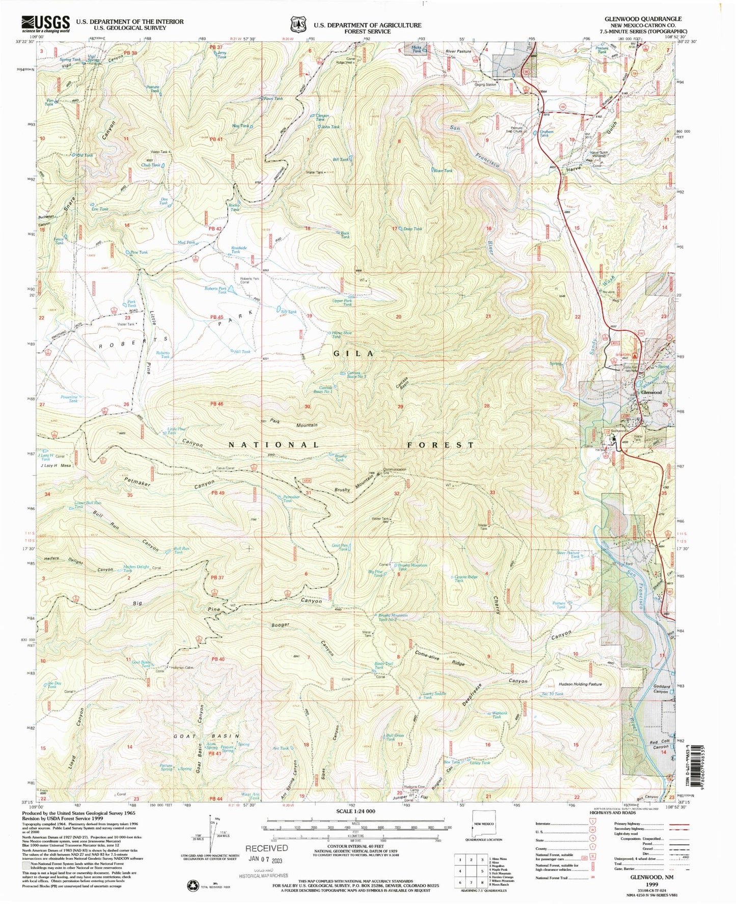
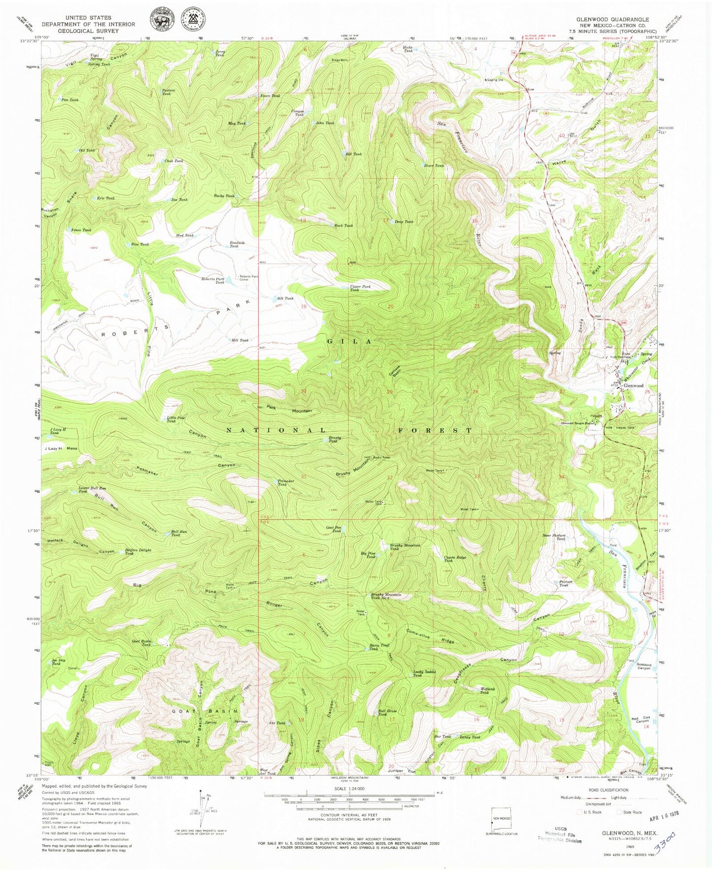
MyTopo
Classic USGS Glenwood New Mexico 7.5'x7.5' Topo Map
Couldn't load pickup availability
Historical USGS topographic quad map of Glenwood in the state of New Mexico. Map scale may vary for some years, but is generally around 1:24,000. Print size is approximately 24" x 27"
This quadrangle is in the following counties: Catron.
The map contains contour lines, roads, rivers, towns, and lakes. Printed on high-quality waterproof paper with UV fade-resistant inks, and shipped rolled.
Contains the following named places: Alum Spring, Ant Tank, Basin Trail Tank, Big Pine Tank, Bill Tank, Booger Canyon, Box Canyon, Box Tank, Brushy Mountain, Brushy Mountain Tank, Brushy Mountain Tank Number Two, Brushy Tank, Buchanan Canyon, Buck Tank, Bull Grass Tank, Bull Run Tank, Canyon Tank, Carcass Basin, Carcass Basin Number One, Carcass Basin Number Three, Cherry Canyon, Chub Tank, Come-alive Ridge, Coyote Ridge Tank, Deep Tank, Deepfreeze Canyon, Doe Tank, Eric Tank, Fawn Tank, Fence Tank, Glenwood, Glenwood Cemetery, Glenwood Census Designated Place, Glenwood Community Center Library, Glenwood Community Presbyterian Church, Glenwood Elementary School, Glenwood Post Office, Glenwood Ranger Station, Glenwood Volunteer Fire and Rescue, Glenwood Weather Station, Goat Basin, Goat Basin Tank, Goat Pen Tank, Goddard Canyon, Graham Tank, Harve Gulch, Harve Gutch Windmill, Heifers Delight Tank, Heil Spring, Hicks Tank, Hill Tank, Hollimon Cabin, Holt Gulch, Horse Shoe Tank, Hudson Holding Pasture, Hudsons Cow Camp, Hurley Community Congregational Church, J Lazy H Tank, Jerry Tank, Joe Day Tank, John Tank, Laney Tank, Little Pine Canyon, Little Pine Tank, Long Canyon Spring, Lower Bull Run Tank, Lucky Saddle Tank, May Tank, Mogollon Village Historic Site, Mud Tank, New Mexico State Fish Hatchery, North Alkali Flat, Old Tank, Pan Tank, Park Mountain, Park Tank, Pasture Spring, Pasture Tank, Pasture Trap Chute, Petmaker Tank, Pine Tank, Pleasanton Census Designated Place, Powerline Tank, Red Colt Canyon, Ridge Well, River Pasture, River Tank, Roadside Tank, Roberto Tank, Roberts Park, Roberts Park Corral, Roberts Park Tank, Rocky Tank, Sandy Wash, Santo Nino Catholic Church, Section 10 Tank, Shelton Canyon, Sierra Aguilada, Silt Tank, Snare Canyon, South Dugway Canyon, Spring Tank, Steer Pasture Tank, Upper Park Tank, Vigil Spring, Wetbank Tank, Whitewater Canyon Pipeline Historic Site, Whitewater Creek