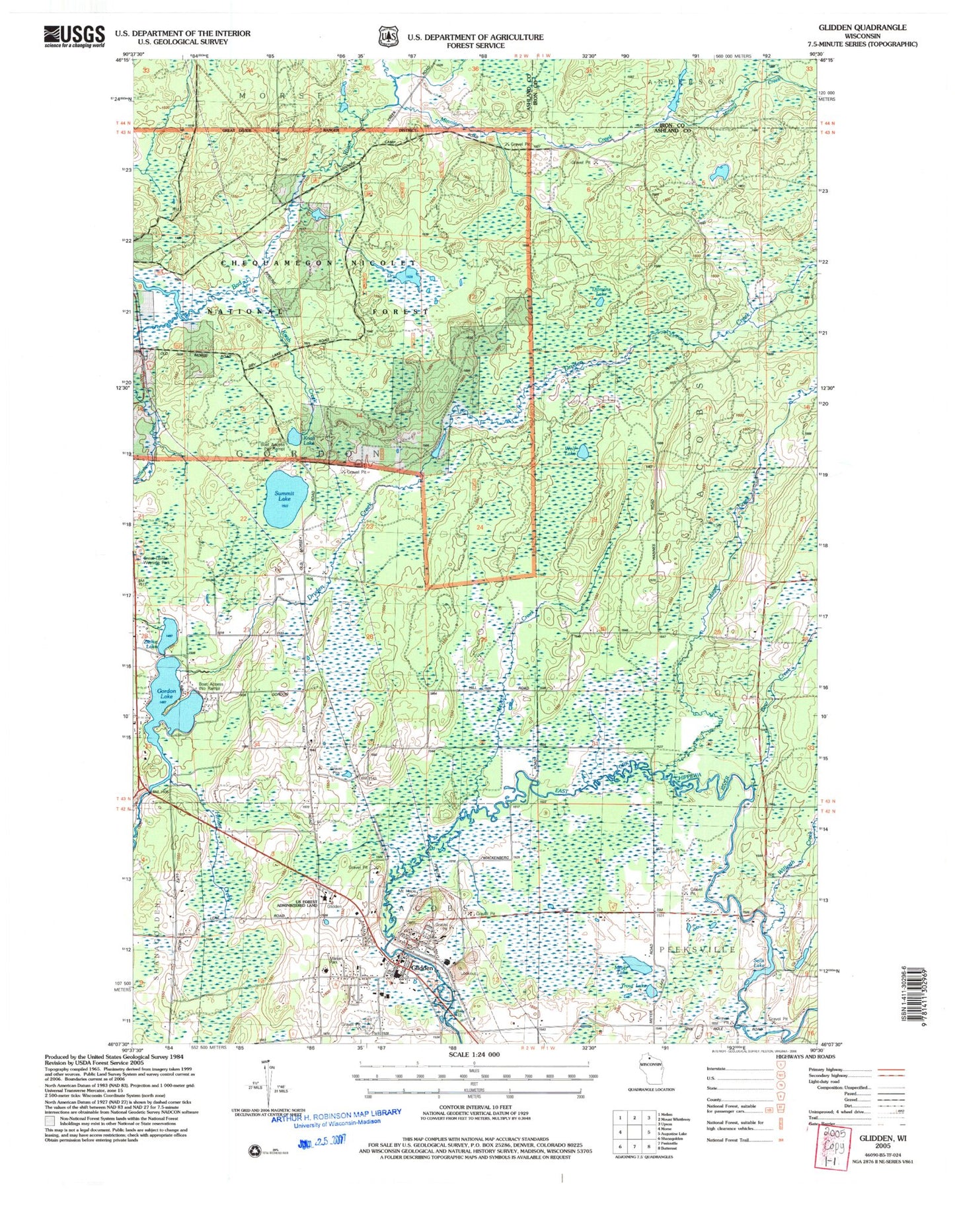
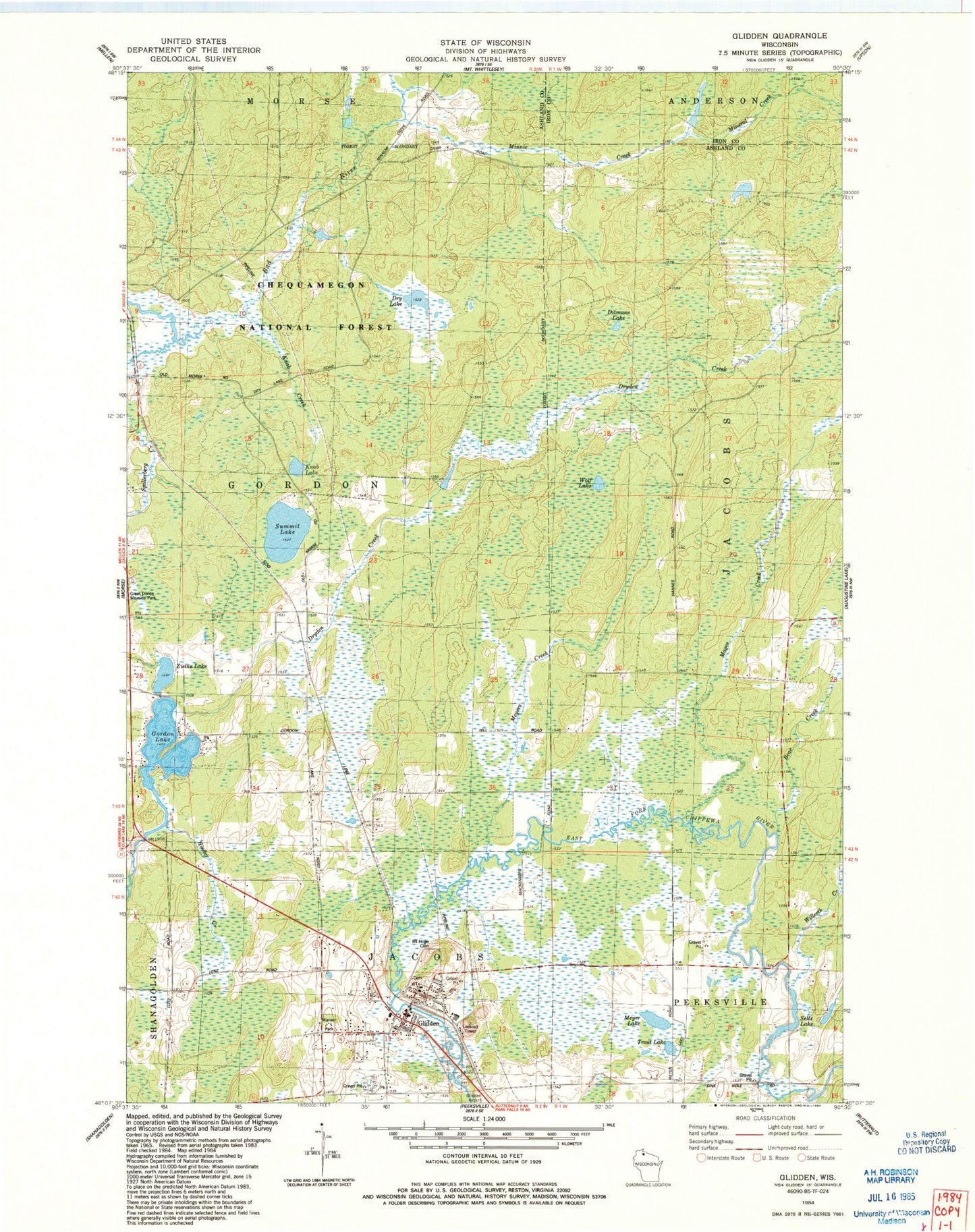
MyTopo
Classic USGS Glidden Wisconsin 7.5'x7.5' Topo Map
Couldn't load pickup availability
Historical USGS topographic quad map of Glidden in the state of Wisconsin. Map scale may vary for some years, but is generally around 1:24,000. Print size is approximately 24" x 27"
This quadrangle is in the following counties: Ashland, Iron.
The map contains contour lines, roads, rivers, towns, and lakes. Printed on high-quality waterproof paper with UV fade-resistant inks, and shipped rolled.
Contains the following named places: Bear Creek, Chequamegon North Campus, Ditmans Lake, Dry Lake, Glidden, Glidden Area Emergency Medical Service, Glidden Census Designated Place, Glidden Post Office, Gordon Lake, Great Divide Wayside Park, Hinder Creek, Knab Creek, Knab Lake, Magee Creek, Marian Park, Meyer Lake, Meyers Creek, Mineral Creek, Minnie Creek, Mount Hope Cemetery, Park Falls Elementary School, Sells Lake, Spillerberg Creek, Summit Lake, Town of Jacobs, Trout Lake, Willerth Creek, Wolf Lake, Zielke Lake