MyTopo
Classic USGS Gobles West Michigan 7.5'x7.5' Topo Map
Couldn't load pickup availability
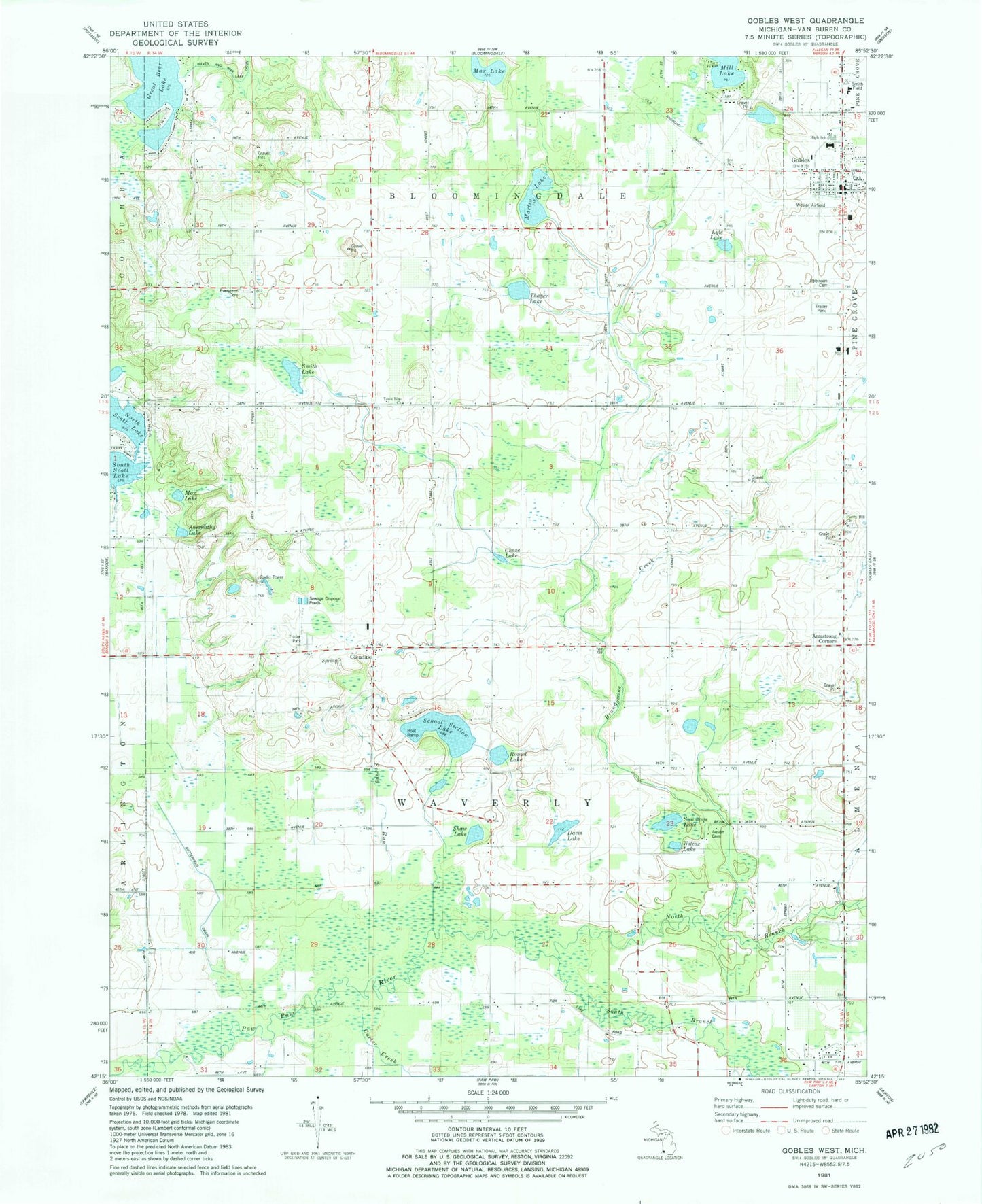
Historical USGS topographic quad map of Gobles West in the state of Michigan. Map scale may vary for some years, but is generally around 1:24,000. Print size is approximately 24" x 27"
This quadrangle is in the following counties: Van Buren.
The map contains contour lines, roads, rivers, towns, and lakes. Printed on high-quality waterproof paper with UV fade-resistant inks, and shipped rolled.
Contains the following named places: Abernathy Lake, Armstrong Corners, Austin Cemetery, Austin School, Beachwood School, Beckman Airport, Bell School, Bethany Presbyterian Church, Brandywine Creek, Brandywine School, Butterfield Drain, Carter Creek, Center of Life Church, Chase Lake, City of Gobles, Country Holiday Estates Mobile Home Park, Covey Hill Church, Cross School, Davis Lake, Dayton School, Dutch Sport Park, Evergreen Cemetery, Evergreen School, Glendale, Glendale Baptist Church, Glendale Cemetery, Glendale Post Office, Gobles, Gobles High School, Gobles Library, Gobles Medical Clinic, Gobles Police Department, Gobles Post Office, Gobles Station, Great Bear Lake, Haven and Max Lake Drain, Kalhaven Community Church, Lakeview School, Lyle Lake, Martin Lake, Max Lake, Myers School, North Branch Paw Paw River, North Extension Drain, North Scott Lake, Rich-Dillon Drain, River Valley School, Riverside School, Robinson Cemetery, Round Lake, Saint Judes Catholic Church, School Section Lake, Scott School, Shaw Lake, Simmons Lake, Smith Lake, South Branch Paw Paw River, Speicher School, Spring Run, Spring Valley Campground, Thayer Lake, Town Line Church, Township of Waverly, United Methodist Church, Waverly Post Office, Wesler Airfield, Wilcox Lake