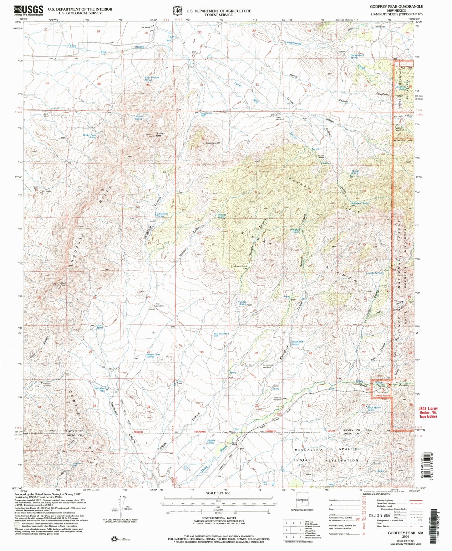
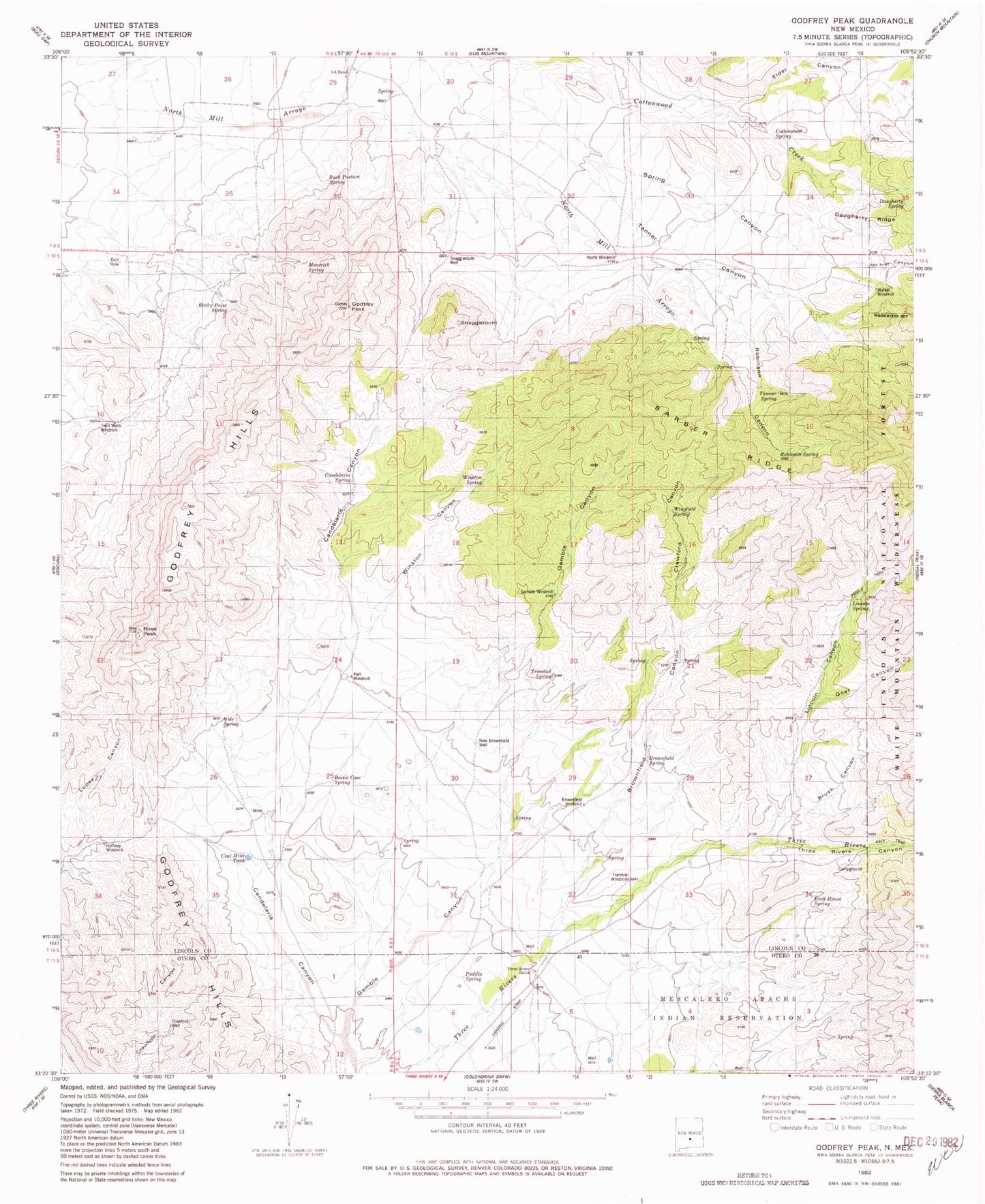
MyTopo
Classic USGS Godfrey Peak New Mexico 7.5'x7.5' Topo Map
Couldn't load pickup availability
Historical USGS topographic quad map of Godfrey Peak in the state of New Mexico. Map scale may vary for some years, but is generally around 1:24,000. Print size is approximately 24" x 27"
This quadrangle is in the following counties: Lincoln, Otero.
The map contains contour lines, roads, rivers, towns, and lakes. Printed on high-quality waterproof paper with UV fade-resistant inks, and shipped rolled.
Contains the following named places: Barber Ridge, Bataan Lodge, Bessie Case Spring, Brownfield Canyon, Brownfield Spring, Brownfield Windmill, Brush Canyon, Buck Pasture Spring, Candelaria Canyon, Candelaria Spring, Coal Mine Tank, Cottonwood Spring, Crawford Canyon, Crawford Well, Daugherty Ridge, Daugherty Spring, Elder Canyon, Gamble Canyon, Gamble Windmill, Goat Canyon, Godfrey Hills, Godfrey Peak, Halfway Windmill, Hall Windmill, Hide Spring, I Bar X Spring, I-X Ranch, Lincoln Canyon, Lincoln Spring, Maverick Spring, Mc Iver Canyon, New Brownfield Well, North Windmill, Padilla Spring, Rattlesnake Canyon, Robinson Canyon, Robinson Spring, Rock House Spring, Rocky Point Spring, Rose Peak, Snaggletooth, Snaggletooth Well, Spring Canyon, Tanner Spring, Three Rivers Campground, Three Rivers Canyon, Three Rivers Ranch, Tramble Windmill, Trinidad Spring, Twin Wells Windmill, Walker Windmill, Wingfield Spring, Winston Canyon, Winston Spring