MyTopo
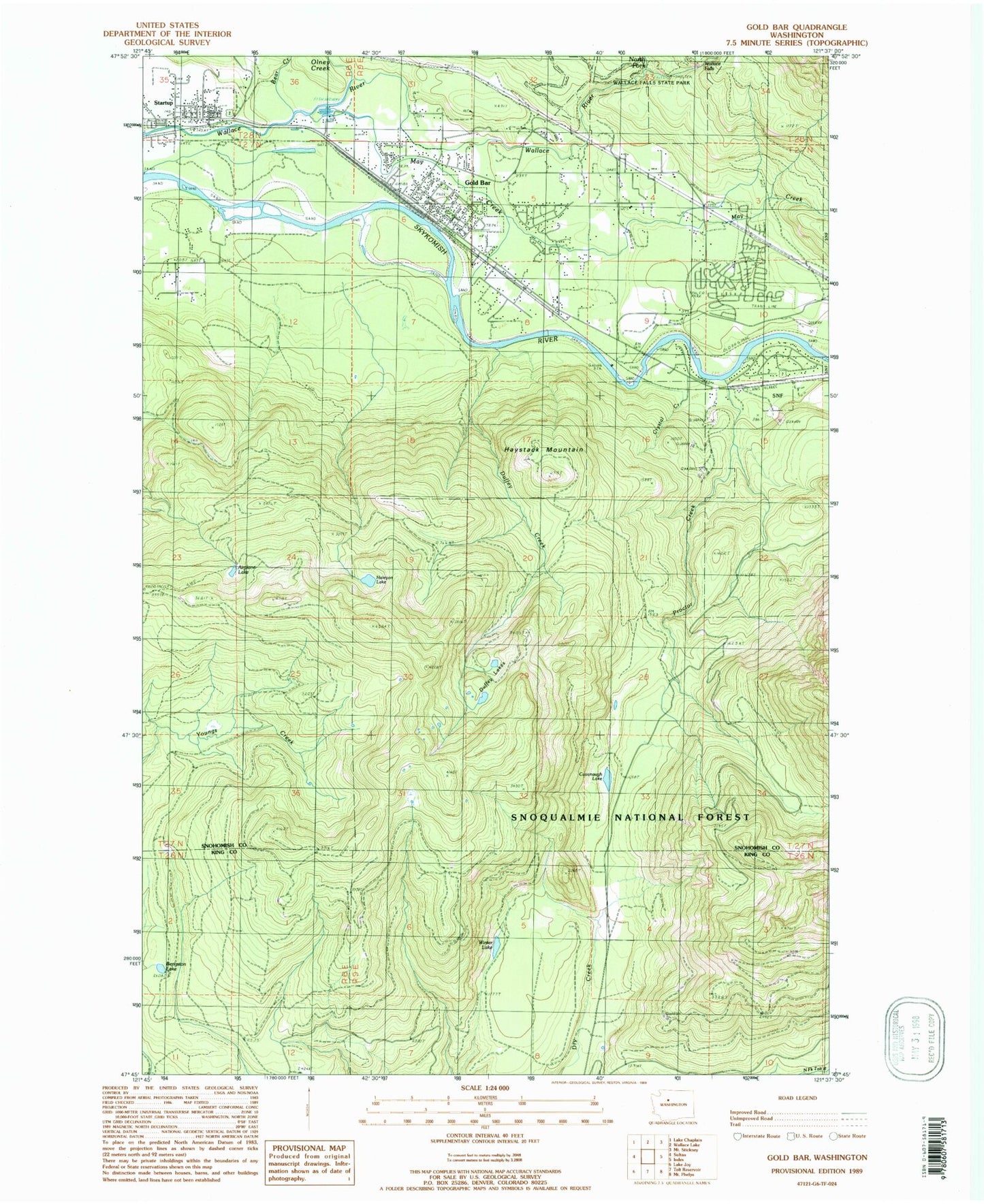
Classic USGS Gold Bar Washington 7.5'x7.5' Topo Map
Couldn't load pickup availability
Historical USGS topographic quad map of Gold Bar in the state of Washington. Typical map scale is 1:24,000, but may vary for certain years, if available. Print size: 24" x 27"
This quadrangle is in the following counties: King, Snohomish.
The map contains contour lines, roads, rivers, towns, and lakes. Printed on high-quality waterproof paper with UV fade-resistant inks, and shipped rolled.
Contains the following named places: Bear Creek, Bengston Lake, Camp Huston, Little Cavanaugh Lake, Crystal Creek, Duffey Creek, Gold Bar, Haystack Mountain, May Creek, North Fork Wallace River, Olney Creek, Proctor Creek, Reiter, Startup, Wallace Falls, Winter Lake, Wallace Falls State Park, Airplane Lake, Haleyon Lake, May Creek, May Creek Census Designated Place, City of Gold Bar, Gold Bar Elementary School, Alpine Meadows Mobile Home Park, McDaniels Mobile Village, Wallace River Mobile Home Park, Wallace River Bridge, Snohomish County Fire District 26 Station 53, Snohomish County Fire District 26 Station 54, Snohomish County Sheriff's Office Gold Bar, Gold Bar Post Office, Startup Post Office