MyTopo
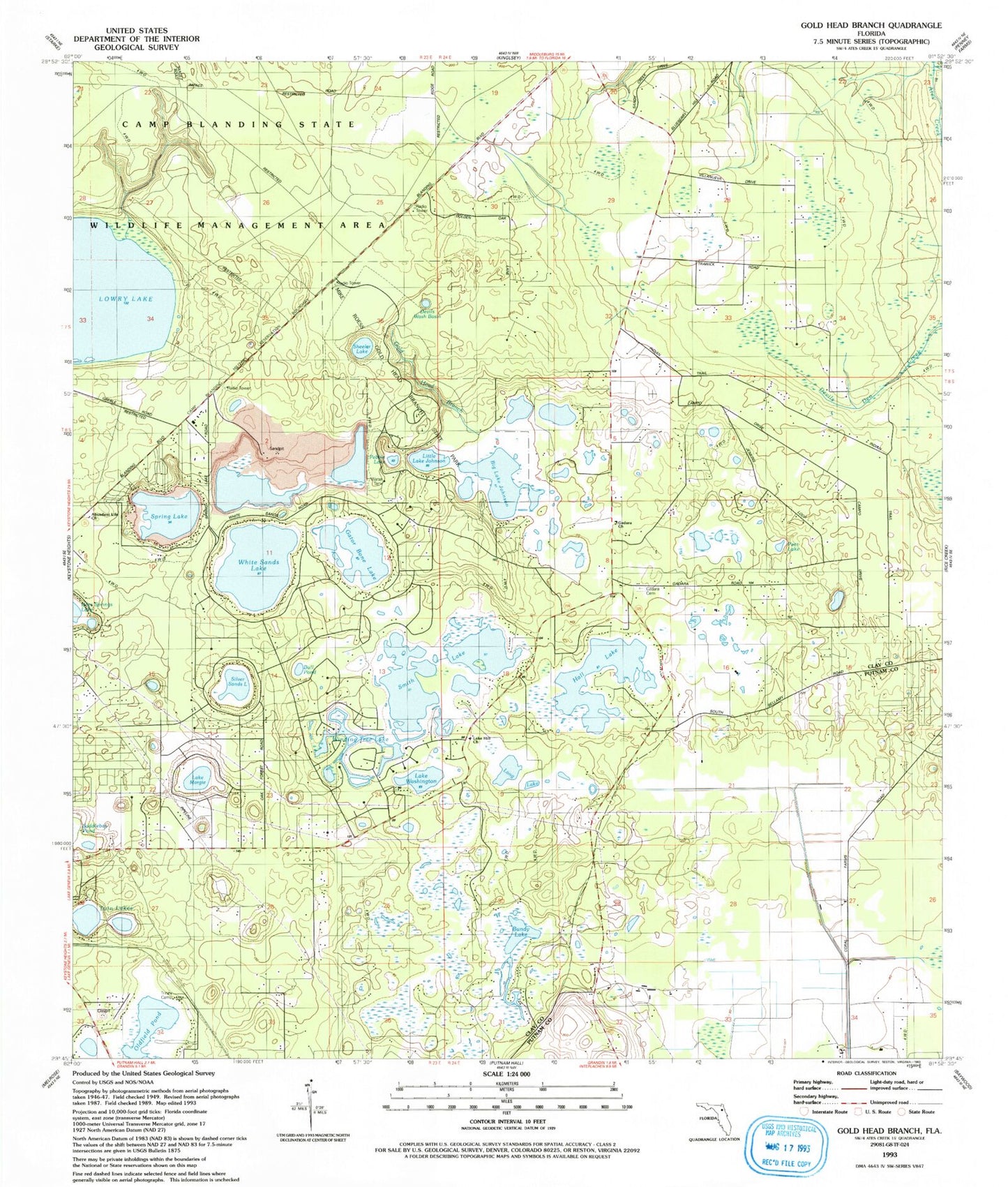
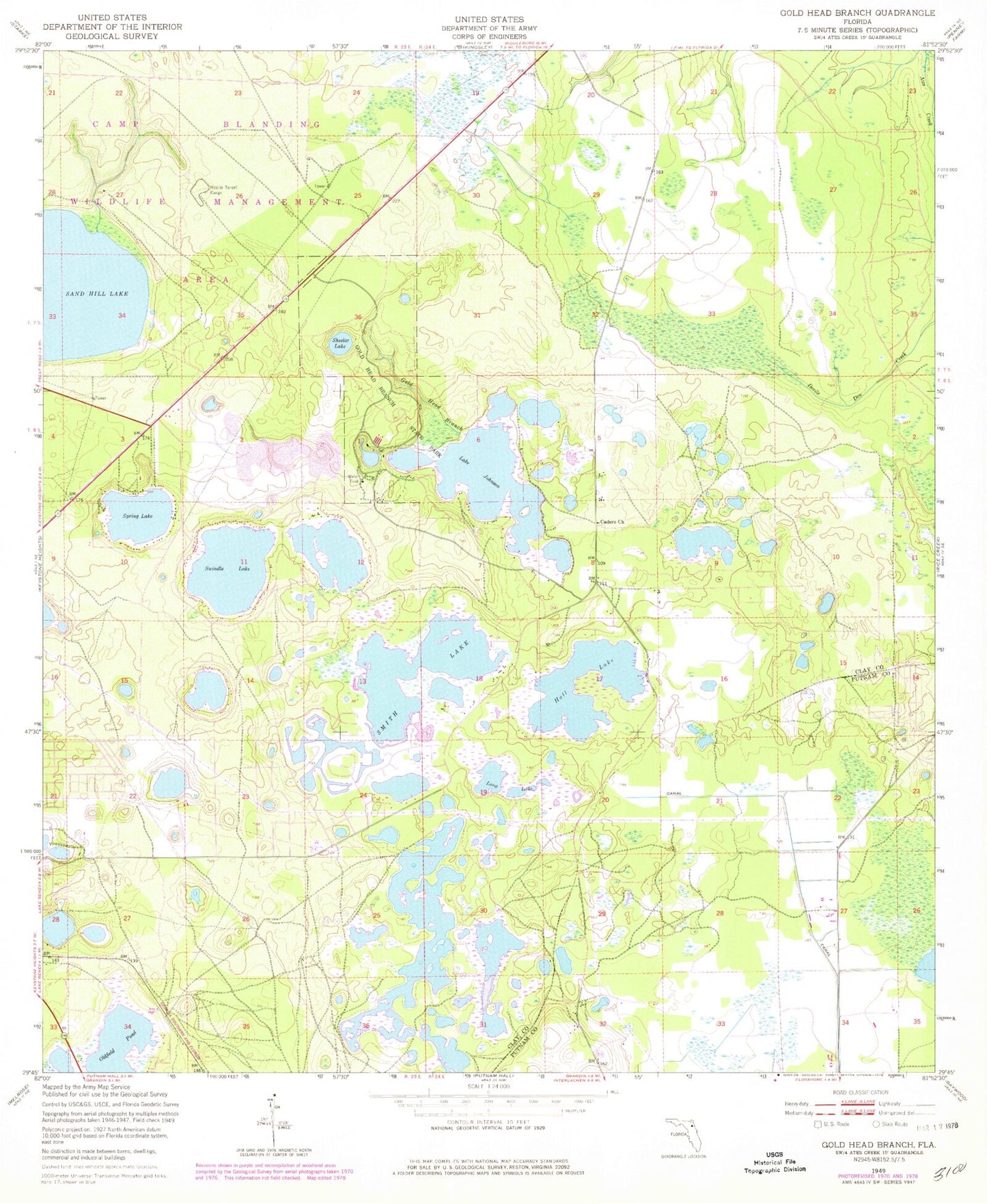
Classic USGS Gold Head Branch Florida 7.5'x7.5' Topo Map
Couldn't load pickup availability
Historical USGS topographic quad map of Gold Head Branch in the state of Florida. Typical map scale is 1:24,000, but may vary for certain years, if available. Print size: 24" x 27"
This quadrangle is in the following counties: Clay, Putnam.
The map contains contour lines, roads, rivers, towns, and lakes. Printed on high-quality waterproof paper with UV fade-resistant inks, and shipped rolled.
Contains the following named places: Gadara Baptist Church, Gold Head Branch, Mike Roess Gold Head Branch State Park, Hall Lake, Long Lake, Oldfield Pond, Sheelar Lake, Smith Lake, Spring Lake, Twin Lakes, M Lake, Coopers Pond, Bundy Lake, Flower Prairie, Big Lake Johnson, White Sands Lake, Lake Washington, Gadara Cemetery, Abundant Life Church, Lake Hill Baptist Church, Pebble Lake, Little Lake Johnson, Pear Lake, Winding Tree Lake, Lake Margie, Silver Sand Lake, Bull Pond, Gator Bone Lake, Devils Wash Basin, Lake Hill Baptist Church, Clay County Fire Rescue Station 23 - McRae, McRae Elementary School, Goldhead American Tower, McRae Volunteer Fire Department