MyTopo
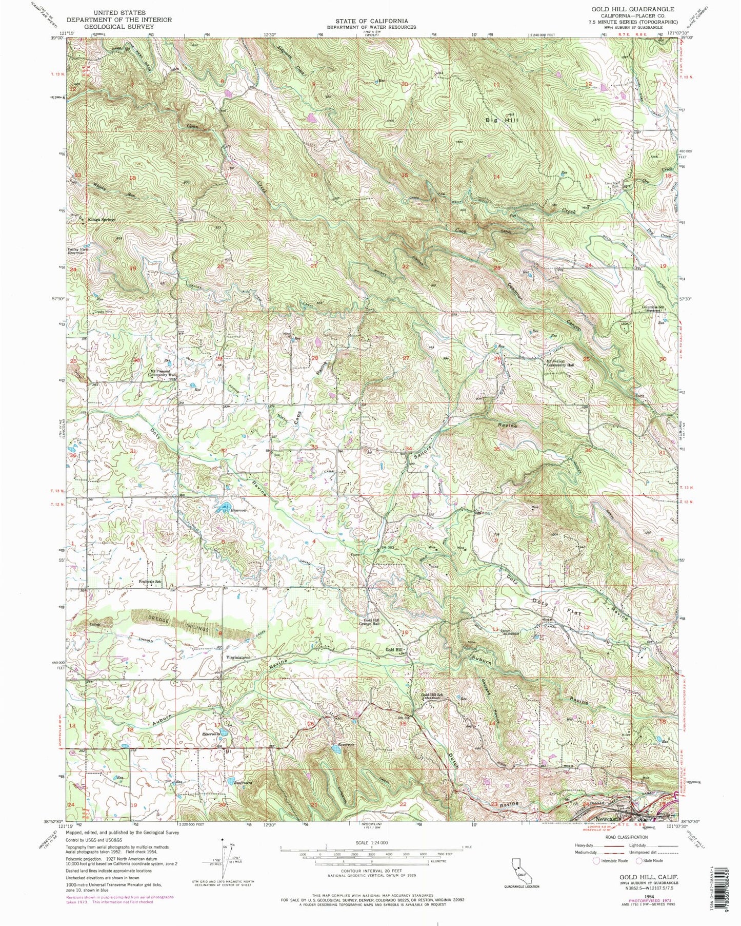
Classic USGS Gold Hill California 7.5'x7.5' Topo Map
Couldn't load pickup availability
Historical USGS topographic quad map of Gold Hill in the state of California. Map scale may vary for some years, but is generally around 1:24,000. Print size is approximately 24" x 27"
This quadrangle is in the following counties: Placer.
The map contains contour lines, roads, rivers, towns, and lakes. Printed on high-quality waterproof paper with UV fade-resistant inks, and shipped rolled.
Contains the following named places: Big Hill, Caperton Canal, Caps Ravine, Columbia School, Columbian 321 Dam, Crosby Mine, Deadman Canyon, Deadman Creek, Doty Flat, Doty Ravine North Canal, Dry Creek, Dudley Canal, Dutch Ravine, Fruitvale Community Hall, Fruitvale School, Georges Ravine, Gold Blossom Canal, Gold Hill, Gold Hill Grange Hall, Gold Hill School, Hidden Falls, Hidden Falls Regional Park, Japanese School, Kilaga Springs, Lincoln Canal, Lone Star Cemetery, Lower Fiddler Green Canal, Mount Pleasant Community Hall, Mount Vernon Community Hall, Ophir Elementary School, Orr Creek, Placer County Fire Department Station 182 Ophir Station, Placer County Fire Department Station 73 Fowler, Sailors Ravine, Valley View Canal, Valley View Reservoir, Virginiatown, Whisky Diggins Canal, ZIP Code: 95658