
MyTopo
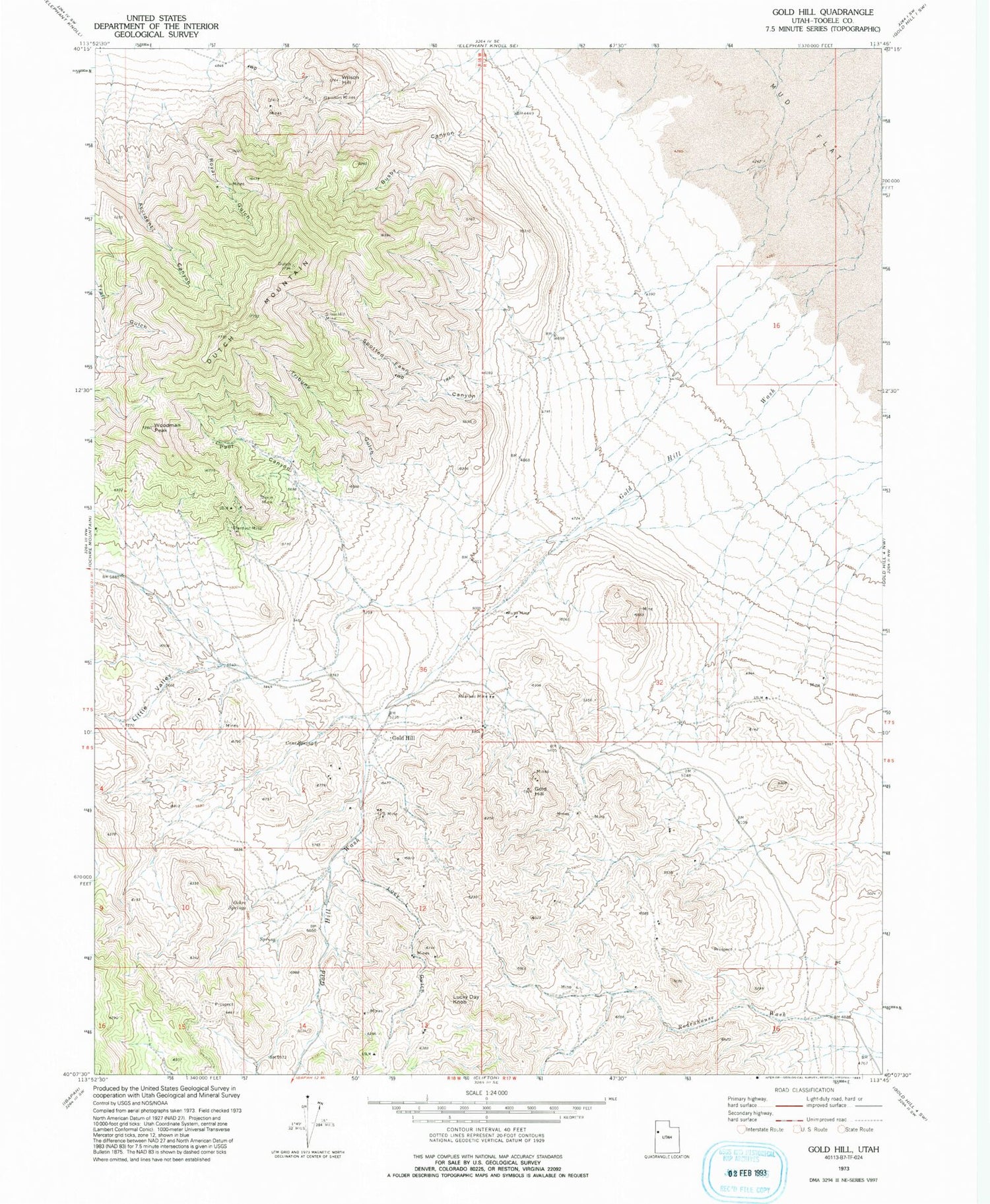
Classic USGS Gold Hill Utah 7.5'x7.5' Topo Map
Couldn't load pickup availability
Historical USGS topographic quad map of Gold Hill in the state of Utah. Map scale may vary for some years, but is generally around 1:24,000. Print size is approximately 24" x 27"
This quadrangle is in the following counties: Tooele.
The map contains contour lines, roads, rivers, towns, and lakes. Printed on high-quality waterproof paper with UV fade-resistant inks, and shipped rolled.
Contains the following named places: Accident Canyon, Alvarado Mine, Busby Canyon, Cane Spring, Dutch Mountain, Garrison Mines, Gold Hill, Little Valley, Lucky Day Knob, Lucy L Gulch, Ochre Springs, Pool Canyon, Royal Gulch, Rube Mine, Silver Hill Mine, Spotted Fawn Canyon, Stardust Mine, Timm Mine, Tribune Gulch, United States Mine, Wilson Hill, Woodman Peak


