MyTopo
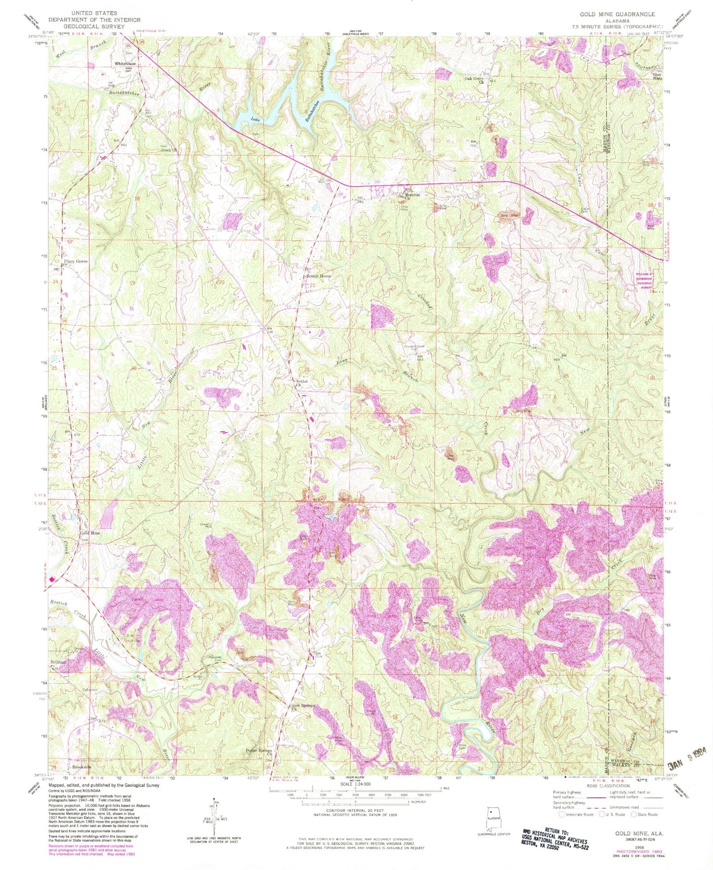
Classic USGS Gold Mine Alabama 7.5'x7.5' Topo Map
Couldn't load pickup availability
Historical USGS topographic quad map of Gold Mine in the state of Alabama. Map scale may vary for some years, but is generally around 1:24,000. Print size is approximately 24" x 27"
This quadrangle is in the following counties: Marion, Walker, Winston.
The map contains contour lines, roads, rivers, towns, and lakes. Printed on high-quality waterproof paper with UV fade-resistant inks, and shipped rolled.
Contains the following named places: Barton Cemetery, Bethel Cemetery, Bethel Church of Christ, Bostick Creek, Brilliant Division, Brock Cemetery, Brock Church of Christ, Brookside, Buttahatchee Dam, Cagle Cemetery, Cagle Cove, Crooked Creek, Crooked Creek Cemetery, Dry Creek, Goat Ranch, Gold Mine, Gold Mine Cemetery, Gold Mine Church of Christ, Green Cemetery, Gum Springs Church, Halcomb Cemetery, Haley Cemetery, Lake Buttahatchee, Little New River Lake Number 3, Little New River Lake Number 3 Dam, Long Branch, Magic Post Office, Miles Cemetery, Myers Hill Baptist Church, Myers Hill Cemetery, Oak Grove Cemetery, Oak Grove Church of Christ, Old Mars Hill Cemetery, Old Poplar Springs Cemetery, Old Poplar Springs Primitive Baptist Church, Pine Grove Church, Piney Grove, Potts Cemetery, Rowell Cemetery, Sunny Home, Sunny Home Volunteer Fire Department, West Branch Buttahatchee River, Whitehouse, Whitehouse Cemetery, Whitehouse Gas Field