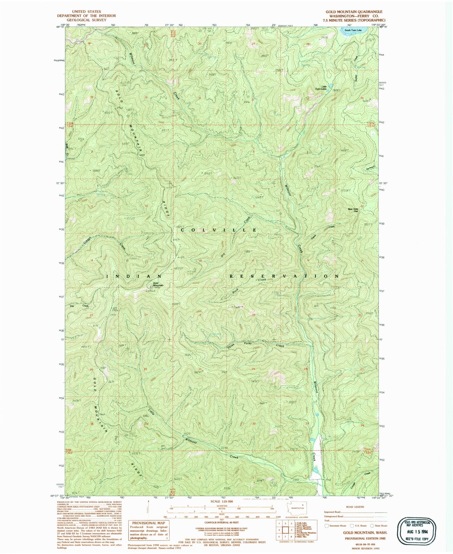
MyTopo
Classic USGS Gold Mountain Washington 7.5'x7.5' Topo Map
Regular price
$16.95
Regular price
Sale price
$16.95
Unit price
per
Couldn't load pickup availability
Historical USGS topographic quad map of Gold Mountain in the state of Washington. Map scale may vary for some years, but is generally around 1:24,000. Print size is approximately 24" x 27"
This quadrangle is in the following counties: Ferry.
The map contains contour lines, roads, rivers, towns, and lakes. Printed on high-quality waterproof paper with UV fade-resistant inks, and shipped rolled.
Contains the following named places: Bear Hide Gap, Dry Creek, Gold Mountain, Gold Mountain Lookout, Gold Mountain Ridge, Little Twin Lakes, Little Wilmont Creek, Rock Creek, Sucker Creek, Tepee Creek, Three Forks Creek, ZIP Code: 99138