MyTopo
Classic USGS Golddust Tennessee 7.5'x7.5' Topo Map
Couldn't load pickup availability
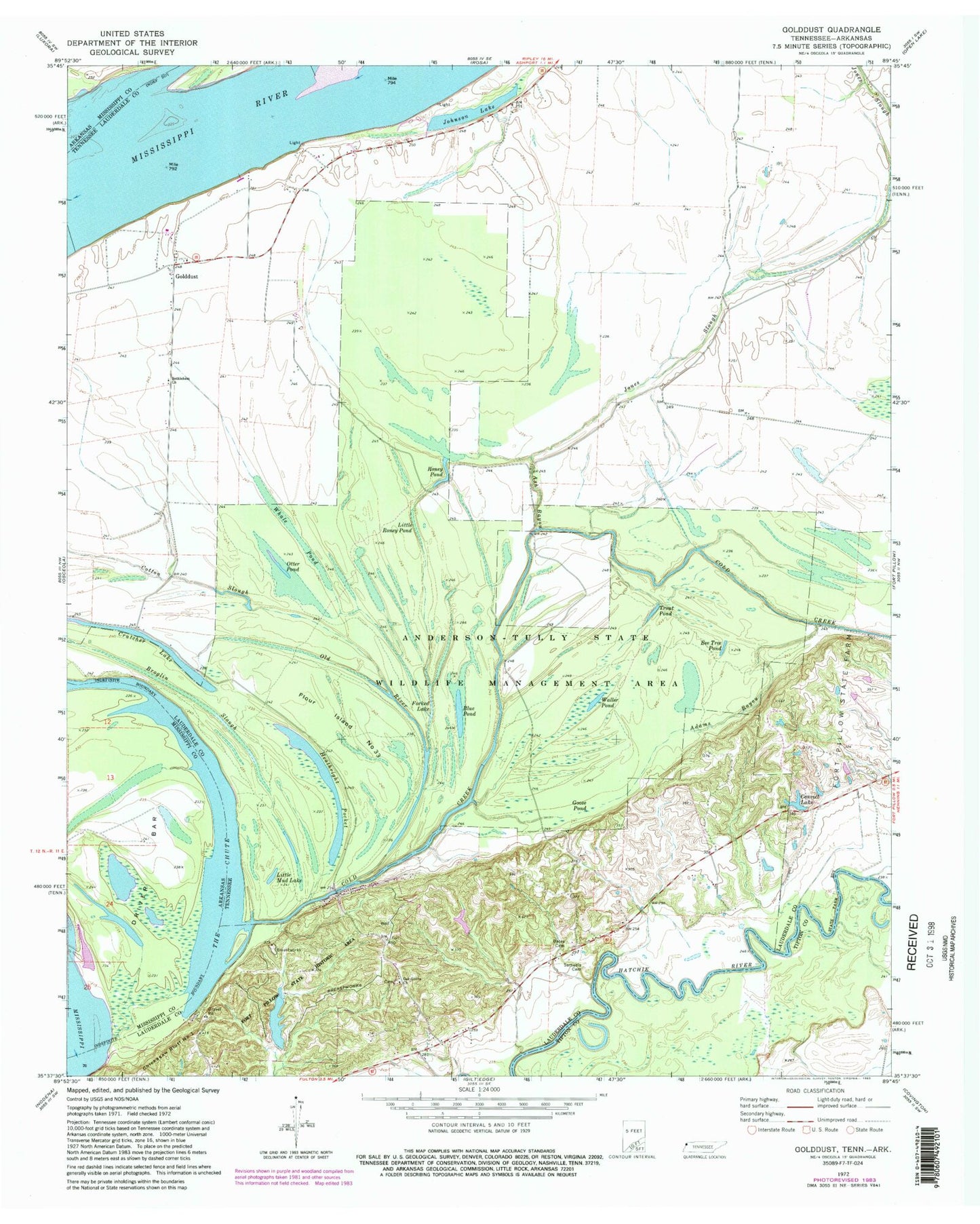
Historical USGS topographic quad map of Golddust in the states of Tennessee, Arkansas. Typical map scale is 1:24,000, but may vary for certain years, if available. Print size: 24" x 27"
This quadrangle is in the following counties: Lauderdale, Mississippi, Tipton.
The map contains contour lines, roads, rivers, towns, and lakes. Printed on high-quality waterproof paper with UV fade-resistant inks, and shipped rolled.
Contains the following named places: Fort Pillow State Park, The Chute, Trout Pond, Walker Pond, Whale Pond, Adams Bayou, Ash Bayou, Bates Family Cemetery, Bee Tree Pond, Bethlehem Church, Blue Pond, Broglin Slough, Cold Creek, Convict Lake, Cotton Slough, Forked Lake, Golddust, Goose Pond, Johnson Lake, Jones Slough, Little Mud Lake, Little Roney Pond, Oak Grove Church, Old River, Otter Pond, Roney Pond, Samuels Cemetery, Sanders Airport (historical), Ashport Keyes Point Revetment, Gold Dust Dike, Oak Grove, Chickasaw Bluff Number One, Flour Island Number Thirtythree, Fort Pillow (historical), Fort Pillow Landing, Fort Pillow School (historical), Fort Pillow State Historic Area, Gold Dust Landing, Golddust Church, Golddust School (historical), Lower Hatchie National Wildlife Refuge, Ashport Towhead, Golddust Bar, Yankee Bar, Heathright Pocket, Commissioner District 5, Driver Bar, The Chute, Yankee Bar